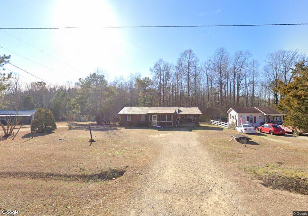
747 Tim Currin Rd Lillington, NC 27546
Estimated Value: $154,692 - $287,000
3
Beds
1
Bath
1,025
Sq Ft
$242/Sq Ft
Est. Value
About This Home
This home is located at 747 Tim Currin Rd, Lillington, NC 27546 and is currently estimated at $248,173, approximately $242 per square foot. 747 Tim Currin Rd is a home located in Harnett County with nearby schools including Boone Trail Elementary School, Western Harnett Middle School, and Western Harnett High School.
Ownership History
Date
Name
Owned For
Owner Type
Purchase Details
Closed on
Feb 16, 2007
Sold by
Gainey Marshall C and Gainey Diane M
Bought by
Campbell Bonnie G
Current Estimated Value
Home Financials for this Owner
Home Financials are based on the most recent Mortgage that was taken out on this home.
Original Mortgage
$53,000
Outstanding Balance
$31,850
Interest Rate
6.22%
Mortgage Type
VA
Estimated Equity
$216,323
Create a Home Valuation Report for This Property
The Home Valuation Report is an in-depth analysis detailing your home's value as well as a comparison with similar homes in the area
Home Values in the Area
Average Home Value in this Area
Purchase History
| Date | Buyer | Sale Price | Title Company |
|---|---|---|---|
| Campbell Bonnie G | $53,000 | None Available |
Source: Public Records
Mortgage History
| Date | Status | Borrower | Loan Amount |
|---|---|---|---|
| Open | Campbell Bonnie G | $53,000 |
Source: Public Records
Tax History Compared to Growth
Tax History
| Year | Tax Paid | Tax Assessment Tax Assessment Total Assessment is a certain percentage of the fair market value that is determined by local assessors to be the total taxable value of land and additions on the property. | Land | Improvement |
|---|---|---|---|---|
| 2025 | $846 | $108,589 | $0 | $0 |
| 2024 | $835 | $108,589 | $0 | $0 |
| 2023 | $835 | $108,589 | $0 | $0 |
| 2022 | $814 | $108,589 | $0 | $0 |
| 2021 | $706 | $75,720 | $0 | $0 |
| 2020 | $706 | $75,720 | $0 | $0 |
| 2019 | $691 | $75,720 | $0 | $0 |
| 2018 | $691 | $75,720 | $0 | $0 |
| 2017 | $691 | $75,720 | $0 | $0 |
| 2016 | $716 | $78,800 | $0 | $0 |
| 2015 | $716 | $78,800 | $0 | $0 |
| 2014 | $716 | $78,800 | $0 | $0 |
Source: Public Records
Map
Nearby Homes
- 71 Hawksmoore Ln
- 57 Black Creek Dr
- 22 Black Creek Dr
- CALI Plan at McKay Place
- WILMINGTON Plan at McKay Place
- 93 Finsbury Ct
- 273 Hawksmoore Ln
- Eldorado Plan at Seagrass Landing
- Shenandoah Plan at Seagrass Landing
- Voyageur Plan at Seagrass Landing
- Cascades Plan at Seagrass Landing
- Clearwater Plan at Seagrass Landing
- Sequoia Plan at Seagrass Landing
- Allegheny Plan at Seagrass Landing
- 1599 Tim Currin Rd
- The Bradley Plan at Reedy Branch
- The Avery Plan at Reedy Branch
- The Benson II Plan at Reedy Branch
- The Landen Plan at Reedy Branch
- The McGinnis Plan at Reedy Branch
- 763 Tim Currin Rd
- 701 Tim Currin Rd
- 787 Tim Currin Rd
- 754 Tim Currin Rd
- 821 Tim Currin Rd
- 818 Tim Currin Rd
- 841 Tim Currin Rd
- 0 Tw Campbell Ln Unit TR1793271
- 0 Tw Campbell Ln Unit 368824
- 0 Tw Campbell Ln Unit 368826
- 0 Tw Campbell Ln Unit 2438719
- 840 Tim Currin Rd
- 856 Tim Currin Rd
- 611 Tim Currin Rd
- 647 Tim Currin Rd
- 876 Tim Currin Rd
- 194 T W Campbell Ln
- 892 Tim Currin Rd
- 905 Tim Currin Rd
- 910 Tim Currin Rd