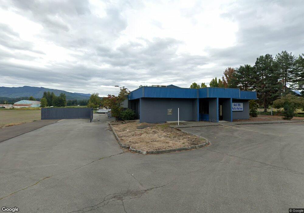
747 Watson St N Enumclaw, WA 98022
Estimated Value: $414,937
Studio
--
Bath
1,245
Sq Ft
$333/Sq Ft
Est. Value
About This Home
This home is located at 747 Watson St N, Enumclaw, WA 98022 and is currently estimated at $414,937, approximately $333 per square foot. 747 Watson St N is a home located in King County with nearby schools including Southwood Elementary School, Enumclaw Middle School, and Enumclaw Senior High School.
Ownership History
Date
Name
Owned For
Owner Type
Purchase Details
Closed on
Sep 10, 2015
Sold by
Shaw Group Lp
Bought by
Osborne Timothy and Osborne Susan
Current Estimated Value
Home Financials for this Owner
Home Financials are based on the most recent Mortgage that was taken out on this home.
Original Mortgage
$187,000
Outstanding Balance
$146,876
Interest Rate
3.91%
Mortgage Type
Commercial
Estimated Equity
$268,061
Purchase Details
Closed on
Jul 24, 2012
Sold by
Union Bank Na
Bought by
Shaw Group Lp
Purchase Details
Closed on
Sep 30, 2011
Sold by
Garrett Patrick W and Garrett Patricia A
Bought by
Union Bank Na
Purchase Details
Closed on
May 24, 2002
Sold by
Keybank National Assn
Bought by
Garrett Patrick W and Garrett Patricia A
Home Financials for this Owner
Home Financials are based on the most recent Mortgage that was taken out on this home.
Original Mortgage
$180,000
Interest Rate
6.89%
Mortgage Type
Commercial
Create a Home Valuation Report for This Property
The Home Valuation Report is an in-depth analysis detailing your home's value as well as a comparison with similar homes in the area
Home Values in the Area
Average Home Value in this Area
Purchase History
| Date | Buyer | Sale Price | Title Company |
|---|---|---|---|
| Osborne Timothy | $220,000 | Fidelity Natio | |
| Shaw Group Lp | $190,000 | First American | |
| Union Bank Na | $227,850 | 1St American | |
| Garrett Patrick W | $200,000 | First American |
Source: Public Records
Mortgage History
| Date | Status | Borrower | Loan Amount |
|---|---|---|---|
| Open | Osborne Timothy | $187,000 | |
| Previous Owner | Garrett Patrick W | $180,000 |
Source: Public Records
Tax History
| Year | Tax Paid | Tax Assessment Tax Assessment Total Assessment is a certain percentage of the fair market value that is determined by local assessors to be the total taxable value of land and additions on the property. | Land | Improvement |
|---|---|---|---|---|
| 2024 | $5,435 | $566,200 | $521,700 | $44,500 |
| 2023 | $4,637 | $528,000 | $481,500 | $46,500 |
| 2022 | $4,618 | $476,800 | $441,400 | $35,400 |
| 2021 | $4,731 | $430,200 | $401,300 | $28,900 |
| 2020 | $4,225 | $402,300 | $401,300 | $1,000 |
| 2018 | $3,921 | $342,100 | $341,100 | $1,000 |
| 2017 | $3,554 | $301,900 | $300,900 | $1,000 |
| 2016 | $3,595 | $281,900 | $280,900 | $1,000 |
| 2015 | $3,505 | $280,900 | $280,900 | $0 |
| 2014 | -- | $261,800 | $260,800 | $1,000 |
| 2013 | -- | $284,100 | $283,100 | $1,000 |
Source: Public Records
Map
Nearby Homes
- 413 Becky Ave E
- 385 Bruhn Ln N
- 103 Jewell St
- 657 Barquist Ln N
- 643 Barquist Ln N
- 176 Love Dr
- 311 Hogan Dr
- 111 Love Dr
- 783 Weaver Dr E
- 806 Pine Dr
- 823 Cottonwood Dr
- 505 Thompson (Lot 1) Dr
- 527 Thompson (Lot 2) Dr
- 549 Thompson (Lot 3) Dr
- 508 Thompson (Lot 22) Dr
- 571 Thompson (Lot 4) Dr
- 936 Mountain Villa Dr
- 615 Thompson (Lot 6) Dr
- 915 Mountain Villa Dr
- 721 Weaver Dr E
- 853 Watson St N
- 739 Watson St N
- 220 Roosevelt Ave E
- 6 Watson St N
- 615 Watson St N Unit E
- 123 Smith Dr
- 175 Smith Dr
- 665 Watson St N
- 757 Watson St N
- 750 Watson St N
- 141 Smith Dr
- 159 Smith Dr
- 197 Smith Dr
- 1 Riggs Dr E
- 215 Smith Dr
- 179 Bondgard Ave E
- 213 Bondgard Ave E
- 102519 BO Undisclosed
- 102519 Undisclosed
- 147 Bondgard Ave E
Your Personal Tour Guide
Ask me questions while you tour the home.