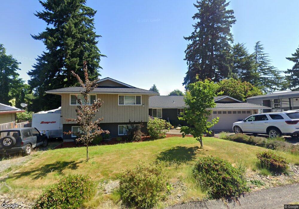
7470 Cason Cir Gladstone, OR 97027
Estimated Value: $537,664 - $623,000
4
Beds
3
Baths
2,166
Sq Ft
$270/Sq Ft
Est. Value
About This Home
This home is located at 7470 Cason Cir, Gladstone, OR 97027 and is currently estimated at $585,416, approximately $270 per square foot. 7470 Cason Cir is a home located in Clackamas County with nearby schools including John Wetten Elementary School, Walter L Kraxberger Middle School, and Gladstone High School.
Ownership History
Date
Name
Owned For
Owner Type
Purchase Details
Closed on
Jul 1, 2019
Sold by
Baker Stephanie and Weatherspoon Stephanie R
Bought by
Baker Adam C and Baker Stephanie
Current Estimated Value
Home Financials for this Owner
Home Financials are based on the most recent Mortgage that was taken out on this home.
Original Mortgage
$245,300
Outstanding Balance
$214,341
Interest Rate
3.9%
Mortgage Type
New Conventional
Estimated Equity
$371,075
Purchase Details
Closed on
Dec 3, 2004
Sold by
Branlund Elmer G
Bought by
Weatherspoon Stephanie R
Home Financials for this Owner
Home Financials are based on the most recent Mortgage that was taken out on this home.
Original Mortgage
$175,200
Interest Rate
5.65%
Mortgage Type
Purchase Money Mortgage
Create a Home Valuation Report for This Property
The Home Valuation Report is an in-depth analysis detailing your home's value as well as a comparison with similar homes in the area
Home Values in the Area
Average Home Value in this Area
Purchase History
| Date | Buyer | Sale Price | Title Company |
|---|---|---|---|
| Baker Adam C | -- | Ticor Title Company Of Or | |
| Weatherspoon Stephanie R | $219,000 | Chicago Title Insurance Co |
Source: Public Records
Mortgage History
| Date | Status | Borrower | Loan Amount |
|---|---|---|---|
| Open | Baker Adam C | $245,300 | |
| Closed | Weatherspoon Stephanie R | $175,200 | |
| Closed | Weatherspoon Stephanie R | $43,800 |
Source: Public Records
Tax History
| Year | Tax Paid | Tax Assessment Tax Assessment Total Assessment is a certain percentage of the fair market value that is determined by local assessors to be the total taxable value of land and additions on the property. | Land | Improvement |
|---|---|---|---|---|
| 2025 | $6,090 | $302,231 | -- | -- |
| 2024 | $5,921 | $293,429 | -- | -- |
| 2023 | $5,921 | $284,883 | $0 | $0 |
| 2022 | $5,506 | $276,586 | $0 | $0 |
| 2021 | $5,304 | $268,531 | $0 | $0 |
| 2020 | $5,177 | $260,710 | $0 | $0 |
| 2019 | $5,117 | $253,117 | $0 | $0 |
| 2018 | $4,931 | $245,745 | $0 | $0 |
| 2017 | $4,784 | $238,587 | $0 | $0 |
| 2016 | $4,626 | $231,638 | $0 | $0 |
Source: Public Records
Map
Nearby Homes
- 7655 Ridgewood Dr
- 8117 Cox Ln
- 17788 Webster Rd
- 17300 Timothy Way
- 17520 SE 82nd Dr
- 8621 SE Strawberry Ln
- 620 Barbary Ct
- 7175 Ridgegate Dr
- 1065 Columbia Ave
- 16981 SE 80th Place
- 16921 SE 80th Place
- 0 Clackamas River Dr Unit 628726355
- 8370 SE Poppy St
- 515 E Hereford St
- 6830 Glen Echo Ave
- 1460 Cornell Ave
- 6605 Parkway Dr
- 16510 SE 81st Ave
- 480 E Gloucester St
- 16421 SE Webster Rd
Your Personal Tour Guide
Ask me questions while you tour the home.