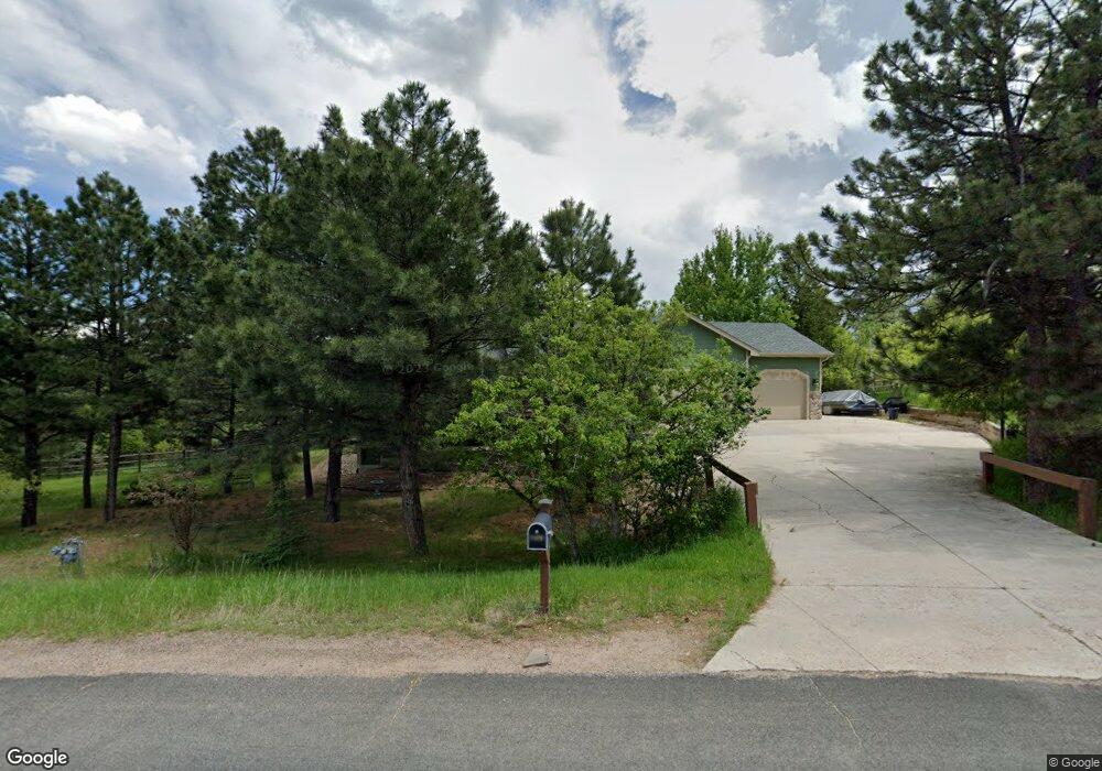
7470 Shrine Rd Larkspur, CO 80118
Estimated Value: $854,860 - $1,050,000
7
Beds
3
Baths
3,781
Sq Ft
$249/Sq Ft
Est. Value
About This Home
This home is located at 7470 Shrine Rd, Larkspur, CO 80118 and is currently estimated at $940,465, approximately $248 per square foot. 7470 Shrine Rd is a home located in Douglas County with nearby schools including Larkspur Elementary School, Castle Rock Middle School, and Castle View High School.
Ownership History
Date
Name
Owned For
Owner Type
Purchase Details
Closed on
Feb 14, 2023
Sold by
Prystupa Lev
Bought by
Lev Prystupa Trust
Current Estimated Value
Purchase Details
Closed on
Aug 20, 2019
Sold by
Pastore Gary C and Pastore Melinda
Bought by
Prystupa Lev and Adams Denise H
Home Financials for this Owner
Home Financials are based on the most recent Mortgage that was taken out on this home.
Original Mortgage
$655,588
Interest Rate
3.7%
Mortgage Type
VA
Purchase Details
Closed on
Jun 7, 2013
Sold by
Lindberg Robert Allen Lindberg Jr Janet
Bought by
Pastore Gary C and Pastore Melinda
Purchase Details
Closed on
Dec 22, 2006
Sold by
Desmarais William C and Desmarais Patricia M
Bought by
Lindberg Robert Allen and Lindberg Janet Gail
Home Financials for this Owner
Home Financials are based on the most recent Mortgage that was taken out on this home.
Original Mortgage
$258,700
Interest Rate
5.87%
Mortgage Type
Unknown
Purchase Details
Closed on
Aug 25, 2003
Sold by
Reeves Philip R and Reeves Clara A
Bought by
Desmarais William C and Desmarais Patricia M
Home Financials for this Owner
Home Financials are based on the most recent Mortgage that was taken out on this home.
Original Mortgage
$322,000
Interest Rate
6.31%
Mortgage Type
Stand Alone First
Purchase Details
Closed on
Aug 1, 2003
Sold by
Reeves Philip R and Reeves Clara A
Bought by
Desmarais William C and Desmarais Patricia M
Home Financials for this Owner
Home Financials are based on the most recent Mortgage that was taken out on this home.
Original Mortgage
$322,000
Interest Rate
6.31%
Mortgage Type
Stand Alone First
Purchase Details
Closed on
Jun 17, 1999
Sold by
Mgb Homes Inc
Bought by
Reeves Philip R and Reeves Clara A
Home Financials for this Owner
Home Financials are based on the most recent Mortgage that was taken out on this home.
Original Mortgage
$230,000
Interest Rate
7.21%
Purchase Details
Closed on
Jun 30, 1998
Sold by
Johnson Richard P
Bought by
Mgb Homes Inc
Purchase Details
Closed on
Feb 18, 1986
Sold by
Pollack Ray C and Pollack Kathleen M
Bought by
Johnson Richard P
Create a Home Valuation Report for This Property
The Home Valuation Report is an in-depth analysis detailing your home's value as well as a comparison with similar homes in the area
Home Values in the Area
Average Home Value in this Area
Purchase History
| Date | Buyer | Sale Price | Title Company |
|---|---|---|---|
| Lev Prystupa Trust | -- | -- | |
| Prystupa Lev | $679,900 | Land Title Guarantee Co | |
| Pastore Gary C | $462,500 | -- | |
| Lindberg Robert Allen | $500,000 | Land Title | |
| Desmarais William C | $410,000 | Chicago Title Co | |
| Desmarais William C | $410,000 | -- | |
| Reeves Philip R | $321,125 | -- | |
| Mgb Homes Inc | $39,501 | -- | |
| Johnson Richard P | $10,000 | -- |
Source: Public Records
Mortgage History
| Date | Status | Borrower | Loan Amount |
|---|---|---|---|
| Previous Owner | Prystupa Lev | $655,588 | |
| Previous Owner | Lindberg Robert Allen | $258,700 | |
| Previous Owner | Desmarais William C | $322,000 | |
| Previous Owner | Reeves Philip R | $230,000 |
Source: Public Records
Tax History Compared to Growth
Tax History
| Year | Tax Paid | Tax Assessment Tax Assessment Total Assessment is a certain percentage of the fair market value that is determined by local assessors to be the total taxable value of land and additions on the property. | Land | Improvement |
|---|---|---|---|---|
| 2024 | $5,562 | $60,750 | $12,570 | $48,180 |
| 2023 | $5,617 | $60,750 | $12,570 | $48,180 |
| 2022 | $4,269 | $45,070 | $8,590 | $36,480 |
| 2021 | $4,420 | $45,070 | $8,590 | $36,480 |
| 2020 | $4,048 | $42,140 | $7,430 | $34,710 |
| 2019 | $4,061 | $42,140 | $7,430 | $34,710 |
| 2018 | $3,453 | $35,200 | $6,800 | $28,400 |
| 2017 | $3,246 | $35,200 | $6,800 | $28,400 |
| 2016 | $3,368 | $35,930 | $6,530 | $29,400 |
| 2015 | $3,294 | $35,930 | $6,530 | $29,400 |
| 2014 | $2,994 | $29,310 | $4,700 | $24,610 |
Source: Public Records
Map
Nearby Homes
- 1038 Tenderfoot Dr
- 7596 Rollins Dr
- 950 Tenderfoot Dr
- 929 Tenderfoot Dr
- 1600 Independence Dr Unit 50
- 1065 Independence Dr
- 0 E Cherry Creek Rd Unit 2541327
- 0 E Cherry Creek Rd Unit REC1786246
- 691 Cumberland Rd
- 1025 Tenderfoot Dr
- 670 Independence Dr
- 7317 Fremont Place
- 7737 Taylor Cir
- 7994 Monarch Rd
- 1275 Fremont Dr
- 773 Copper Fox Place
- 1210 Kenosha Dr
- 1653 Gore Dr
- 682 Copper Fox Place
- 720 Copper Fox Place
- 7769 Shrine Rd
- 1109 Tenderfoot Dr
- 7450 Shrine Rd
- 7500 Shrine Rd
- 7479 Shrine Rd
- 7461 Shrine Rd
- 1064 Cottonwood Ln
- 1111 Tenderfoot Dr
- 7789 Shrine Rd
- 7441 Shrine Rd
- 1044 Cottonwood Ln
- 7520 Shrine Rd
- 7527 Shrine Rd
- 1139 Tenderfoot Dr
- 1049 Tenderfoot Dr
- 1087 Tenderfoot Dr
- 1085 Cottonwood Ln
- 7700 Rollins Dr
- 1055 Cottonwood Ln
- 7419 Shrine Rd