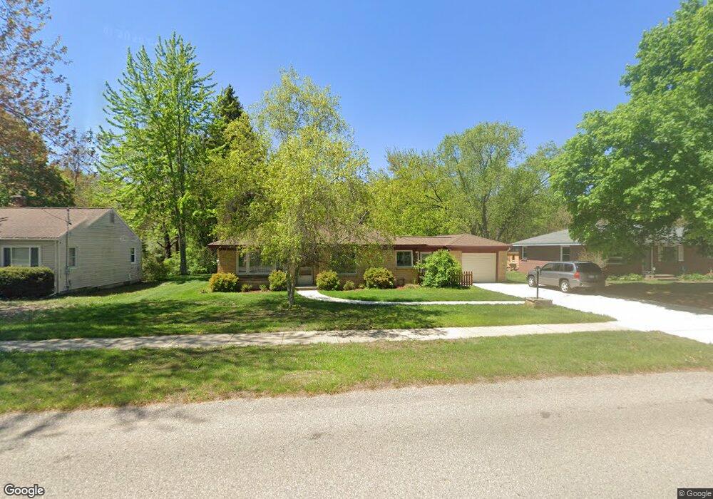
7471 12th Ave Jenison, MI 49428
Estimated Value: $329,866 - $373,000
3
Beds
2
Baths
1,171
Sq Ft
$298/Sq Ft
Est. Value
About This Home
This home is located at 7471 12th Ave, Jenison, MI 49428 and is currently estimated at $348,717, approximately $297 per square foot. 7471 12th Ave is a home located in Ottawa County with nearby schools including Jenison Junior High School and Jenison High School.
Ownership History
Date
Name
Owned For
Owner Type
Purchase Details
Closed on
May 30, 2017
Sold by
Aitken Beverly B and Aitken James M
Bought by
Blue Stone Llc
Current Estimated Value
Home Financials for this Owner
Home Financials are based on the most recent Mortgage that was taken out on this home.
Interest Rate
3.95%
Purchase Details
Closed on
Jul 13, 2016
Sold by
Davis Randy L
Bought by
Davis Randy L and Randy L Davis Trust
Purchase Details
Closed on
Oct 14, 2005
Sold by
Davis Joellen
Bought by
Davis Randy L
Create a Home Valuation Report for This Property
The Home Valuation Report is an in-depth analysis detailing your home's value as well as a comparison with similar homes in the area
Home Values in the Area
Average Home Value in this Area
Purchase History
| Date | Buyer | Sale Price | Title Company |
|---|---|---|---|
| Blue Stone Llc | $140,000 | -- | |
| Davis Randy L | -- | Attorney | |
| Davis Randy L | -- | -- |
Source: Public Records
Mortgage History
| Date | Status | Borrower | Loan Amount |
|---|---|---|---|
| Closed | Blue Stone Llc | -- |
Source: Public Records
Tax History
| Year | Tax Paid | Tax Assessment Tax Assessment Total Assessment is a certain percentage of the fair market value that is determined by local assessors to be the total taxable value of land and additions on the property. | Land | Improvement |
|---|---|---|---|---|
| 2025 | $2,001 | $159,200 | $0 | $0 |
| 2024 | $19 | $136,000 | $0 | $0 |
| 2023 | $1,836 | $121,200 | $0 | $0 |
| 2022 | $2,015 | $106,900 | $0 | $0 |
| 2021 | $1,957 | $100,500 | $0 | $0 |
| 2020 | $1,936 | $94,200 | $0 | $0 |
| 2019 | $1,937 | $87,400 | $0 | $0 |
| 2018 | $1,807 | $86,700 | $0 | $0 |
| 2017 | $1,775 | $82,200 | $0 | $0 |
| 2016 | $1,764 | $76,000 | $0 | $0 |
| 2015 | $1,684 | $71,300 | $0 | $0 |
| 2014 | $1,684 | $69,800 | $0 | $0 |
Source: Public Records
Map
Nearby Homes
- 7391 Terrace Ln
- 7350 Glendora Ave
- 7425 Boulder Bluff Dr Unit 112
- 7522 Melody Ln
- 7439 Eastlane Ave
- 1215 Sycamore Dr
- 9067 Hollace Ct
- 7373 Pinegrove Dr Unit 109
- 7341 Pinegrove Dr
- 1468 Maplewood Dr Unit 9
- 625 Summerset Dr
- 7425 Pinegrove Dr Unit 98
- 8081 Weatherwax Dr Unit 44
- 1941 Newcastle Dr
- 8148 Greenridge Dr
- 2272 Baldwin St
- 2111 Timberlane Dr
- 91 Grand Village Ct SW Unit 34
- 6325 8th Ave SW
- 6352 Livingston Ct
Your Personal Tour Guide
Ask me questions while you tour the home.