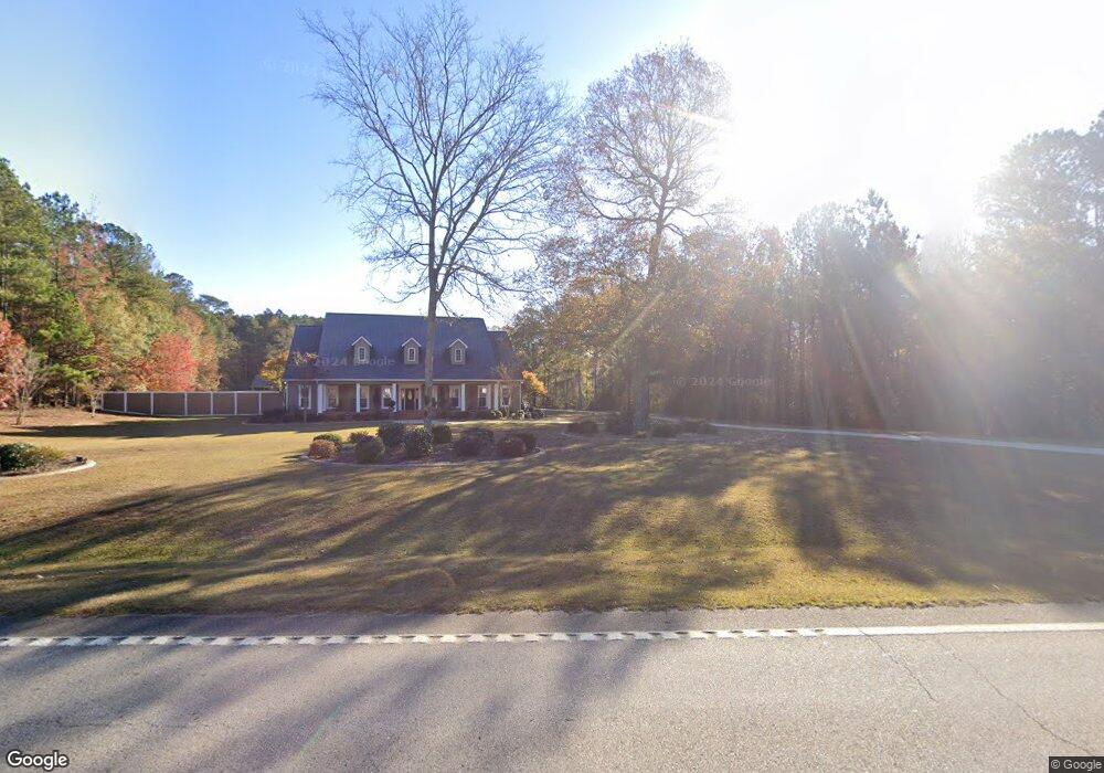
7479 Westpoint Rd West Point, GA 31833
Estimated Value: $124,192 - $222,000
3
Beds
1
Bath
1,030
Sq Ft
$155/Sq Ft
Est. Value
About This Home
This home is located at 7479 Westpoint Rd, West Point, GA 31833 and is currently estimated at $159,298, approximately $154 per square foot. 7479 Westpoint Rd is a home located in Troup County with nearby schools including West Point Elementary School, Long Cane Elementary School, and Berta Weathersbee Elementary School.
Ownership History
Date
Name
Owned For
Owner Type
Purchase Details
Closed on
May 13, 2008
Sold by
Mcglown Pauline L
Bought by
Beasley Timothy P and Beasley Martha M
Current Estimated Value
Home Financials for this Owner
Home Financials are based on the most recent Mortgage that was taken out on this home.
Original Mortgage
$75,613
Outstanding Balance
$47,835
Interest Rate
5.86%
Mortgage Type
FHA
Estimated Equity
$111,463
Purchase Details
Closed on
Oct 27, 2003
Sold by
Mcglown Estate Of Eddie Mcglow
Bought by
Pauline L Mcglown
Purchase Details
Closed on
Nov 1, 1957
Bought by
Mcglown Estate Of Eddie Mcglow
Create a Home Valuation Report for This Property
The Home Valuation Report is an in-depth analysis detailing your home's value as well as a comparison with similar homes in the area
Home Values in the Area
Average Home Value in this Area
Purchase History
| Date | Buyer | Sale Price | Title Company |
|---|---|---|---|
| Beasley Timothy P | $76,800 | -- | |
| Pauline L Mcglown | -- | -- | |
| Mcglown Estate Of Eddie Mcglow | -- | -- |
Source: Public Records
Mortgage History
| Date | Status | Borrower | Loan Amount |
|---|---|---|---|
| Open | Beasley Timothy P | $75,613 |
Source: Public Records
Tax History Compared to Growth
Tax History
| Year | Tax Paid | Tax Assessment Tax Assessment Total Assessment is a certain percentage of the fair market value that is determined by local assessors to be the total taxable value of land and additions on the property. | Land | Improvement |
|---|---|---|---|---|
| 2024 | $1,119 | $41,040 | $5,040 | $36,000 |
| 2023 | $1,010 | $37,040 | $5,040 | $32,000 |
| 2022 | $894 | $32,040 | $5,040 | $27,000 |
| 2021 | $949 | $31,480 | $13,800 | $17,680 |
| 2020 | $949 | $31,480 | $13,800 | $17,680 |
| 2019 | $971 | $32,200 | $13,800 | $18,400 |
| 2018 | $946 | $31,360 | $13,800 | $17,560 |
| 2017 | $946 | $31,360 | $13,800 | $17,560 |
| 2016 | $976 | $32,357 | $13,815 | $18,542 |
| 2015 | $978 | $32,357 | $13,815 | $18,542 |
| 2014 | $952 | $31,474 | $13,815 | $17,659 |
| 2013 | -- | $17,677 | $3,132 | $14,545 |
Source: Public Records
Map
Nearby Homes
- 1599 Highway 29
- 0 Ga Highway 0116 Unit 10619139
- 508 Pine St
- 1903 Ridgewood Dr
- 1505 Wisteria Dr
- 0 Lambert Rd
- 0 Sunset Dr Unit 10451831
- 4517 Georgia 18
- 4509 Georgia 18
- 4523 Georgia 18
- 4527 Georgia 18
- 111 Tudor Way
- 1095 County Road 212
- 1008 E 12th St
- 1410 Roper Ave
- 0 Johns Rd Unit 10615130
- 1314 4th Ave
- 1103 Clara Dr
- 1109 Clara Dr
- 1111 Clara Dr
- 7455 Westpoint Rd
- 7521 Westpoint Rd
- 7455 Hwy 29
- 7541 Westpoint Rd
- 7541 Westpoint Rd
- 7430 Westpoint Rd
- 7229 W Point Rd
- 78 Webb Rd
- 7472 Westpoint Rd
- 7382 W Point Rd
- 110 Webb Rd
- 7382 Westpoint Rd
- 7326 Westpoint Rd
- 7279 Westpoint Rd
- 7326 W Point Rd
- 186 Fuller Rd
- 197 Fuller Rd
- 101 Webb Rd
- 230 Fuller Rd
- 401 Reed Rd