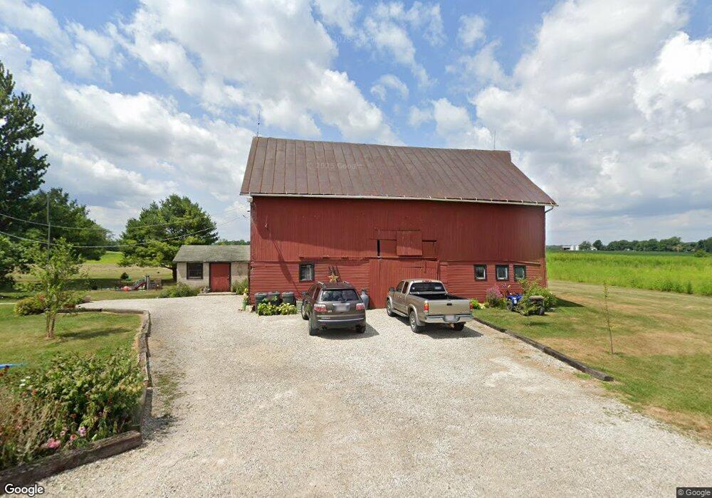
748 Brindle Rd Ostrander, OH 43061
Scioto NeighborhoodEstimated Value: $344,000 - $417,000
3
Beds
2
Baths
1,494
Sq Ft
$255/Sq Ft
Est. Value
About This Home
This home is located at 748 Brindle Rd, Ostrander, OH 43061 and is currently estimated at $381,090, approximately $255 per square foot. 748 Brindle Rd is a home located in Delaware County with nearby schools including Buckeye Valley High School.
Ownership History
Date
Name
Owned For
Owner Type
Purchase Details
Closed on
Jun 2, 2009
Sold by
Watts Pamela J
Bought by
Watts Robert E
Current Estimated Value
Home Financials for this Owner
Home Financials are based on the most recent Mortgage that was taken out on this home.
Original Mortgage
$123,090
Outstanding Balance
$78,021
Interest Rate
4.83%
Mortgage Type
New Conventional
Estimated Equity
$303,069
Purchase Details
Closed on
Jun 21, 2006
Sold by
Wood Glen H and Wood Doris J
Bought by
Watts Robert E and Watts Pamela J
Home Financials for this Owner
Home Financials are based on the most recent Mortgage that was taken out on this home.
Original Mortgage
$128,000
Interest Rate
5.5%
Mortgage Type
Purchase Money Mortgage
Create a Home Valuation Report for This Property
The Home Valuation Report is an in-depth analysis detailing your home's value as well as a comparison with similar homes in the area
Home Values in the Area
Average Home Value in this Area
Purchase History
| Date | Buyer | Sale Price | Title Company |
|---|---|---|---|
| Watts Robert E | -- | Attorney | |
| Watts Robert E | $53,333 | None Available |
Source: Public Records
Mortgage History
| Date | Status | Borrower | Loan Amount |
|---|---|---|---|
| Open | Watts Robert E | $123,090 | |
| Closed | Watts Robert E | $128,000 |
Source: Public Records
Tax History
| Year | Tax Paid | Tax Assessment Tax Assessment Total Assessment is a certain percentage of the fair market value that is determined by local assessors to be the total taxable value of land and additions on the property. | Land | Improvement |
|---|---|---|---|---|
| 2024 | $2,803 | $84,460 | $29,330 | $55,130 |
| 2023 | $2,803 | $84,460 | $29,330 | $55,130 |
| 2022 | $2,259 | $60,620 | $21,420 | $39,200 |
| 2021 | $2,198 | $60,620 | $21,420 | $39,200 |
| 2020 | $2,211 | $60,620 | $21,420 | $39,200 |
| 2019 | $2,077 | $51,940 | $17,850 | $34,090 |
| 2018 | $2,115 | $51,940 | $17,850 | $34,090 |
| 2017 | $1,787 | $40,150 | $15,960 | $24,190 |
| 2016 | $1,538 | $40,150 | $15,960 | $24,190 |
| 2015 | $1,624 | $40,150 | $15,960 | $24,190 |
| 2014 | $1,526 | $40,150 | $15,960 | $24,190 |
| 2013 | $1,544 | $38,990 | $15,960 | $23,030 |
Source: Public Records
Map
Nearby Homes
- 0 Carr Rd Unit 225016840
- 6685 State Route 37 W
- 715 Tyler Rd
- 0 Burnt Pond Rd Unit Tract 2
- 0 Burnt Pond Rd Unit Tract 4
- 0 Burnt Pond Rd Unit Tract 5
- 535 Brayshaw Dr
- 1817 Lawrence Rd
- 3480 Ostrander Rd
- 9485 State Route 37
- 20478 Delaware County Line Rd
- 0 Delaware County Line Rd
- 231 Bluegrass Way
- 311 Ben Curtis Dr
- 187 Long Trail
- 3734 Warrensburg Rd
- 3680 Warrensburg Rd
- 0 E High St Unit Tract 1 225034753
- 0 E High St Unit Tract 4 225034758
- 0 E High St Unit Tract 3 225034757
- 6857 Houseman Rd
- 0 Brindle Rd Unit Tract 2 219032537
- 0 Brindle Rd Unit 11686
- 0 Brindle Rd Unit 11689
- 0 Brindle Rd Unit Trac5 2443328
- 0 Brindle Rd Unit Trac7 2443331
- 0 Brindle Rd Unit Tr7 2612212
- 0 Brindle Rd Unit Lot4 2421096
- 0 Brindle Rd Unit Lot1 2421080
- 0 Brindle Rd Unit Tr7 2542076
- 0 Brindle Rd Unit Tr5 2541914
- 0 Brindle Rd Unit Trac6 2443329
- 0 Brindle Rd Unit Lot3 2421085
- 0 Brindle Rd Unit Lot2 2421083
- 0 Brindle Rd Unit 2230457
- 0 Brindle Rd Unit 2230462
- 0 Brindle Rd Unit 2230285
- 0 Brindle Rd Unit 2203719
- 0 Brindle Rd Unit 86409
- 0 Brindle Rd Unit 60653
Your Personal Tour Guide
Ask me questions while you tour the home.