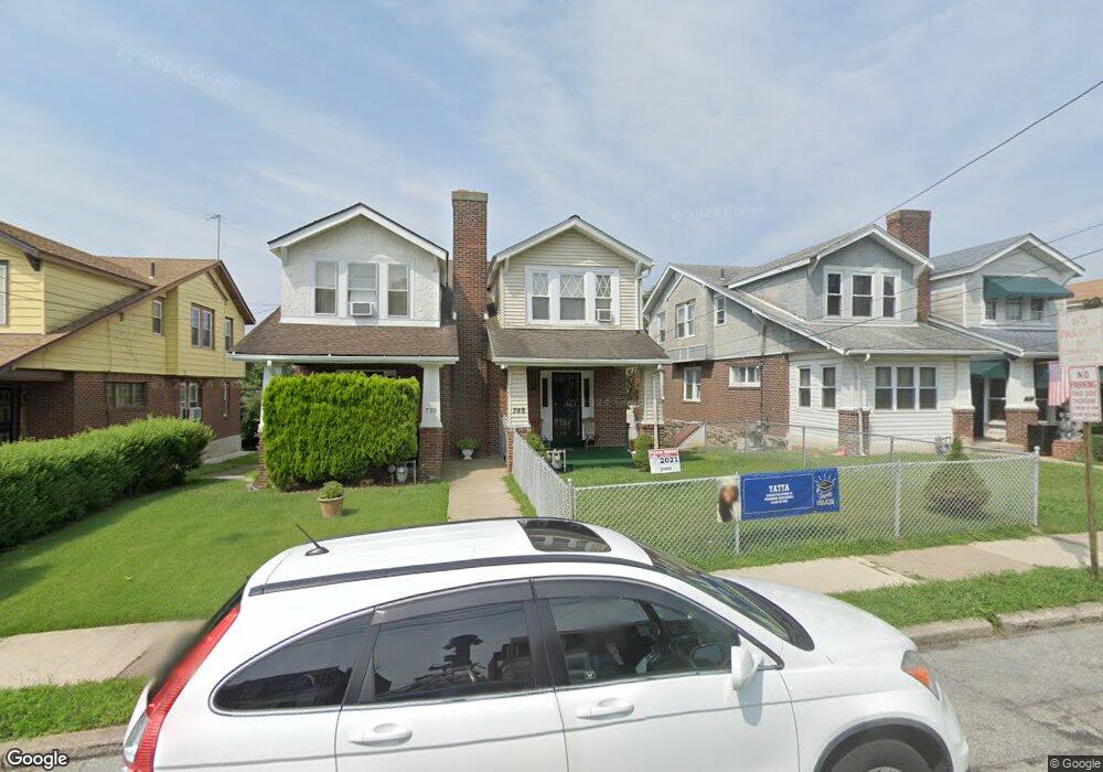
748 Bullock Ave Lansdowne, PA 19050
Estimated Value: $181,000 - $242,000
3
Beds
1
Bath
1,354
Sq Ft
$157/Sq Ft
Est. Value
About This Home
This home is located at 748 Bullock Ave, Lansdowne, PA 19050 and is currently estimated at $211,942, approximately $156 per square foot. 748 Bullock Ave is a home located in Delaware County with nearby schools including Evans Elementary School, Penn Wood Middle School, and Penn Wood High School - Cypress Street Campus.
Ownership History
Date
Name
Owned For
Owner Type
Purchase Details
Closed on
May 1, 2014
Sold by
Hall George
Bought by
Holder Harry L and Holder Elizabeth Y
Current Estimated Value
Home Financials for this Owner
Home Financials are based on the most recent Mortgage that was taken out on this home.
Original Mortgage
$71,186
Outstanding Balance
$54,089
Interest Rate
4.25%
Mortgage Type
FHA
Estimated Equity
$157,853
Create a Home Valuation Report for This Property
The Home Valuation Report is an in-depth analysis detailing your home's value as well as a comparison with similar homes in the area
Home Values in the Area
Average Home Value in this Area
Purchase History
| Date | Buyer | Sale Price | Title Company |
|---|---|---|---|
| Holder Harry L | $72,500 | None Available |
Source: Public Records
Mortgage History
| Date | Status | Borrower | Loan Amount |
|---|---|---|---|
| Open | Holder Harry L | $71,186 |
Source: Public Records
Tax History Compared to Growth
Tax History
| Year | Tax Paid | Tax Assessment Tax Assessment Total Assessment is a certain percentage of the fair market value that is determined by local assessors to be the total taxable value of land and additions on the property. | Land | Improvement |
|---|---|---|---|---|
| 2025 | $4,514 | $105,710 | $32,630 | $73,080 |
| 2024 | $4,514 | $105,710 | $32,630 | $73,080 |
| 2023 | $4,100 | $105,710 | $32,630 | $73,080 |
| 2022 | $3,909 | $105,710 | $32,630 | $73,080 |
| 2021 | $5,911 | $105,710 | $32,630 | $73,080 |
| 2020 | $3,974 | $63,640 | $18,830 | $44,810 |
| 2019 | $3,904 | $63,640 | $18,830 | $44,810 |
| 2018 | $3,850 | $63,640 | $0 | $0 |
| 2017 | $3,769 | $63,640 | $0 | $0 |
| 2016 | $349 | $63,640 | $0 | $0 |
| 2015 | $356 | $63,640 | $0 | $0 |
| 2014 | $349 | $63,640 | $0 | $0 |
Source: Public Records
Map
Nearby Homes
- 740 Church Ln
- 722 Yeadon Ave
- 711 Yeadon Ave Unit 1
- 800 Bullock Ave
- 702 Cedar Ave
- 808 Serrill Ave
- 825 Laurel Rd
- 813 Arbor Rd
- 908 Yeadon Ave
- 921 Serrill Ave
- 939 Serrill Ave
- 923 Bell Ave
- 1016 Whitby Ave
- 537 Orchard Ave
- 530 Orchard Ave
- 536 Cypress St
- 503 Bonsall Ave
- 1049 Yeadon Ave
- 435 Bonsall Ave
- 407 Church Ln
- 750 Bullock Ave
- 746 Bullock Ave
- 752 Bullock Ave
- 744 Bullock Ave
- 754 Bullock Ave
- 742 Bullock Ave
- 747 Yeadon Ave
- 756 Bullock Ave
- 745 Yeadon Ave
- 749 Yeadon Ave
- 740 Bullock Ave
- 743 Yeadon Ave
- 751 Yeadon Ave
- 741 Yeadon Ave
- 758 Bullock Ave
- 753 Yeadon Ave
- 738 Bullock Ave
- 739 Yeadon Ave
- 755 Yeadon Ave
- 760 Bullock Ave