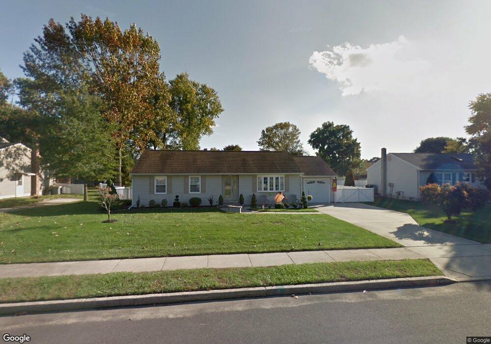
748 Duncan Ave Gibbstown, NJ 08027
Greenwich Township NeighborhoodEstimated Value: $276,838 - $348,000
--
Bed
--
Bath
1,624
Sq Ft
$201/Sq Ft
Est. Value
About This Home
This home is located at 748 Duncan Ave, Gibbstown, NJ 08027 and is currently estimated at $326,710, approximately $201 per square foot. 748 Duncan Ave is a home located in Gloucester County with nearby schools including Nehaunsey Middle School and Guardian Angels Regional School.
Create a Home Valuation Report for This Property
The Home Valuation Report is an in-depth analysis detailing your home's value as well as a comparison with similar homes in the area
Home Values in the Area
Average Home Value in this Area
Tax History Compared to Growth
Tax History
| Year | Tax Paid | Tax Assessment Tax Assessment Total Assessment is a certain percentage of the fair market value that is determined by local assessors to be the total taxable value of land and additions on the property. | Land | Improvement |
|---|---|---|---|---|
| 2025 | $5,175 | $150,300 | $37,500 | $112,800 |
| 2024 | $4,903 | $150,300 | $37,500 | $112,800 |
| 2023 | $4,903 | $150,300 | $37,500 | $112,800 |
| 2022 | $4,906 | $150,300 | $37,500 | $112,800 |
| 2021 | $4,502 | $150,300 | $37,500 | $112,800 |
| 2020 | $4,922 | $150,300 | $37,500 | $112,800 |
| 2019 | $4,925 | $150,300 | $37,500 | $112,800 |
| 2018 | $4,786 | $150,300 | $37,500 | $112,800 |
| 2017 | $4,670 | $150,300 | $37,500 | $112,800 |
| 2016 | $4,619 | $150,300 | $37,500 | $112,800 |
| 2015 | $4,470 | $150,300 | $37,500 | $112,800 |
| 2014 | $4,278 | $150,300 | $37,500 | $112,800 |
Source: Public Records
Map
Nearby Homes
- 752 Duncan Ave
- 132 Tomlin Station Rd
- 433 Jefferson St
- 157 S Poplar St
- 431 Washington St
- 268 Memorial Ave
- W Broad St
- 126 Repaupo Station Rd
- 0 S Democrat Rd Unit NJGL2065008
- 43 45 Repaupo Station Rd
- 792 Paulsboro Rd
- 788 Paulsboro Rd
- 456 Freund Ave
- 0 Swedesboro Ave Unit NJGL2061592
- 0 Rd Unit NJGL2061600
- 330 Croce Ave
- 219 Vanneman Blvd
- 344 W Washington St
- 123 W Tomlin Station Rd
- L18 20 W Broad St