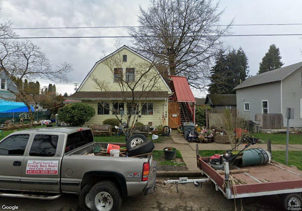
748 Grove St Lebanon, OR 97355
Estimated Value: $466,790 - $494,000
2
Beds
2
Baths
2,715
Sq Ft
$177/Sq Ft
Est. Value
About This Home
This home is located at 748 Grove St, Lebanon, OR 97355 and is currently estimated at $480,395, approximately $176 per square foot. 748 Grove St is a home located in Linn County with nearby schools including Pioneer School, Lebanon High School, and East Linn Christian Academy.
Ownership History
Date
Name
Owned For
Owner Type
Purchase Details
Closed on
Jul 19, 2022
Sold by
Biery Theodore E
Bought by
Brooks Steven
Current Estimated Value
Home Financials for this Owner
Home Financials are based on the most recent Mortgage that was taken out on this home.
Original Mortgage
$412,392
Outstanding Balance
$394,679
Interest Rate
5.81%
Mortgage Type
New Conventional
Estimated Equity
$85,716
Purchase Details
Closed on
Mar 13, 2015
Sold by
Biles La Vergne M
Bought by
Biery Theodore E
Home Financials for this Owner
Home Financials are based on the most recent Mortgage that was taken out on this home.
Original Mortgage
$123,960
Interest Rate
3.61%
Mortgage Type
VA
Create a Home Valuation Report for This Property
The Home Valuation Report is an in-depth analysis detailing your home's value as well as a comparison with similar homes in the area
Home Values in the Area
Average Home Value in this Area
Purchase History
| Date | Buyer | Sale Price | Title Company |
|---|---|---|---|
| Brooks Steven | $420,000 | Ticor Title | |
| Biery Theodore E | $120,000 | Amerititle |
Source: Public Records
Mortgage History
| Date | Status | Borrower | Loan Amount |
|---|---|---|---|
| Open | Brooks Steven | $412,392 | |
| Previous Owner | Biery Theodore E | $123,960 |
Source: Public Records
Tax History Compared to Growth
Tax History
| Year | Tax Paid | Tax Assessment Tax Assessment Total Assessment is a certain percentage of the fair market value that is determined by local assessors to be the total taxable value of land and additions on the property. | Land | Improvement |
|---|---|---|---|---|
| 2024 | $5,100 | $242,700 | -- | -- |
| 2023 | $4,936 | $235,640 | $0 | $0 |
| 2022 | $4,832 | $228,780 | $0 | $0 |
| 2021 | $4,659 | $222,120 | $0 | $0 |
| 2020 | $4,602 | $215,660 | $0 | $0 |
| 2019 | $4,372 | $209,380 | $0 | $0 |
| 2018 | $4,339 | $203,290 | $0 | $0 |
| 2017 | $4,124 | $197,370 | $0 | $0 |
| 2016 | $3,686 | $191,630 | $0 | $0 |
| 2015 | $3,474 | $186,050 | $0 | $0 |
| 2014 | $3,214 | $180,640 | $0 | $0 |
Source: Public Records
Map
Nearby Homes
- 54 W Sherman St
- 411 Mayer Dr
- 64 W Vine St
- TL 600 E Oak St
- 760 S 2nd St
- 938 Cleveland St
- 1111 Hiatt St
- 0 Hiatt (Lot Unit 7000) St
- 294 S 2nd St
- 324 W Sherman St
- 178 S Main St
- 705 E Sherman St
- 121 S Williams (125) St
- 875 S 5th St
- 495 Carlson Dr
- 235 Cleveland St
- 1400 Grove St
- 653 E Elmore (Next To) St
- 151 Cleveland St
- Parcel 2 E Grant St
- 748 Grove (-746) St
- 170 E Sherman St
- 169 E Grant St
- 157 E Grant St
- 176 E Sherman St
- 197 E Grant St
- 160 E Sherman St
- 157 E Grant (-169) St
- 140 E Sherman St
- 0 E Grant (Parcel 1) St
- 0 E Grant (Parcel 2) St Unit 24214748
- 202 E Grant St
- 213 E Grant St
- 210 E Sherman St
- 723 Park St
- 170 E Grant St
- 231 E Grant St
- 685 Grove St
- 242 E Sherman St
- 210 E Grant St