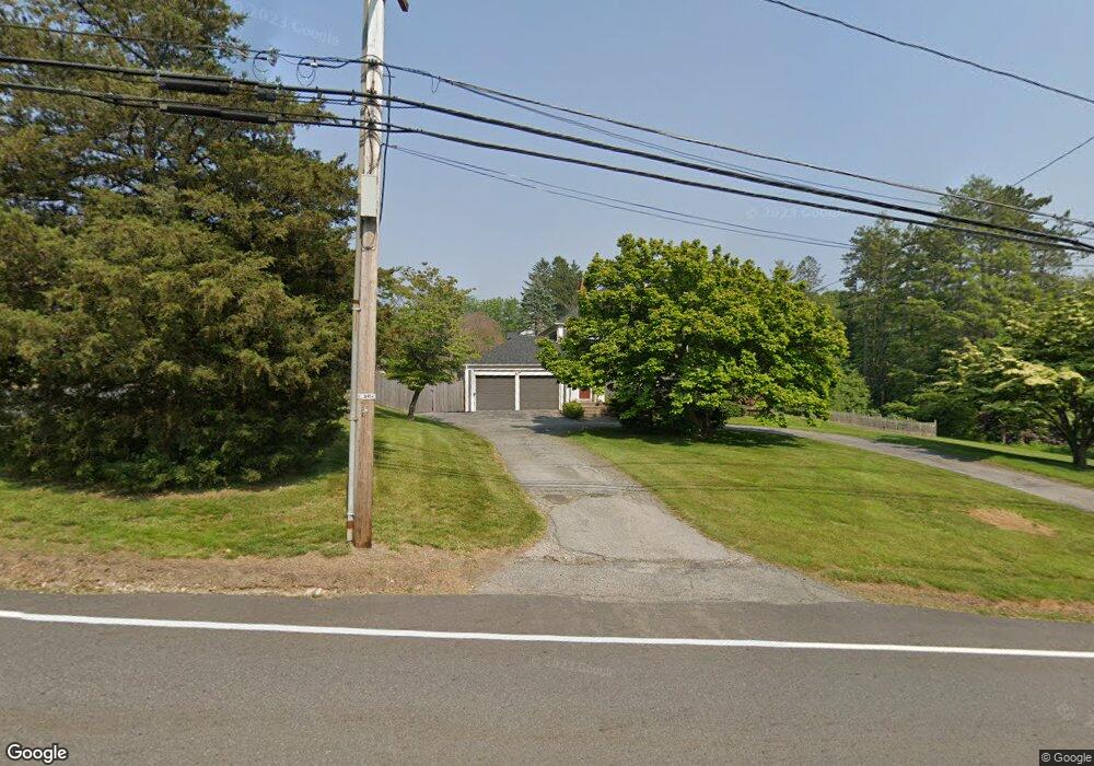
748 Hill St Whitinsville, MA 01588
Estimated Value: $487,062 - $587,000
2
Beds
2
Baths
1,835
Sq Ft
$286/Sq Ft
Est. Value
About This Home
This home is located at 748 Hill St, Whitinsville, MA 01588 and is currently estimated at $525,266, approximately $286 per square foot. 748 Hill St is a home located in Worcester County with nearby schools including Northbridge Elementary School, Northbridge Middle School, and Northbridge High School.
Ownership History
Date
Name
Owned For
Owner Type
Purchase Details
Closed on
Apr 14, 2014
Sold by
Kotval Cheryl A
Bought by
Kotval Cheryl A and Kotval George
Current Estimated Value
Purchase Details
Closed on
Mar 18, 2014
Sold by
Kotval George and Kotval Cheryl A
Bought by
Kotval Cheryl A
Purchase Details
Closed on
Mar 24, 1992
Sold by
Savers Coop Bank
Bought by
Kotval George
Purchase Details
Closed on
Apr 21, 1988
Sold by
Buma Madeline L
Bought by
Desjarlais Michael G
Create a Home Valuation Report for This Property
The Home Valuation Report is an in-depth analysis detailing your home's value as well as a comparison with similar homes in the area
Home Values in the Area
Average Home Value in this Area
Purchase History
| Date | Buyer | Sale Price | Title Company |
|---|---|---|---|
| Kotval Cheryl A | -- | -- | |
| Kotval Cheryl A | -- | -- | |
| Kotval Cheryl A | -- | -- | |
| Kotval Cheryl A | -- | -- | |
| Kotval George | $115,000 | -- | |
| Kotval George | $115,000 | -- | |
| Desjarlais Michael G | $177,500 | -- |
Source: Public Records
Mortgage History
| Date | Status | Borrower | Loan Amount |
|---|---|---|---|
| Previous Owner | Desjarlais Michael G | $45,000 | |
| Previous Owner | Desjarlais Michael G | $30,000 | |
| Previous Owner | Desjarlais Michael G | $80,000 |
Source: Public Records
Tax History Compared to Growth
Tax History
| Year | Tax Paid | Tax Assessment Tax Assessment Total Assessment is a certain percentage of the fair market value that is determined by local assessors to be the total taxable value of land and additions on the property. | Land | Improvement |
|---|---|---|---|---|
| 2025 | $4,664 | $395,600 | $157,400 | $238,200 |
| 2024 | $4,542 | $375,700 | $157,400 | $218,300 |
| 2023 | $4,590 | $354,200 | $157,400 | $196,800 |
| 2022 | $4,165 | $302,500 | $121,400 | $181,100 |
| 2021 | $7,965 | $282,600 | $115,800 | $166,800 |
| 2020 | $611 | $275,200 | $115,800 | $159,400 |
| 2019 | $3,450 | $266,000 | $115,800 | $150,200 |
| 2018 | $22,981 | $254,900 | $110,200 | $144,700 |
| 2017 | $3,232 | $243,800 | $110,200 | $133,600 |
| 2016 | $3,139 | $228,300 | $100,100 | $128,200 |
| 2015 | $3,055 | $228,300 | $100,100 | $128,200 |
| 2014 | $3,027 | $228,300 | $100,100 | $128,200 |
Source: Public Records
Map
Nearby Homes
- 86 Kingsnorth St
- 192 Rebecca Rd
- 46 Rebecca Rd
- 731 Samuel Dr
- 135 Windstone Dr
- 708 Marston Rd
- 894 Marston Rd
- 90 Nathaniel Dr
- 24 Crescent St Unit 6
- 2 D St
- 14 C St Unit 24
- 14 C St Unit 14
- Lots 1-9 Spring St
- 11 A St Unit 11
- 157 Rolling Ridge Dr Unit 84
- 331 Cooper Rd
- 5 Summit St
- 21 Granite St
- 104 Alana Dr
- 18 East St Unit 24
- 9 Heights of Hill St
- 768 Hill St
- 28 Heights of Hill St
- 28 Heights of Hill St Unit n/a
- 28 Heights of Hill St Unit 1
- 753 Hill St
- 33 Heights of Hill St
- 769 Hill St
- 782 Hill St
- 50 Heights of Hill St
- 49 Heights of Hill St
- 794 Hill St
- 0 Kingsnorth St
- 78 Heights of Hill St
- 719 Hill St
- 37 Kingsnorth St
- 806 Hill St
- 75 Heights of Hill St
- 805 Hill St
- 30 Kingsnorth St