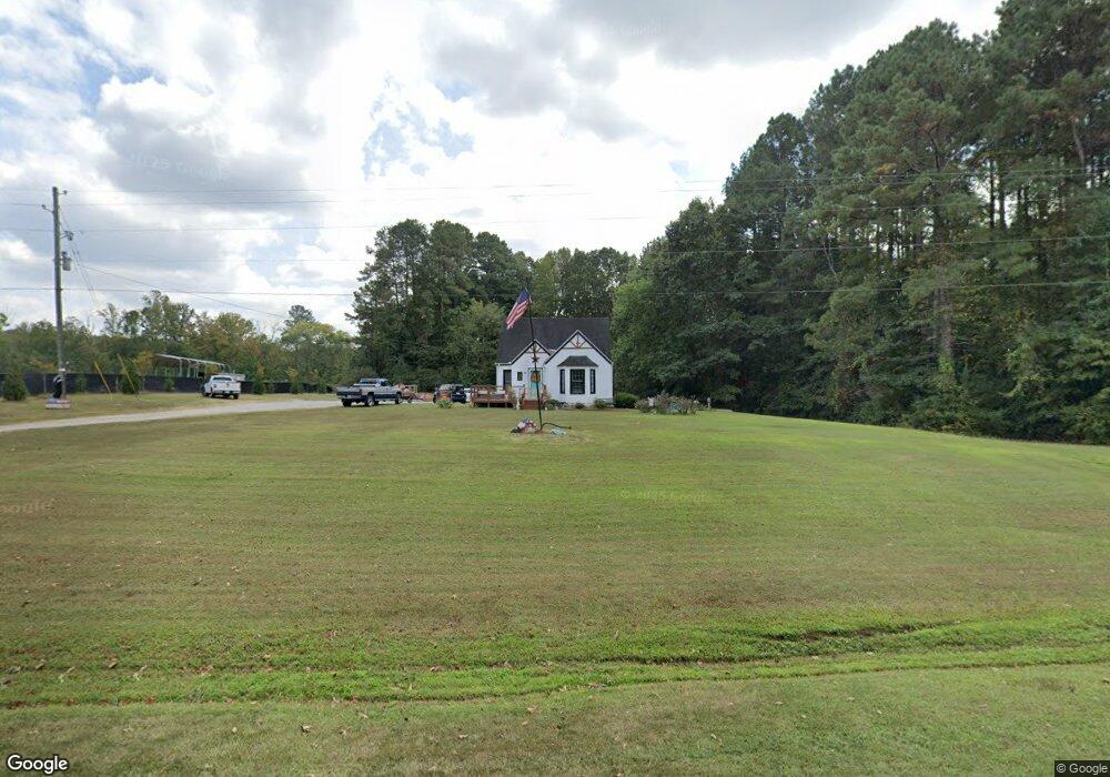
748 Nc 561 Hwy Louisburg, NC 27549
Estimated Value: $170,000 - $242,000
2
Beds
1
Bath
1,432
Sq Ft
$151/Sq Ft
Est. Value
About This Home
This home is located at 748 Nc 561 Hwy, Louisburg, NC 27549 and is currently estimated at $215,826, approximately $150 per square foot. 748 Nc 561 Hwy is a home located in Franklin County with nearby schools including Louisburg Elementary School, Terrell Lane Middle School, and Louisburg High School.
Ownership History
Date
Name
Owned For
Owner Type
Purchase Details
Closed on
Aug 5, 2020
Sold by
Joyner Deborah W and Estate Of Malcolm E Wren
Bought by
Finn Michael Ray and Finn Janet Deans
Current Estimated Value
Home Financials for this Owner
Home Financials are based on the most recent Mortgage that was taken out on this home.
Original Mortgage
$74,949
Outstanding Balance
$66,311
Interest Rate
3.1%
Mortgage Type
New Conventional
Estimated Equity
$149,515
Purchase Details
Closed on
Apr 5, 2013
Sold by
Skeans Martha Louchheim and Skeans Clark
Bought by
Wrenn Malcolm E
Home Financials for this Owner
Home Financials are based on the most recent Mortgage that was taken out on this home.
Original Mortgage
$50,000
Interest Rate
3.52%
Mortgage Type
Purchase Money Mortgage
Create a Home Valuation Report for This Property
The Home Valuation Report is an in-depth analysis detailing your home's value as well as a comparison with similar homes in the area
Home Values in the Area
Average Home Value in this Area
Purchase History
| Date | Buyer | Sale Price | Title Company |
|---|---|---|---|
| Finn Michael Ray | $74,500 | None Available | |
| Wrenn Malcolm E | $50,000 | None Available |
Source: Public Records
Mortgage History
| Date | Status | Borrower | Loan Amount |
|---|---|---|---|
| Open | Finn Michael Ray | $74,949 | |
| Previous Owner | Wrenn Malcolm E | $50,000 |
Source: Public Records
Tax History Compared to Growth
Tax History
| Year | Tax Paid | Tax Assessment Tax Assessment Total Assessment is a certain percentage of the fair market value that is determined by local assessors to be the total taxable value of land and additions on the property. | Land | Improvement |
|---|---|---|---|---|
| 2025 | $1,002 | $148,100 | $41,340 | $106,760 |
| 2024 | $1,002 | $148,100 | $41,340 | $106,760 |
| 2023 | $818 | $80,170 | $20,010 | $60,160 |
| 2022 | $808 | $80,170 | $20,010 | $60,160 |
| 2021 | $737 | $71,410 | $20,010 | $51,400 |
| 2020 | $734 | $71,410 | $20,010 | $51,400 |
| 2019 | $722 | $71,410 | $20,010 | $51,400 |
| 2018 | $719 | $71,410 | $20,010 | $51,400 |
| 2017 | $505 | $43,500 | $16,680 | $26,820 |
| 2016 | $520 | $43,500 | $16,680 | $26,820 |
| 2015 | $518 | $43,500 | $16,680 | $26,820 |
| 2014 | $470 | $43,500 | $16,680 | $26,820 |
Source: Public Records
Map
Nearby Homes
- 55 Leisure Ln
- 70 Leisure Ln
- 45 Leisure Ln
- 109 Drew St
- 376 T K Allen Rd
- 7.69 Acres N Carolina 561
- 23.20 Acre N Carolina 561
- 10.26 Acre N Carolina 561
- 0-0 Halifax Rd
- 491 Nc 56 Hwy E
- 126 Person St
- 125 Davis St
- 191 Nc 56 Hwy E
- 311 Nc 56 Hwy E
- 612 N Main St
- 101 Briarwood Ct
- 604 N Main St
- 121 Tanglewood Dr
- 205 Williamson St
- 401 N Main St
- 790 Nc 561 Hwy
- 821 Nc 561 Hwy
- 821 N Carolina 561
- 167 Hugh Perry Rd
- 554 Terrell Ln
- 550 Terrell Ln
- 860 Nc 561 Hwy
- 860 Nc 561 Hwy
- 135 Rolling Cloud Dr
- 125 Rolling Cloud Dr
- 866 Nc 561 Hwy
- 861 Nc 561 Hwy
- 861 Nc 561 Hwy
- 861 Nc 561 Hwy
- 115 Rolling Cloud Dr
- 428 Terrell Ln
- 110 Rolling Cloud Dr
- 95 Rolling Cloud Dr
- 100 Rolling Cloud Dr
- 90 Rolling Cloud Dr