Estimated Value: $321,308 - $483,000
3
Beds
2
Baths
2,256
Sq Ft
$168/Sq Ft
Est. Value
About This Home
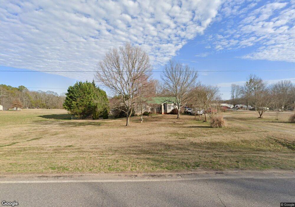
This home is located at 7480 Nowhere Rd, Hull, GA 30646 and is currently estimated at $379,577, approximately $168 per square foot. 7480 Nowhere Rd is a home located in Madison County with nearby schools including Madison County High School and Union Christian Academy.
Ownership History
Date
Name
Owned For
Owner Type
Purchase Details
Closed on
Jun 27, 2006
Sold by
Chitwood David S
Bought by
Campbell Ricky M and Campbell Marie M
Current Estimated Value
Home Financials for this Owner
Home Financials are based on the most recent Mortgage that was taken out on this home.
Original Mortgage
$128,000
Outstanding Balance
$74,572
Interest Rate
6.6%
Mortgage Type
New Conventional
Estimated Equity
$305,005
Purchase Details
Closed on
Apr 11, 1996
Bought by
Chitwood David S
Create a Home Valuation Report for This Property
The Home Valuation Report is an in-depth analysis detailing your home's value as well as a comparison with similar homes in the area
Purchase History
| Date | Buyer | Sale Price | Title Company |
|---|---|---|---|
| Campbell Ricky M | $160,000 | -- | |
| Chitwood David S | -- | -- |
Source: Public Records
Mortgage History
| Date | Status | Borrower | Loan Amount |
|---|---|---|---|
| Open | Campbell Ricky M | $128,000 | |
| Closed | Campbell Ricky M | $16,000 |
Source: Public Records
Tax History
| Year | Tax Paid | Tax Assessment Tax Assessment Total Assessment is a certain percentage of the fair market value that is determined by local assessors to be the total taxable value of land and additions on the property. | Land | Improvement |
|---|---|---|---|---|
| 2025 | $2,991 | $119,730 | $18,240 | $101,490 |
| 2024 | $29 | $116,460 | $18,240 | $98,220 |
| 2023 | $3,262 | $106,850 | $15,200 | $91,650 |
| 2022 | $2,456 | $91,030 | $10,450 | $80,580 |
| 2021 | $2,058 | $69,432 | $10,450 | $58,982 |
| 2020 | $2,026 | $67,912 | $8,930 | $58,982 |
| 2019 | $2,008 | $66,557 | $8,930 | $57,627 |
| 2018 | $1,928 | $63,831 | $8,170 | $55,661 |
| 2017 | $1,821 | $63,229 | $7,600 | $55,629 |
| 2016 | $1,493 | $54,019 | $6,912 | $47,107 |
| 2015 | $1,494 | $54,019 | $6,912 | $47,107 |
| 2014 | $1,490 | $53,582 | $6,912 | $46,670 |
| 2013 | -- | $53,582 | $6,912 | $46,670 |
Source: Public Records
Map
Nearby Homes
- 310 Sawdust Rd
- 0 Crabapple Hollow Rd Unit TRACT 2
- 1246 Stone Stewart Rd
- 832 Stone Stewart Rd
- 0 Stone Stewart Rd Unit 7519457
- 0 Stone Stewart Rd Unit 10452697
- 0 Stone Stewart Rd Unit 1023553
- 357 Carither Rd
- 284 Snow Farm Rd
- 9980 Nowhere Rd
- 1067 Garnett Ward Rd Unit 2
- 3655 Neese Commerce Rd
- 0 Erastus Church Rd Unit 10647280
- 0 Erastus Church Rd Unit 10647276
- 0 Erastus Church Rd Unit 26346190
- 0 Erastus Church Rd Unit 10647273
- 25 Rose Hill Ln
- 975 Diamond Hill Neese Rd
- 450 Candlestick Dr
- 103 Three Rivers Ct
- 7575 Nowhere Rd
- 7591 Nowhere Rd
- 7306 Nowhere Rd
- 7435 Nowhere Rd
- 7701 Nowhere Rd
- 7705 Nowhere Rd
- 7252 Nowhere Rd
- 7488 Nowhere Rd
- 7269 Nowhere Rd
- 7314 Nowhere Rd
- 7225 Nowhere Rd
- 7191 Nowhere Rd
- 1395 Leon Ellis Rd
- 123 Dillard Rd
- 7171 Nowhere Rd
- Lot 10 Leon Ellis Rd
- Lot 12 Leon Ellis Rd
- Lot 1 Leon Ellis Rd
- 00 Leon Ellis Rd
- 1467 Leon Ellis Rd
Your Personal Tour Guide
Ask me questions while you tour the home.