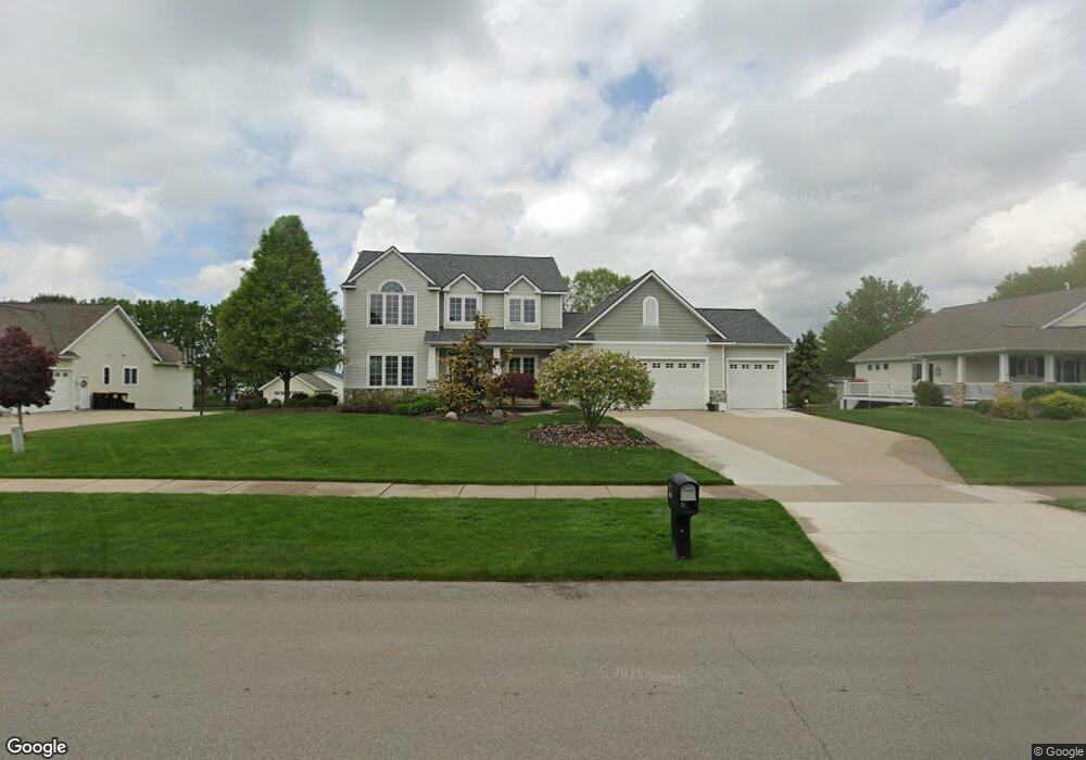
7487 Southwood Ave SW Byron Center, MI 49315
Estimated Value: $730,762 - $826,000
--
Bed
1
Bath
2,524
Sq Ft
$302/Sq Ft
Est. Value
About This Home
This home is located at 7487 Southwood Ave SW, Byron Center, MI 49315 and is currently estimated at $762,691, approximately $302 per square foot. 7487 Southwood Ave SW is a home located in Kent County with nearby schools including Marshall Elementary School, Robert L. Nickels Intermediate School, and Byron Center West Middle School.
Ownership History
Date
Name
Owned For
Owner Type
Purchase Details
Closed on
Apr 22, 2003
Sold by
Kulper Victor P and Kulper Lisa J
Bought by
Birdsall Michael L and Birdsall Diane G
Current Estimated Value
Home Financials for this Owner
Home Financials are based on the most recent Mortgage that was taken out on this home.
Original Mortgage
$291,550
Interest Rate
5.71%
Mortgage Type
Balloon
Create a Home Valuation Report for This Property
The Home Valuation Report is an in-depth analysis detailing your home's value as well as a comparison with similar homes in the area
Home Values in the Area
Average Home Value in this Area
Purchase History
| Date | Buyer | Sale Price | Title Company |
|---|---|---|---|
| Birdsall Michael L | $343,000 | -- |
Source: Public Records
Mortgage History
| Date | Status | Borrower | Loan Amount |
|---|---|---|---|
| Closed | Birdsall Michael L | $291,550 |
Source: Public Records
Tax History Compared to Growth
Tax History
| Year | Tax Paid | Tax Assessment Tax Assessment Total Assessment is a certain percentage of the fair market value that is determined by local assessors to be the total taxable value of land and additions on the property. | Land | Improvement |
|---|---|---|---|---|
| 2025 | $4,024 | $335,400 | $0 | $0 |
| 2024 | $4,024 | $317,200 | $0 | $0 |
| 2023 | $3,848 | $275,400 | $0 | $0 |
| 2022 | $5,364 | $248,200 | $0 | $0 |
| 2021 | $5,220 | $217,000 | $0 | $0 |
| 2020 | $3,542 | $204,800 | $0 | $0 |
| 2019 | $5,094 | $199,100 | $0 | $0 |
| 2018 | $4,989 | $185,200 | $25,500 | $159,700 |
| 2017 | $4,774 | $173,500 | $0 | $0 |
| 2016 | $4,597 | $165,800 | $0 | $0 |
| 2015 | $4,518 | $165,800 | $0 | $0 |
| 2013 | -- | $145,200 | $0 | $0 |
Source: Public Records
Map
Nearby Homes
- 2581 Ravines Trail Dr SW
- 2569 Ravines Trail Dr SW
- 2567 Ravines Trail Dr SW
- 2553 Ravines Trail Dr SW
- 3183 Railway Dr SW
- 7998 Byron Depot Dr SW
- 8030 Lionel Dr
- 8115 Byron Depot Dr SW
- 8090 Country Rail Ct SW
- Redwood Plan at Railside - Woodland Series
- Sycamore Plan at Railside - Woodland Series
- Bay Harbor Plan at Railside - Landmark Series
- Northport Plan at Railside - Landmark Series
- Pentwater Plan at Railside - Landmark Series
- Oakwood Plan at Railside - Woodland Series
- 8138 Boardwalk Dr SW
- 8047 Erie Dr
- 3563 Conrail Dr
- 8393 Woodhaven Dr SW Unit 1
- 2740 Woodhaven Ct SW Unit 2
- 7501 Southwood Ave SW
- 7471 Southwood Ave SW
- 7488 Indigo Ridge Dr SW
- 7500 Indigo Ridge Dr SW
- 7453 Southwood Ave SW
- 7474 Indigo Ridge Dr SW
- 7509 Southwood Ave SW
- 7490 Southwood Ave SW
- 7476 Southwood Ave SW
- 7516 Indigo Ridge Dr SW
- 7512 Southwood Ave SW
- 7456 Indigo Ridge Dr SW
- 7517 Southwood Ave SW
- 7524 Southwood Ave SW
- 7454 Southwood Ave SW
- 7530 Indigo Ridge Dr SW
- 7440 Indigo Ridge Dr SW
- 7431 Southwood Ave SW
- 7438 Southwood Ave SW
- 7479 Indigo Ridge Dr SW