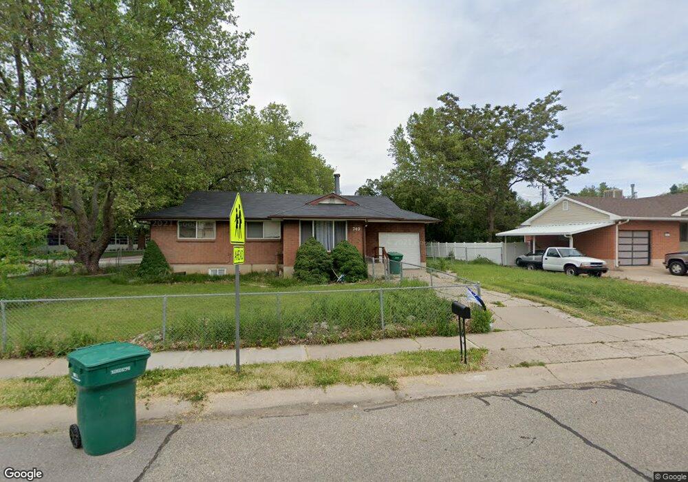
749 Lindsay St Layton, UT 84041
Estimated Value: $409,000 - $443,401
4
Beds
2
Baths
2,028
Sq Ft
$208/Sq Ft
Est. Value
About This Home
This home is located at 749 Lindsay St, Layton, UT 84041 and is currently estimated at $422,350, approximately $208 per square foot. 749 Lindsay St is a home located in Davis County with nearby schools including Whitesides Elementary School, Central Davis Junior High School, and Layton High School.
Ownership History
Date
Name
Owned For
Owner Type
Purchase Details
Closed on
Jun 3, 2016
Sold by
Williams Danny L and Williams Renee D
Bought by
Seelye Ameedaun
Current Estimated Value
Purchase Details
Closed on
Sep 17, 2008
Sold by
Norton Richard A and Norton Rebekah I
Bought by
Williams Danny L and Williams Renee D
Home Financials for this Owner
Home Financials are based on the most recent Mortgage that was taken out on this home.
Original Mortgage
$169,759
Interest Rate
6.51%
Mortgage Type
FHA
Purchase Details
Closed on
Feb 15, 2008
Sold by
Simpson Charles M and Simpson Jolynn S
Bought by
Norton Richard A and Norton Rebekah I
Home Financials for this Owner
Home Financials are based on the most recent Mortgage that was taken out on this home.
Original Mortgage
$106,100
Interest Rate
5.64%
Mortgage Type
Purchase Money Mortgage
Create a Home Valuation Report for This Property
The Home Valuation Report is an in-depth analysis detailing your home's value as well as a comparison with similar homes in the area
Home Values in the Area
Average Home Value in this Area
Purchase History
| Date | Buyer | Sale Price | Title Company |
|---|---|---|---|
| Seelye Ameedaun | -- | None Available | |
| Williams Danny L | -- | Merrill Title Company | |
| Norton Richard A | -- | Western States Title Company |
Source: Public Records
Mortgage History
| Date | Status | Borrower | Loan Amount |
|---|---|---|---|
| Previous Owner | Williams Danny L | $169,759 | |
| Previous Owner | Norton Richard A | $106,100 |
Source: Public Records
Tax History Compared to Growth
Tax History
| Year | Tax Paid | Tax Assessment Tax Assessment Total Assessment is a certain percentage of the fair market value that is determined by local assessors to be the total taxable value of land and additions on the property. | Land | Improvement |
|---|---|---|---|---|
| 2025 | $2,091 | $219,450 | $101,787 | $117,663 |
| 2024 | $2,023 | $213,950 | $118,303 | $95,647 |
| 2023 | $1,894 | $353,000 | $137,897 | $215,103 |
| 2022 | $1,983 | $200,750 | $73,725 | $127,025 |
| 2021 | $1,736 | $262,000 | $105,609 | $156,391 |
| 2020 | $1,574 | $228,000 | $87,935 | $140,065 |
| 2019 | $1,544 | $219,000 | $82,681 | $136,319 |
| 2018 | $1,384 | $197,000 | $82,681 | $114,319 |
| 2016 | $1,200 | $88,111 | $27,014 | $61,097 |
| 2015 | $1,138 | $79,366 | $27,014 | $52,352 |
| 2014 | $1,381 | $98,496 | $27,014 | $71,482 |
| 2013 | -- | $76,956 | $18,612 | $58,344 |
Source: Public Records
Map
Nearby Homes
- 942 E Gentile St
- 556 N Fairfield Rd Unit A2
- 556 N Fairfield Rd Unit D1
- 556 N Fairfield Rd Unit D2
- 556 N Fairfield Rd Unit A3
- 556 N Fairfield Rd Unit D3
- 556 N Fairfield Rd Unit D4
- 556 N Fairfield Rd Unit A1
- 556 N Fairfield Rd Unit A4
- 508 N Adamswood Rd
- 857 E 575 N
- 861 E 575 N
- 431 N 1050 E
- 86 Mill Rd
- 654 Colonial St
- 110 Mill Rd
- 1247 E 300 N
- 479 N 1375 E
- 794 Valeria Dr
- 580 N Allanwood Place
- 749 E Lindsay St
- 767 Lindsay St
- 262 Colonial Ave
- 760 Lindsay St
- 744 Lindsay St
- 776 Lindsay St
- 787 Lindsay St
- 787 E Lindsay200 N
- 275 Dixie Ave
- 132 Colonial Ave
- 145 Dixie Ave
- 287 Dixie Ave
- 308 Colonial Ave
- 125 Dixie Ave
- 124 Colonial Ave
- 131 Dixie Ave
- 301 Dixie Ave
- 137 Dixie Ave
- 116 Colonial Ave
- 316 Colonial Ave