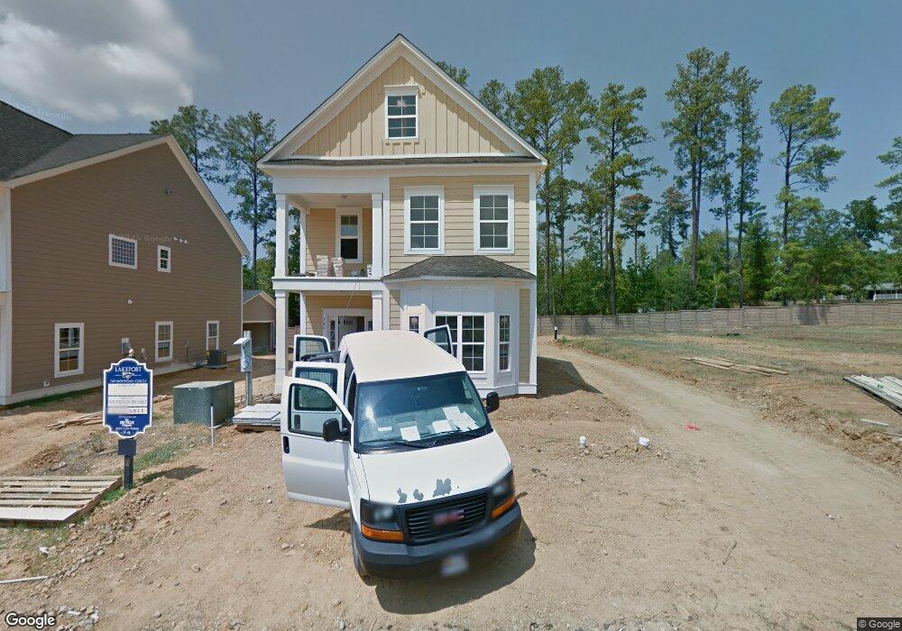
749 Moonsail Cir Chapin, SC 29036
Estimated Value: $316,000 - $393,050
3
Beds
3
Baths
1,900
Sq Ft
$191/Sq Ft
Est. Value
About This Home
This home is located at 749 Moonsail Cir, Chapin, SC 29036 and is currently estimated at $362,683, approximately $190 per square foot. 749 Moonsail Cir is a home located in Richland County with nearby schools including Lake Murray Elementary School, Chapin Intermediate, and Chapin High School.
Ownership History
Date
Name
Owned For
Owner Type
Purchase Details
Closed on
Dec 15, 2023
Sold by
Crosby Charles E
Bought by
Hatcher Paul O and Hatcher Tammy D
Current Estimated Value
Purchase Details
Closed on
Dec 4, 2020
Sold by
Shealy Virginia H and Hyatt Virginia E
Bought by
Crosby Charles E
Purchase Details
Closed on
Jun 7, 2017
Sold by
Stas Amanda D and Graves Amanda D
Bought by
Shealy Virginia H
Home Financials for this Owner
Home Financials are based on the most recent Mortgage that was taken out on this home.
Original Mortgage
$176,000
Interest Rate
4.03%
Mortgage Type
New Conventional
Purchase Details
Closed on
Aug 3, 2012
Sold by
Mungo Homes Inc
Bought by
Graves Amanda D
Home Financials for this Owner
Home Financials are based on the most recent Mortgage that was taken out on this home.
Original Mortgage
$160,000
Interest Rate
3.65%
Mortgage Type
New Conventional
Create a Home Valuation Report for This Property
The Home Valuation Report is an in-depth analysis detailing your home's value as well as a comparison with similar homes in the area
Home Values in the Area
Average Home Value in this Area
Purchase History
| Date | Buyer | Sale Price | Title Company |
|---|---|---|---|
| Hatcher Paul O | $369,900 | South Carolina Title | |
| Crosby Charles E | $246,500 | None Available | |
| Crosby Charles E | $246,500 | New Title Company Name | |
| Shealy Virginia H | $220,000 | None Available | |
| Graves Amanda D | $200,000 | None Available |
Source: Public Records
Mortgage History
| Date | Status | Borrower | Loan Amount |
|---|---|---|---|
| Previous Owner | Shealy Virginia H | $176,000 | |
| Previous Owner | Graves Amanda D | $160,000 |
Source: Public Records
Tax History Compared to Growth
Tax History
| Year | Tax Paid | Tax Assessment Tax Assessment Total Assessment is a certain percentage of the fair market value that is determined by local assessors to be the total taxable value of land and additions on the property. | Land | Improvement |
|---|---|---|---|---|
| 2023 | $2,992 | $0 | $0 | $0 |
| 2021 | $6,743 | $14,790 | $0 | $0 |
| 2020 | $1,951 | $8,820 | $0 | $0 |
| 2019 | $1,935 | $8,820 | $0 | $0 |
| 2018 | $1,713 | $8,800 | $0 | $0 |
| 2017 | $1,539 | $8,000 | $0 | $0 |
| 2016 | $1,532 | $8,000 | $0 | $0 |
| 2015 | $1,540 | $8,000 | $0 | $0 |
| 2014 | $1,536 | $200,000 | $0 | $0 |
| 2013 | -- | $8,000 | $0 | $0 |
Source: Public Records
Map
Nearby Homes
- 756 Helmsman Ln
- 739 Helmsman Ln
- 177 Lakeport Dr
- 608 Calypso Ct
- 149 Lakeport Dr
- 613 Calypso Ct
- 312 Lanyard Ln
- 371 Explorer Dr
- 379 Explorer Dr
- 313 Explorer Dr
- 384 Explorer Dr
- 1304 Silver Point Rd
- 552 Eagles Rest Dr
- 873 Sunseeker Dr
- 0 Johnson Marina Rd Unit 539063
- 740 Ruskin Dr
- 550 Malachite Ln
- 515 Malachite Ln
- 509 Malachite Ln
- 13 Botticelli Ct
- 745 Moonsail Cir
- 753 Moonsail Cir
- 741 Moonsail Cir
- 757 Moonsail Cir
- 761 Moonsail Cir
- 748 Moonsail Cir
- 752 Moonsail Cir
- 744 Moonsail Cir
- 756 Moonsail Cir
- 740 Moonsail Cir
- 765 Moonsail Cir
- 835 Bob Stay Way
- 760 Moonsail Cir
- 769 Moonsail Cir
- 643 Kumatage Ln
- 827 Bob Stay Way
- 716 Moonsail Cir
- 720 Moonsail Cir
- 724 Moonsail Cir
- 770 Helmsman Ln