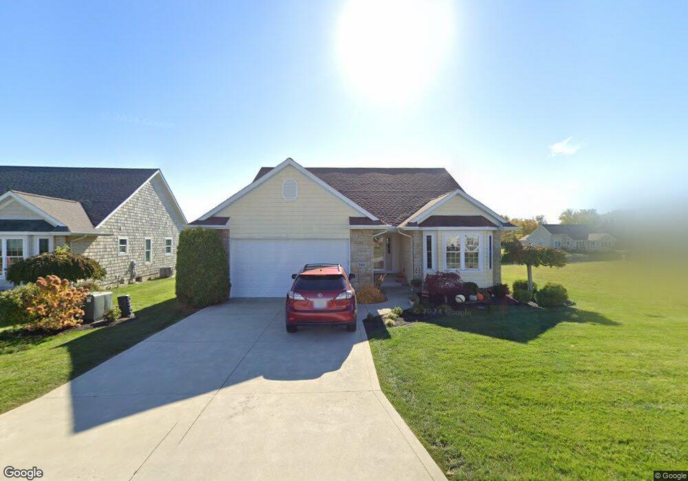
749 N Harbor Pointe Dr Port Clinton, OH 43452
Estimated Value: $455,273 - $551,000
3
Beds
2
Baths
1,841
Sq Ft
$276/Sq Ft
Est. Value
About This Home
This home is located at 749 N Harbor Pointe Dr, Port Clinton, OH 43452 and is currently estimated at $507,568, approximately $275 per square foot. 749 N Harbor Pointe Dr is a home located in Ottawa County with nearby schools including Bataan Memorial Primary School, Bataan Memorial Intermediate School, and Port Clinton Middle School.
Ownership History
Date
Name
Owned For
Owner Type
Purchase Details
Closed on
Jul 29, 2020
Sold by
Callihan Judith A and Hovis Todd W
Bought by
Jcw Investments Llc
Current Estimated Value
Purchase Details
Closed on
Feb 4, 2016
Sold by
Callihan Judith A
Bought by
Callihan Judith A Trustee & and Callihan Judith A
Purchase Details
Closed on
Jun 22, 2010
Sold by
Davenport Real Estate Development Llc
Bought by
Callihan Judith A
Home Financials for this Owner
Home Financials are based on the most recent Mortgage that was taken out on this home.
Original Mortgage
$200,000
Interest Rate
4.97%
Mortgage Type
Future Advance Clause Open End Mortgage
Create a Home Valuation Report for This Property
The Home Valuation Report is an in-depth analysis detailing your home's value as well as a comparison with similar homes in the area
Home Values in the Area
Average Home Value in this Area
Purchase History
| Date | Buyer | Sale Price | Title Company |
|---|---|---|---|
| Jcw Investments Llc | -- | None Available | |
| Callihan Judith A Trustee & | -- | -- | |
| Callihan Judith A | $50,000 | Attorney |
Source: Public Records
Mortgage History
| Date | Status | Borrower | Loan Amount |
|---|---|---|---|
| Previous Owner | Callihan Judith A | $200,000 |
Source: Public Records
Tax History Compared to Growth
Tax History
| Year | Tax Paid | Tax Assessment Tax Assessment Total Assessment is a certain percentage of the fair market value that is determined by local assessors to be the total taxable value of land and additions on the property. | Land | Improvement |
|---|---|---|---|---|
| 2024 | $4,949 | $152,656 | $40,173 | $112,483 |
| 2023 | $4,949 | $90,489 | $23,632 | $66,857 |
| 2022 | $3,224 | $90,489 | $23,632 | $66,857 |
| 2021 | $3,219 | $90,490 | $23,630 | $66,860 |
| 2020 | $3,200 | $88,890 | $23,630 | $65,260 |
| 2019 | $3,166 | $88,890 | $23,630 | $65,260 |
| 2018 | $3,161 | $88,890 | $23,630 | $65,260 |
| 2017 | $2,805 | $77,730 | $23,630 | $54,100 |
| 2016 | $2,811 | $77,730 | $23,630 | $54,100 |
| 2015 | $2,823 | $77,730 | $23,630 | $54,100 |
| 2014 | $2,758 | $77,730 | $23,630 | $54,100 |
| 2013 | $1,382 | $77,730 | $23,630 | $54,100 |
Source: Public Records
Map
Nearby Homes
- 1217 NE Catawba Rd Unit 13
- 1217 NE Catawba Rd Unit 14
- 1217 NE Catawba Rd Unit 15
- 1217 NE Catawba Rd Unit 16
- 1217 NE Catawba Rd
- 3776 E Pine Dr
- 4075 E Christopher Dr
- 4881 E Wood Duck Ct
- 3571 E Eagle Beach Cir
- 891 Lost Lake Rd
- 146 N Harbors End Dr Unit 21A
- 61 N Harbors End Dr
- 1876 N Lakewood Ave
- 1229 Catawba Bay Dr
- 0 N Windward Dr Unit 5144701
- Kimberly Plan at Catawba Meadows
- 739 N Harbor Pointe Dr
- 759 N Harbor Pointe Dr
- 601 Harbor Point Dr
- 829 Harbor Point Dr
- 631 Harbor Point Dr
- 661 Harbor Point Dr
- 601 Harbor Point Dr
- 789 Harbor Point Dr
- 819 Harbor Point Dr
- 701 Harbor Point Dr
- 739 Harbor Point Dr
- 621 Harbor Point Dr
- 691 Harbor Point Dr
- 834 Harbor Point Dr
- 769 Harbor Point Dr
- 841 Harbor Point Dr
- 824 Harbor Point Dr
- 641 Harbor Point Dr
- 651 Harbor Point Dr
- 799 Harbor Point Dr