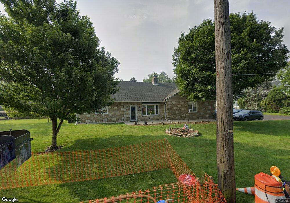
749 State Rd Bensalem, PA 19020
Estimated Value: $509,000 - $672,000
4
Beds
2
Baths
2,526
Sq Ft
$233/Sq Ft
Est. Value
About This Home
This home is located at 749 State Rd, Bensalem, PA 19020 and is currently estimated at $588,031, approximately $232 per square foot. 749 State Rd is a home located in Bucks County with nearby schools including Robert K. Shafer Middle School, St Charles Borromeo School, and Nazareth Academy Grade School.
Ownership History
Date
Name
Owned For
Owner Type
Purchase Details
Closed on
Mar 31, 2005
Sold by
Kozakeicz Joseph B and Kozakeicz Helen R
Bought by
Stokes Robert A and Stokes Deirdre G
Current Estimated Value
Home Financials for this Owner
Home Financials are based on the most recent Mortgage that was taken out on this home.
Original Mortgage
$236,000
Interest Rate
5.94%
Mortgage Type
Stand Alone First
Purchase Details
Closed on
Mar 22, 1973
Bought by
Kozakeicz Joseph B and Kozakeicz Helen R
Create a Home Valuation Report for This Property
The Home Valuation Report is an in-depth analysis detailing your home's value as well as a comparison with similar homes in the area
Home Values in the Area
Average Home Value in this Area
Purchase History
| Date | Buyer | Sale Price | Title Company |
|---|---|---|---|
| Stokes Robert A | $295,000 | First American Title Ins Co | |
| Kozakeicz Joseph B | -- | -- |
Source: Public Records
Mortgage History
| Date | Status | Borrower | Loan Amount |
|---|---|---|---|
| Previous Owner | Stokes Robert A | $236,000 |
Source: Public Records
Tax History Compared to Growth
Tax History
| Year | Tax Paid | Tax Assessment Tax Assessment Total Assessment is a certain percentage of the fair market value that is determined by local assessors to be the total taxable value of land and additions on the property. | Land | Improvement |
|---|---|---|---|---|
| 2025 | $6,032 | $27,630 | $4,760 | $22,870 |
| 2024 | $6,032 | $27,630 | $4,760 | $22,870 |
| 2023 | $5,861 | $27,630 | $4,760 | $22,870 |
| 2022 | $5,827 | $27,630 | $4,760 | $22,870 |
| 2021 | $5,827 | $27,630 | $4,760 | $22,870 |
| 2020 | $5,769 | $27,630 | $4,760 | $22,870 |
| 2019 | $5,640 | $27,630 | $4,760 | $22,870 |
| 2018 | $5,509 | $27,630 | $4,760 | $22,870 |
| 2017 | $5,475 | $27,630 | $4,760 | $22,870 |
| 2016 | $5,475 | $27,630 | $4,760 | $22,870 |
| 2015 | -- | $27,630 | $4,760 | $22,870 |
| 2014 | -- | $27,630 | $4,760 | $22,870 |
Source: Public Records
Map
Nearby Homes
- 827 Mitchell Ave
- 1039 Clinton Ave
- 1103 Colonial Ave
- 1080 Buttonwood Ave
- 3750 Clarendon Ave Unit 3
- 3750 00 Clarendon Unit 221
- 3727 Pitt Place
- 4161 Orchard Ln
- 3726 Clarendon Ave
- 3720 Clarendon Ave
- 4953 Fitler St Units #K & #L
- 1126 Evelyn Ave
- 3994 Constance Rd
- 3624 E Crown Ave
- 3609 Essex Ln
- 9580 State Rd Unit 36A
- 3627 N Hereford Ln
- 3623 N Hereford Ln
- 1236 Whittier Ave
- 124 Meadow Ln
- 533 Edgewood Ave
- 538 Edgewood Ave
- 549 Locust Ave
- 616 Locust Ave
- 615 Edgewood Ave
- 615 Edgewood Ave Unit E
- 539 Locust Ave
- 532 Edgewood Ave
- 519 Edgewood Ave
- 726 State Rd
- 527 Locust Ave
- 615 Locust Ave
- 526 Edgewood Ave
- 518 Edgewood Ave
- 709 State Rd
- 845 Village Ln
- 750 Midvale Ave
- 519 Locust Ave
- 630 Locust Ave
- 533 Walnut Ave