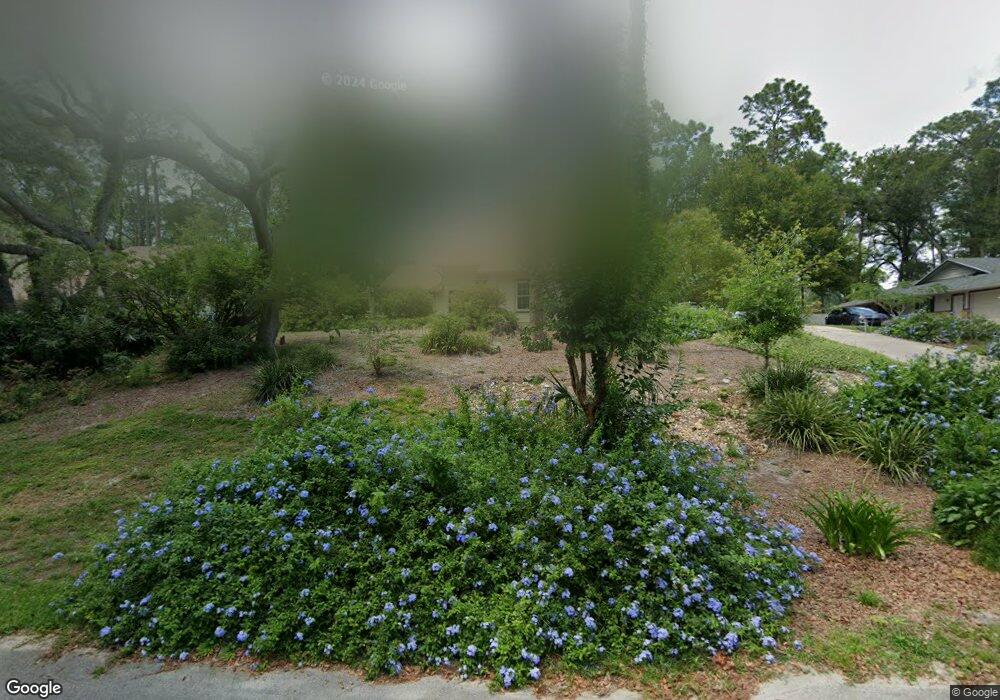
749 Torchwood Dr Deland, FL 32724
Estimated Value: $359,863 - $413,000
3
Beds
3
Baths
1,658
Sq Ft
$235/Sq Ft
Est. Value
About This Home
This home is located at 749 Torchwood Dr, Deland, FL 32724 and is currently estimated at $389,216, approximately $234 per square foot. 749 Torchwood Dr is a home located in Volusia County with nearby schools including Freedom Elementary School, Deland High School, and Deland Middle School.
Ownership History
Date
Name
Owned For
Owner Type
Purchase Details
Closed on
Feb 7, 2024
Sold by
Maddox Edward N and Maddox Marlyn Brister
Bought by
Maddox Marlyn Brister and Maddox Eric Nicholas
Current Estimated Value
Purchase Details
Closed on
Jul 15, 1992
Bought by
Maddox Edward N
Purchase Details
Closed on
Sep 15, 1985
Bought by
Maddox Edward N
Purchase Details
Closed on
Dec 15, 1980
Bought by
Maddox Edward N
Purchase Details
Closed on
Oct 15, 1980
Bought by
Maddox Edward N
Create a Home Valuation Report for This Property
The Home Valuation Report is an in-depth analysis detailing your home's value as well as a comparison with similar homes in the area
Home Values in the Area
Average Home Value in this Area
Purchase History
| Date | Buyer | Sale Price | Title Company |
|---|---|---|---|
| Maddox Marlyn Brister | $100 | None Listed On Document | |
| Maddox Edward N | $114,000 | -- | |
| Maddox Edward N | $91,000 | -- | |
| Maddox Edward N | $10,000 | -- | |
| Maddox Edward N | $13,000 | -- |
Source: Public Records
Tax History Compared to Growth
Tax History
| Year | Tax Paid | Tax Assessment Tax Assessment Total Assessment is a certain percentage of the fair market value that is determined by local assessors to be the total taxable value of land and additions on the property. | Land | Improvement |
|---|---|---|---|---|
| 2025 | $2,028 | $141,219 | -- | -- |
| 2024 | $2,028 | $137,240 | -- | -- |
| 2023 | $2,028 | $133,243 | $0 | $0 |
| 2022 | $1,970 | $129,362 | $0 | $0 |
| 2021 | $2,004 | $125,594 | $0 | $0 |
| 2020 | $1,970 | $123,860 | $0 | $0 |
| 2019 | $2,015 | $121,075 | $0 | $0 |
| 2018 | $1,993 | $118,817 | $0 | $0 |
| 2017 | $1,979 | $116,373 | $0 | $0 |
| 2016 | $1,888 | $113,979 | $0 | $0 |
| 2015 | $1,920 | $113,187 | $0 | $0 |
| 2014 | $1,895 | $112,289 | $0 | $0 |
Source: Public Records
Map
Nearby Homes
- 802 Royal Oak Ct
- 801 Royal Oak Ct
- 860 Torchwood Dr
- 889 Torchwood Dr
- 574 Lady Grace Place
- 551 Shaelyn Place
- 1540 Bent Oaks Blvd
- 531 Emily Glen St
- 929 Torchwood Dr
- 511 Baroness Way
- 336 Camilla Rd
- 435 Anne St
- 391 Lady Bella Place
- 2032 Yorkshire Dr
- 1026 Torchwood Dr
- 720 Mountain Laurel Ave
- 1632 Blue Grass Blvd
- 151 Saddlebrook Way
- 1745 Taylor Woods Rd
- 508 Royal Palm Dr
- 739 Torchwood Dr
- 759 Torchwood Dr
- 729 Torchwood Dr
- 769 Torchwood Dr
- 1627 Red Mangrove Dr
- 1626 Red Mangrove Dr
- 719 Torchwood Dr
- 779 Torchwood Dr
- 1628 Wild Indigo Dr
- 903 Taylor Rd E
- 1637 Red Mangrove Dr Unit 2
- 945 Taylor Rd E
- 734 Black Ironwood Dr
- 709 Torchwood Dr
- 789 Torchwood Dr
- 1636 Red Mangrove Dr
- 1638 Wild Indigo Dr
- 724 Black Ironwood Dr
- 1629 Wild Indigo Dr
- 1667 Red Mangrove Dr