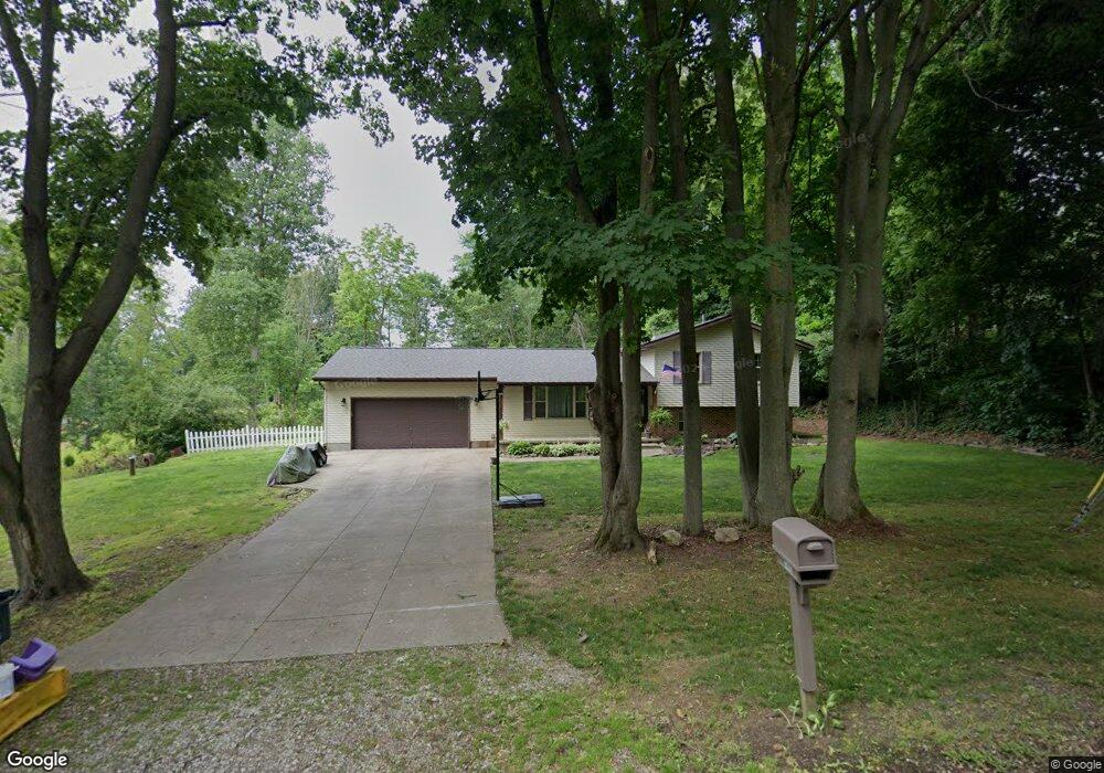
7495 Mctaggart Rd NW Canal Fulton, OH 44614
Estimated Value: $218,000 - $304,000
3
Beds
2
Baths
1,144
Sq Ft
$234/Sq Ft
Est. Value
About This Home
This home is located at 7495 Mctaggart Rd NW, Canal Fulton, OH 44614 and is currently estimated at $268,117, approximately $234 per square foot. 7495 Mctaggart Rd NW is a home located in Stark County with nearby schools including W.S. Stinson Elementary School, Northwest Primary School, and Northwest Middle School.
Ownership History
Date
Name
Owned For
Owner Type
Purchase Details
Closed on
Dec 12, 1997
Sold by
Whipp Kenneth B
Bought by
Eberly Timothy C and Eberly Tanja
Current Estimated Value
Home Financials for this Owner
Home Financials are based on the most recent Mortgage that was taken out on this home.
Original Mortgage
$104,040
Outstanding Balance
$17,741
Interest Rate
7.32%
Mortgage Type
VA
Estimated Equity
$250,376
Purchase Details
Closed on
Apr 6, 1994
Create a Home Valuation Report for This Property
The Home Valuation Report is an in-depth analysis detailing your home's value as well as a comparison with similar homes in the area
Home Values in the Area
Average Home Value in this Area
Purchase History
| Date | Buyer | Sale Price | Title Company |
|---|---|---|---|
| Eberly Timothy C | $102,000 | -- | |
| -- | $11,500 | -- |
Source: Public Records
Mortgage History
| Date | Status | Borrower | Loan Amount |
|---|---|---|---|
| Open | Eberly Timothy C | $104,040 |
Source: Public Records
Tax History Compared to Growth
Tax History
| Year | Tax Paid | Tax Assessment Tax Assessment Total Assessment is a certain percentage of the fair market value that is determined by local assessors to be the total taxable value of land and additions on the property. | Land | Improvement |
|---|---|---|---|---|
| 2025 | -- | $89,500 | $25,730 | $63,770 |
| 2024 | -- | $89,500 | $25,730 | $63,770 |
| 2023 | $3,345 | $73,610 | $20,760 | $52,850 |
| 2022 | $3,343 | $73,610 | $20,760 | $52,850 |
| 2021 | $3,352 | $73,610 | $20,760 | $52,850 |
| 2020 | $3,047 | $59,820 | $16,730 | $43,090 |
| 2019 | $3,081 | $59,820 | $16,730 | $43,090 |
| 2018 | $3,010 | $59,820 | $16,730 | $43,090 |
| 2017 | $2,414 | $45,470 | $13,410 | $32,060 |
| 2016 | $2,426 | $45,470 | $13,410 | $32,060 |
| 2015 | $2,432 | $45,470 | $13,410 | $32,060 |
| 2014 | $453 | $42,360 | $12,500 | $29,860 |
| 2013 | $1,209 | $42,360 | $12,500 | $29,860 |
Source: Public Records
Map
Nearby Homes
- 10400 Strausser St NW
- 7509 Galena Ave NW
- 6764 Silver Leaf Ave NW
- 9725 Diamond Ridge Cir NW
- 9756 Strausser St NW
- 9729 Emerald Hill St NW
- 9671 Beryl St NW
- 10778 Yare Cir NW
- 7479 Montella Ave NW
- 7596 Montella Ave NW
- 11265 Tritts St NW
- 963 Saint Brendan Dr
- 0 High Mill Ave NW
- 915 Shackleton Dr
- 8801 Willingham Dr NW
- 8817 Willingham Dr NW
- 919 Baffin Dr
- 11391 Michelle Dr NW
- 7601 Lutz Ave NW
- 9315 Paulding St NW
- 7521 Mctaggart Rd NW
- 7464 Akron Ave NW
- 7488 Akron Ave NW
- 7541 Mctaggart Rd NW
- 7510 Akron Ave NW
- 7534 Mctaggart Rd NW
- 7634 Akron Ave NW
- 7428 Akron Ave NW
- 7540 Mctaggart Rd NW
- 10400 Stoneacre Rd NW
- 7520 Akron Ave NW
- 7555 Mctaggart Rd NW
- 10389 Stoneacre St NW
- 10388 Stoneacre St NW
- 7566 Mctaggart Rd NW
- 7481 Akron Ave NW
- 7554 Akron Ave NW
- 7575 Mctaggart Rd NW
- 7445 Akron Ave NW
- 10366 Stoneacre St NW