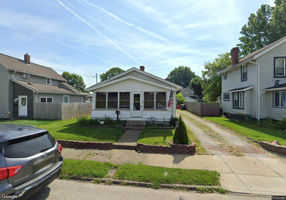
75 19th St NW Barberton, OH 44203
Columbia Lake NeighborhoodEstimated Value: $76,000 - $114,952
2
Beds
1
Bath
936
Sq Ft
$98/Sq Ft
Est. Value
About This Home
This home is located at 75 19th St NW, Barberton, OH 44203 and is currently estimated at $91,738, approximately $98 per square foot. 75 19th St NW is a home located in Summit County with nearby schools including Barberton Middle School, Barberton High School, and St Augustine Elementary School.
Ownership History
Date
Name
Owned For
Owner Type
Purchase Details
Closed on
Oct 20, 2014
Sold by
Habegger Jeffrey and Habegger Shelly
Bought by
Habegger Jeffrey D and Habegger Shelly L
Current Estimated Value
Purchase Details
Closed on
Dec 22, 2006
Sold by
Deutsche Bank National Trust Co
Bought by
Habegger Jeffrey D and Habegger Shelly L
Purchase Details
Closed on
Nov 6, 2006
Sold by
Cota Michael J
Bought by
Deutsche Bank National Trust Co and Registered Holders Of Equifirst Mortgage
Purchase Details
Closed on
Oct 4, 1999
Sold by
Willis Frances L
Bought by
Cota Michael J
Home Financials for this Owner
Home Financials are based on the most recent Mortgage that was taken out on this home.
Original Mortgage
$61,759
Interest Rate
7.83%
Mortgage Type
FHA
Create a Home Valuation Report for This Property
The Home Valuation Report is an in-depth analysis detailing your home's value as well as a comparison with similar homes in the area
Home Values in the Area
Average Home Value in this Area
Purchase History
| Date | Buyer | Sale Price | Title Company |
|---|---|---|---|
| Habegger Jeffrey D | -- | None Available | |
| Habegger Jeffrey D | $42,800 | Sovereign Title Agency Llc | |
| Deutsche Bank National Trust Co | $48,000 | Sovereign Title Agency Llc | |
| Cota Michael J | $62,300 | Title One Agency Inc |
Source: Public Records
Mortgage History
| Date | Status | Borrower | Loan Amount |
|---|---|---|---|
| Previous Owner | Cota Michael J | $61,759 |
Source: Public Records
Tax History Compared to Growth
Tax History
| Year | Tax Paid | Tax Assessment Tax Assessment Total Assessment is a certain percentage of the fair market value that is determined by local assessors to be the total taxable value of land and additions on the property. | Land | Improvement |
|---|---|---|---|---|
| 2025 | $1,533 | $29,866 | $8,351 | $21,515 |
| 2024 | $1,533 | $29,866 | $8,351 | $21,515 |
| 2023 | $1,533 | $29,866 | $8,351 | $21,515 |
| 2022 | $1,108 | $18,722 | $5,061 | $13,661 |
| 2021 | $1,107 | $18,722 | $5,061 | $13,661 |
| 2020 | $1,084 | $18,720 | $5,060 | $13,660 |
| 2019 | $911 | $14,250 | $5,060 | $9,190 |
| 2018 | $897 | $14,250 | $5,060 | $9,190 |
| 2017 | $909 | $14,250 | $5,060 | $9,190 |
| 2016 | $911 | $14,250 | $5,060 | $9,190 |
| 2015 | $909 | $14,250 | $5,060 | $9,190 |
| 2014 | $904 | $14,250 | $5,060 | $9,190 |
| 2013 | $878 | $14,350 | $5,060 | $9,290 |
Source: Public Records
Map
Nearby Homes
- 173 21st St NW
- 1080 Belleview Ave
- 139 24th St NW
- 1084 Wooster Rd W
- 243 19th St NW
- 38 24th St NW
- 376 Hillsdale Ave
- 243 27th St NW
- 679 Wooster Rd W
- 673 Wooster Rd W
- 680 W Paige Ave
- 1125 Prospect St
- 21 29th St SW
- 443 Beech Row Dr
- 1030 Stratford St
- 96 Helen St
- 32 29th St SW
- 1364 Wooster Rd W
- 1253 Prospect St
- 524 Long Dr