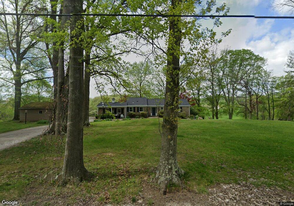
75 Aber Rd Gastonville, PA 15336
Estimated Value: $328,000 - $423,000
2
Beds
3
Baths
1,806
Sq Ft
$203/Sq Ft
Est. Value
About This Home
This home is located at 75 Aber Rd, Gastonville, PA 15336 and is currently estimated at $365,739, approximately $202 per square foot. 75 Aber Rd is a home with nearby schools including Ringgold High School.
Ownership History
Date
Name
Owned For
Owner Type
Purchase Details
Closed on
May 31, 2005
Sold by
Miller Richard A
Bought by
Boyle Shari R
Current Estimated Value
Home Financials for this Owner
Home Financials are based on the most recent Mortgage that was taken out on this home.
Original Mortgage
$182,400
Outstanding Balance
$95,652
Interest Rate
5.83%
Mortgage Type
New Conventional
Estimated Equity
$270,087
Create a Home Valuation Report for This Property
The Home Valuation Report is an in-depth analysis detailing your home's value as well as a comparison with similar homes in the area
Home Values in the Area
Average Home Value in this Area
Purchase History
| Date | Buyer | Sale Price | Title Company |
|---|---|---|---|
| Boyle Shari R | $228,000 | -- |
Source: Public Records
Mortgage History
| Date | Status | Borrower | Loan Amount |
|---|---|---|---|
| Open | Boyle Shari R | $182,400 |
Source: Public Records
Tax History Compared to Growth
Tax History
| Year | Tax Paid | Tax Assessment Tax Assessment Total Assessment is a certain percentage of the fair market value that is determined by local assessors to be the total taxable value of land and additions on the property. | Land | Improvement |
|---|---|---|---|---|
| 2025 | $3,783 | $186,500 | $66,100 | $120,400 |
| 2024 | $3,503 | $186,500 | $66,100 | $120,400 |
| 2023 | $3,503 | $186,500 | $66,100 | $120,400 |
| 2022 | $3,429 | $186,500 | $66,100 | $120,400 |
| 2021 | $3,382 | $186,500 | $66,100 | $120,400 |
| 2020 | $3,307 | $186,500 | $66,100 | $120,400 |
| 2019 | $3,270 | $186,500 | $66,100 | $120,400 |
| 2018 | $3,233 | $186,500 | $66,100 | $120,400 |
| 2017 | $491 | $186,500 | $66,100 | $120,400 |
| 2016 | $491 | $19,719 | $2,250 | $17,469 |
| 2015 | -- | $19,719 | $2,250 | $17,469 |
| 2014 | $491 | $19,719 | $2,250 | $17,469 |
| 2013 | $491 | $19,719 | $2,250 | $17,469 |
Source: Public Records
Map
Nearby Homes
- 215 Rolling Mill Ln
- 217 Rolling Mill Ln
- 219 Rolling Mill Ln
- 214 Rolling Mill Ln
- 216 Rolling Mill Ln
- Hadley Plan at Millstone Village
- Hamilton Plan at Millstone Village
- Hampshire Plan at Millstone Village
- Hanover Plan at Millstone Village
- Galen Plan at Millstone Village
- Penwell Plan at Millstone Village
- 302 Forge Dr
- 413 Millstone Ln
- 415 Millstone Ln
- Avalon Plan at Millstone Village - Reserve
- Rockford Plan at Millstone Village - Reserve
- Longwood Plan at Millstone Village - Reserve
- Carlisle Plan at Millstone Village - Reserve
- Somerset Plan at Millstone Village - Reserve
- Chattanooga Plan at Millstone Village - Reserve
- 74 Aber Rd
- 68 Aber Rd
- 52 Aber Rd
- 60 Aber Rd
- 48 Aber Rd
- 399 Stone Church Rd
- 416 Stone Church Rd
- 403 Stone Church Rd
- 407 Stone Church Rd
- 393 Stone Church Rd
- 375 Stone Church Rd
- 409 Stone Church Rd
- LOT 1 Snowden
- LOT 3 Snowden Rd
- 366 Stone Church Rd
- 28 Aber Rd
- 5 Snowden Rd
- 359 Stone Church Rd
- 430 Stone Church Rd
- Lot 4 Snowden Rd