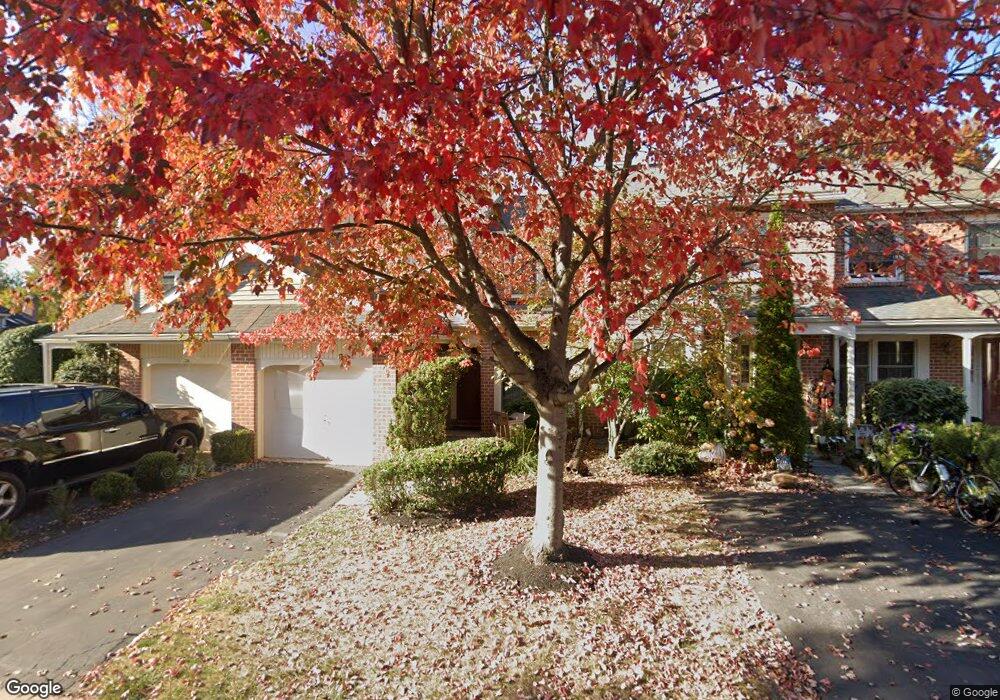
75 Abrams Ln Chesterbrook, PA 19087
Estimated Value: $535,609 - $595,000
3
Beds
3
Baths
1,852
Sq Ft
$310/Sq Ft
Est. Value
About This Home
This home is located at 75 Abrams Ln, Chesterbrook, PA 19087 and is currently estimated at $573,902, approximately $309 per square foot. 75 Abrams Ln is a home located in Chester County with nearby schools including Valley Forge Elementary School, Valley Forge Middle School, and Conestoga Senior High School.
Ownership History
Date
Name
Owned For
Owner Type
Purchase Details
Closed on
Oct 10, 2017
Sold by
Kim Kyung Joo
Bought by
Holdings Paoli
Current Estimated Value
Purchase Details
Closed on
Aug 11, 1994
Sold by
Abramson R Jeff and Abramson Laura H
Bought by
Kim Kyung Joo
Home Financials for this Owner
Home Financials are based on the most recent Mortgage that was taken out on this home.
Original Mortgage
$50,000
Interest Rate
8.52%
Purchase Details
Closed on
Jun 27, 1994
Sold by
Mill Valley Associates
Bought by
Abramson R Jeff and Abramson Laura H
Home Financials for this Owner
Home Financials are based on the most recent Mortgage that was taken out on this home.
Original Mortgage
$50,000
Interest Rate
8.52%
Create a Home Valuation Report for This Property
The Home Valuation Report is an in-depth analysis detailing your home's value as well as a comparison with similar homes in the area
Home Values in the Area
Average Home Value in this Area
Purchase History
| Date | Buyer | Sale Price | Title Company |
|---|---|---|---|
| Holdings Paoli | $366,500 | -- | |
| Kim Kyung Joo | -- | -- | |
| Abramson R Jeff | $417,006 | Stewart Title Guaranty Compa |
Source: Public Records
Mortgage History
| Date | Status | Borrower | Loan Amount |
|---|---|---|---|
| Previous Owner | Kim Kyung Joo | $50,000 | |
| Previous Owner | Abramson R Jeff | $30,000 |
Source: Public Records
Tax History
| Year | Tax Paid | Tax Assessment Tax Assessment Total Assessment is a certain percentage of the fair market value that is determined by local assessors to be the total taxable value of land and additions on the property. | Land | Improvement |
|---|---|---|---|---|
| 2025 | $5,793 | $164,450 | $41,030 | $123,420 |
| 2024 | $5,793 | $164,450 | $41,030 | $123,420 |
| 2023 | $5,441 | $164,450 | $41,030 | $123,420 |
| 2022 | $5,301 | $164,450 | $41,030 | $123,420 |
| 2021 | $5,200 | $164,450 | $41,030 | $123,420 |
| 2020 | $5,057 | $164,450 | $41,030 | $123,420 |
| 2019 | $4,897 | $164,450 | $41,030 | $123,420 |
| 2018 | $4,800 | $164,450 | $41,030 | $123,420 |
| 2017 | $4,685 | $164,450 | $41,030 | $123,420 |
| 2016 | -- | $164,450 | $41,030 | $123,420 |
| 2015 | -- | $164,450 | $41,030 | $123,420 |
| 2014 | -- | $164,450 | $41,030 | $123,420 |
Source: Public Records
Map
Nearby Homes
- 4 Knox Ct
- 116 Chase Rd Unit 108
- 65 Le Forge Ct Unit 65
- 340 Coldstream Dr
- 910 Mountainview Dr Unit 910
- 201 Springhouse Pond
- 170, 200, 220 Old State Rd
- 305 Paddock Dr Unit 305
- 423 Cannon Ct
- 793 Tory Hollow Rd
- 66 Old Forge Crossing Unit 66
- 278 Old Forge Crossing Unit 278
- 631 Westwind Dr
- 293 Valley Stream Ln
- 46 Rampart Dr
- 143 Valley Stream Cir Unit 143
- 1430 Washington Place Unit 30
- 620 Washington Place Unit 20
- 510 Washington Place Unit 10
- 1323 Eagles Ridge Dr
- 75 Abrams Ct
- 76 Abrams Ln
- 74 Abrams Ct
- 77 Abrams Ct
- 77 Abrams Ln
- 74 Abrams Ln
- 78 Abrams Ln Unit O
- 79 Abrams Ln
- 48 Stonehurst Ct Unit I
- 54 Abrams Ln Unit K
- 55 Abrams Ln Unit K
- 56 Abrams Ln
- 55 Abrams Ct
- 53 Abrams Ln Unit K53D
- 53 Abrams Ct
- 47 Stonehurst Ct
- 57 Abrams Ln
- 1 Windsor Cir
- 70 Shelbourne Ct Unit N
- 69 Shelbourne Ct
Your Personal Tour Guide
Ask me questions while you tour the home.