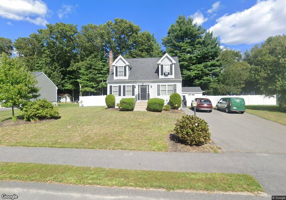
75 Appaloosa Way Taunton, MA 02780
Estimated Value: $383,000 - $446,000
3
Beds
2
Baths
1,331
Sq Ft
$311/Sq Ft
Est. Value
About This Home
This home is located at 75 Appaloosa Way, Taunton, MA 02780 and is currently estimated at $414,256, approximately $311 per square foot. 75 Appaloosa Way is a home located in Bristol County with nearby schools including Mulcahey Elementary School, Taunton High School, and Joseph H. Martin.
Ownership History
Date
Name
Owned For
Owner Type
Purchase Details
Closed on
Mar 19, 2008
Sold by
Bruce Llc
Bought by
Desrosiers Ryan F and Desrosiers Jennifer A
Current Estimated Value
Home Financials for this Owner
Home Financials are based on the most recent Mortgage that was taken out on this home.
Original Mortgage
$184,300
Outstanding Balance
$114,878
Interest Rate
5.75%
Mortgage Type
Purchase Money Mortgage
Estimated Equity
$299,378
Create a Home Valuation Report for This Property
The Home Valuation Report is an in-depth analysis detailing your home's value as well as a comparison with similar homes in the area
Home Values in the Area
Average Home Value in this Area
Purchase History
| Date | Buyer | Sale Price | Title Company |
|---|---|---|---|
| Desrosiers Ryan F | $190,000 | -- |
Source: Public Records
Mortgage History
| Date | Status | Borrower | Loan Amount |
|---|---|---|---|
| Open | Desrosiers Ryan F | $184,300 |
Source: Public Records
Tax History Compared to Growth
Tax History
| Year | Tax Paid | Tax Assessment Tax Assessment Total Assessment is a certain percentage of the fair market value that is determined by local assessors to be the total taxable value of land and additions on the property. | Land | Improvement |
|---|---|---|---|---|
| 2025 | $2,079 | $190,000 | $133,000 | $57,000 |
| 2024 | $2,126 | $190,000 | $151,100 | $38,900 |
| 2023 | $2,290 | $190,000 | $151,100 | $38,900 |
| 2022 | $2,504 | $190,000 | $130,900 | $59,100 |
| 2021 | $2,698 | $190,000 | $114,500 | $75,500 |
| 2020 | $2,823 | $190,000 | $114,500 | $75,500 |
| 2019 | $2,994 | $190,000 | $120,000 | $70,000 |
| 2018 | $2,987 | $190,000 | $121,200 | $68,800 |
| 2017 | $2,985 | $190,000 | $114,800 | $75,200 |
| 2016 | $2,979 | $190,000 | $111,500 | $78,500 |
| 2015 | $2,852 | $190,000 | $96,000 | $94,000 |
| 2014 | $2,776 | $190,000 | $96,000 | $94,000 |
Source: Public Records
Map
Nearby Homes
- 15 Shetland Rd
- 410 Warner Blvd Unit A
- 50 Highland St Unit 135
- 58 Lawton St
- 1181 Cohannet St
- 4 A Lawton St Unit A
- 125 Highland St Unit 103
- 38 Cranesbill Rd
- 321 Winthrop St Unit 109
- 170 Highland St Unit 320
- 170 Highland St Unit 119
- 173 Highland St Unit 201
- 65 Bridget Dr
- 193 Winthrop St
- 1438 Somerset Ave
- 36 Maynard Unit A
- 16 Billings St
- 1472 Somerset Ave
- 140 N Walker St Unit 511
- 233-R Summer St
- 87 Appaloosa Way Unit 22
- 87 Appaloosa Way
- 65 Appaloosa Way
- LOT 30 Appaloosa Way
- LOT 26 Appaloosa Way
- Lot 27 Appaloosa Way
- Lot 17 Appaloosa Way
- 97 Appaloosa Way
- 97 Appaloosa Way Unit 21
- 55 Appaloosa Way
- 231 Dighton Ave
- 74 Appaloosa Way
- 82 Appaloosa Way Unit 38
- 251 Dighton Ave
- 92 Appaloosa Way
- 120 Arabian Dr
- Lot 46 Appaloosa Way
- Lot 44 Appaloosa Way
- Lot 48 Appaloosa Way
- 107 Appaloosa Way Unit 20