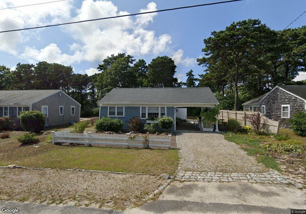
75 Captain Chase Rd Dennis Port, MA 02639
Dennis Port NeighborhoodEstimated Value: $463,000 - $591,000
2
Beds
1
Bath
800
Sq Ft
$675/Sq Ft
Est. Value
About This Home
This home is located at 75 Captain Chase Rd, Dennis Port, MA 02639 and is currently estimated at $540,239, approximately $675 per square foot. 75 Captain Chase Rd is a home located in Barnstable County with nearby schools including Dennis-Yarmouth Regional High School and St. Pius X. School.
Ownership History
Date
Name
Owned For
Owner Type
Purchase Details
Closed on
Sep 11, 1998
Sold by
Whelan Barbara A
Bought by
Kippen Michael J and Kippen Emma C
Current Estimated Value
Home Financials for this Owner
Home Financials are based on the most recent Mortgage that was taken out on this home.
Original Mortgage
$94,800
Interest Rate
6.92%
Mortgage Type
Purchase Money Mortgage
Create a Home Valuation Report for This Property
The Home Valuation Report is an in-depth analysis detailing your home's value as well as a comparison with similar homes in the area
Home Values in the Area
Average Home Value in this Area
Purchase History
| Date | Buyer | Sale Price | Title Company |
|---|---|---|---|
| Kippen Michael J | $118,500 | -- |
Source: Public Records
Mortgage History
| Date | Status | Borrower | Loan Amount |
|---|---|---|---|
| Open | Kippen Michael J | $90,000 | |
| Closed | Kippen Michael J | $94,800 |
Source: Public Records
Tax History Compared to Growth
Tax History
| Year | Tax Paid | Tax Assessment Tax Assessment Total Assessment is a certain percentage of the fair market value that is determined by local assessors to be the total taxable value of land and additions on the property. | Land | Improvement |
|---|---|---|---|---|
| 2025 | $2,091 | $482,800 | $193,500 | $289,300 |
| 2024 | $1,951 | $444,500 | $186,100 | $258,400 |
| 2023 | $1,910 | $409,000 | $169,200 | $239,800 |
| 2022 | $1,859 | $332,000 | $152,400 | $179,600 |
| 2021 | $1,920 | $318,400 | $170,800 | $147,600 |
| 2020 | $1,728 | $283,200 | $149,400 | $133,800 |
| 2019 | $1,636 | $265,200 | $146,500 | $118,700 |
| 2018 | $1,116 | $239,200 | $139,500 | $99,700 |
| 2017 | $1,390 | $226,000 | $129,500 | $96,500 |
| 2016 | $1,437 | $220,000 | $139,500 | $80,500 |
| 2015 | $1,408 | $220,000 | $139,500 | $80,500 |
| 2014 | $1,270 | $200,000 | $119,500 | $80,500 |
Source: Public Records
Map
Nearby Homes
- 31 Easy St
- 80 Michaels Ave
- 22 Wixon Rd
- 19 Standish Way
- 37 Ocean Dr Unit 2
- 64 Beaten Rd
- 37 Beach Hills Rd
- 262 Old Wharf Rd Unit 67
- 262 Old Wharf Rd Unit 5
- 262 Old Wharf Rd Unit 5
- 262 Old Wharf Rd Unit 20
- 262 Old Wharf Rd Unit 87
- 37-A Beach Hills Rd
- 22 Ferncliff Rd
- 154 Old Wharf Rd Unit 26
- 154 Old Wharf Rd Unit 14
- 72 Bassett Ln
- 4 Coffey Ln
- 112 Old Wharf Rd Unit E4
- 112 Old Wharf Rd Unit E1
- 73 Captain Chase Rd
- 79 Captain Chase Rd
- 81 Captain Chase Rd
- 8 Uncle Ezras Path
- 70 Captain Chase Rd
- 67 Captain Chase Rd
- 0 Uncle Toms Path
- 85 Captain Chase Rd
- 4 1st Mate Row
- 63 Captain Chase Rd
- 9 Uncle Ezras Path
- 87 Captain Chase Rd
- 66 Captain Chase Rd
- 9 1st Mate Row
- 12 Uncle Ezras Path
- 83 Siasconset Ave
- 81 Siasconset Ave
- 79 Siasconset Ave
- 85 Siasconset Ave
- 8 1st Mate Row