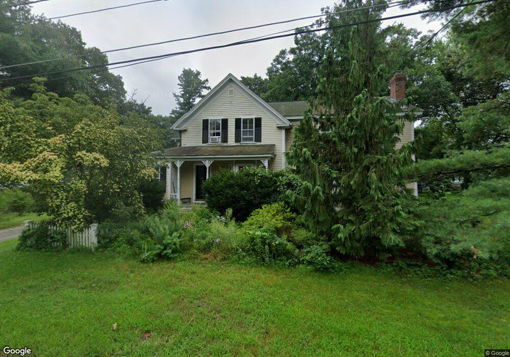
75 Grove St Concord, MA 01742
Estimated Value: $1,146,000 - $1,720,000
3
Beds
3
Baths
2,396
Sq Ft
$579/Sq Ft
Est. Value
About This Home
This home is located at 75 Grove St, Concord, MA 01742 and is currently estimated at $1,386,853, approximately $578 per square foot. 75 Grove St is a home located in Middlesex County with nearby schools including Thoreau Elementary School, Concord Middle School, and Concord Carlisle High School.
Ownership History
Date
Name
Owned For
Owner Type
Purchase Details
Closed on
Jan 23, 2007
Sold by
Johnston-Demuth Jennifer and Demuth Jack
Bought by
Demuth Jack
Current Estimated Value
Purchase Details
Closed on
Dec 30, 1998
Sold by
Walker James E
Bought by
Demuth Jack and Johnston Jennifer M
Purchase Details
Closed on
Nov 14, 1997
Sold by
Cohen Adam Z and Cohen Kate M
Bought by
Walker James E
Home Financials for this Owner
Home Financials are based on the most recent Mortgage that was taken out on this home.
Original Mortgage
$343,200
Interest Rate
7.23%
Mortgage Type
Purchase Money Mortgage
Purchase Details
Closed on
May 13, 1992
Sold by
L O Greenough T No 1
Bought by
Cohen Adam Z and Cohen Kate M
Create a Home Valuation Report for This Property
The Home Valuation Report is an in-depth analysis detailing your home's value as well as a comparison with similar homes in the area
Home Values in the Area
Average Home Value in this Area
Purchase History
| Date | Buyer | Sale Price | Title Company |
|---|---|---|---|
| Demuth Jack | -- | -- | |
| Demuth Jack | $425,000 | -- | |
| Walker James E | $429,000 | -- | |
| Cohen Adam Z | $225,000 | -- |
Source: Public Records
Mortgage History
| Date | Status | Borrower | Loan Amount |
|---|---|---|---|
| Previous Owner | Cohen Adam Z | $343,200 | |
| Previous Owner | Cohen Adam Z | $167,000 |
Source: Public Records
Tax History Compared to Growth
Tax History
| Year | Tax Paid | Tax Assessment Tax Assessment Total Assessment is a certain percentage of the fair market value that is determined by local assessors to be the total taxable value of land and additions on the property. | Land | Improvement |
|---|---|---|---|---|
| 2025 | $153 | $1,154,100 | $543,000 | $611,100 |
| 2024 | $14,863 | $1,132,000 | $543,000 | $589,000 |
| 2023 | $13,270 | $1,023,900 | $493,600 | $530,300 |
| 2022 | $14,369 | $973,500 | $394,800 | $578,700 |
| 2021 | $13,506 | $917,500 | $394,800 | $522,700 |
| 2020 | $13,106 | $921,000 | $394,800 | $526,200 |
| 2019 | $12,645 | $891,100 | $407,800 | $483,300 |
| 2018 | $11,571 | $809,700 | $374,200 | $435,500 |
| 2017 | $11,186 | $795,000 | $347,500 | $447,500 |
| 2016 | $10,759 | $772,900 | $347,500 | $425,400 |
| 2015 | $10,107 | $707,300 | $321,700 | $385,600 |
Source: Public Records
Map
Nearby Homes
- 79-81 Assabet Ave
- 855 Barretts Mill Rd
- 138 Baker Ave
- 488 Elm St
- 16 Concord Greene Unit 5
- 23 Concord Greene Unit 4
- 295 Musterfield Rd
- 29 Concord Greene Unit 2
- 24 Concord Greene Unit 7
- 54 Maple St
- 1053 Main St
- 244 Musterfield Rd
- 27 Pine St
- 213 Nashoba Rd
- 102 Highland St
- 111 Central St
- 70 McCallar Ln
- 38 McCallar Ln
- 12 S Meadow Ridge Unit 12
- 12 S Meadow Ridge