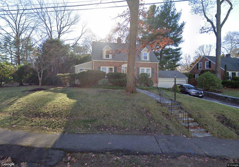
75 Laurel Dr Needham, MA 02492
Estimated Value: $1,056,000 - $1,291,000
3
Beds
2
Baths
968
Sq Ft
$1,214/Sq Ft
Est. Value
About This Home
This home is located at 75 Laurel Dr, Needham, MA 02492 and is currently estimated at $1,174,943, approximately $1,213 per square foot. 75 Laurel Dr is a home located in Norfolk County with nearby schools including Newman Elementary School, High Rock Middle School, and Pollard Middle School.
Create a Home Valuation Report for This Property
The Home Valuation Report is an in-depth analysis detailing your home's value as well as a comparison with similar homes in the area
Home Values in the Area
Average Home Value in this Area
Tax History
| Year | Tax Paid | Tax Assessment Tax Assessment Total Assessment is a certain percentage of the fair market value that is determined by local assessors to be the total taxable value of land and additions on the property. | Land | Improvement |
|---|---|---|---|---|
| 2025 | $9,987 | $942,200 | $755,900 | $186,300 |
| 2024 | $10,994 | $878,100 | $529,400 | $348,700 |
| 2023 | $11,061 | $848,200 | $529,400 | $318,800 |
| 2022 | $10,644 | $796,100 | $490,200 | $305,900 |
| 2021 | $10,021 | $769,100 | $490,200 | $278,900 |
| 2020 | $8,900 | $712,600 | $490,100 | $222,500 |
| 2019 | $8,218 | $663,300 | $445,600 | $217,700 |
| 2018 | $7,880 | $663,300 | $445,600 | $217,700 |
| 2017 | $7,572 | $636,800 | $445,600 | $191,200 |
| 2016 | $7,349 | $636,800 | $445,600 | $191,200 |
| 2015 | $7,189 | $636,800 | $445,600 | $191,200 |
| 2014 | $6,885 | $591,500 | $405,100 | $186,400 |
Source: Public Records
Map
Nearby Homes
- 150 Laurel Dr
- 60 Sutton Rd
- 1011 Webster St
- 90 Norfolk St
- 971 Webster St
- 68 Pleasant St Unit 68
- 233 Warren St
- 100 Bradford St
- 569 Chestnut St
- 47 Emerson Rd
- 53 Heather Ln
- 126 Prince St
- 73 Maple St Unit 1
- 287 High Rock St
- 36 Otis St Unit 36
- 957 South St
- 193 Garden St
- 31 Birds Hill Ave
- 28 Green St
- 19 Highland Ct Unit 19
Your Personal Tour Guide
Ask me questions while you tour the home.