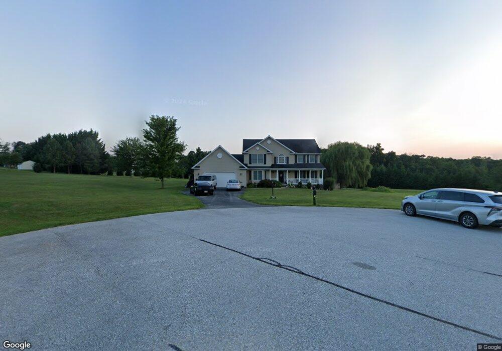
75 Logan Cir Unit 19 Littlestown, PA 17340
Estimated Value: $513,000 - $548,000
4
Beds
3
Baths
2,619
Sq Ft
$203/Sq Ft
Est. Value
About This Home
This home is located at 75 Logan Cir Unit 19, Littlestown, PA 17340 and is currently estimated at $532,242, approximately $203 per square foot. 75 Logan Cir Unit 19 is a home located in Adams County with nearby schools including Rolling Acres El School, Maple Avenue Middle School, and Littlestown Senior High School.
Ownership History
Date
Name
Owned For
Owner Type
Purchase Details
Closed on
Aug 6, 2014
Sold by
Rock Adam L and Rock Kathryn B
Bought by
Rock Adam L and Rock Kathryn B
Current Estimated Value
Purchase Details
Closed on
Sep 30, 2004
Bought by
Rock Adam L and Rock Kathryn B
Create a Home Valuation Report for This Property
The Home Valuation Report is an in-depth analysis detailing your home's value as well as a comparison with similar homes in the area
Home Values in the Area
Average Home Value in this Area
Purchase History
| Date | Buyer | Sale Price | Title Company |
|---|---|---|---|
| Rock Adam L | -- | None Available | |
| Rock Adam L | $290,200 | -- |
Source: Public Records
Tax History Compared to Growth
Tax History
| Year | Tax Paid | Tax Assessment Tax Assessment Total Assessment is a certain percentage of the fair market value that is determined by local assessors to be the total taxable value of land and additions on the property. | Land | Improvement |
|---|---|---|---|---|
| 2025 | $6,328 | $334,300 | $149,900 | $184,400 |
| 2024 | $6,082 | $334,300 | $149,900 | $184,400 |
| 2023 | $5,929 | $334,300 | $149,900 | $184,400 |
| 2022 | $5,886 | $334,300 | $149,900 | $184,400 |
| 2021 | $5,676 | $334,300 | $149,900 | $184,400 |
| 2020 | $5,594 | $334,300 | $149,900 | $184,400 |
| 2019 | $5,474 | $334,300 | $149,900 | $184,400 |
| 2018 | $5,312 | $334,300 | $149,900 | $184,400 |
| 2017 | $5,145 | $334,300 | $149,900 | $184,400 |
| 2016 | -- | $334,300 | $149,900 | $184,400 |
| 2015 | -- | $334,300 | $149,900 | $184,400 |
| 2014 | -- | $336,800 | $142,600 | $194,200 |
Source: Public Records
Map
Nearby Homes
- 630 Mehring Rd Unit 4
- LOT 9 Mehring Rd
- 2100 Blacks School House Rd
- 567 Lumber St
- 559 Lumber St
- 535 Lumber St
- 241 M St
- 211 E King St
- 1175 Bollinger Rd
- 893 Georgetown Rd
- 61 E King St
- 106 E King St
- 43 Ashfield Dr Unit 14
- 115 Charles St
- 117 Charles St
- 41 Smith Cir
- 1 Hickory Ln
- 129 W King St
- 22 Rita Marie Ave
- 1555 Humbert Schoolhouse Rd
- 74 Logan Cir Unit 18
- 48 Logan Cir
- 286 Bollinger Rd Unit 9
- 270 Bollinger Rd Unit 10
- 320 Bollinger Rd Unit 8
- 46 Logan Cir Unit 17
- 51 Logan Cir
- 49 Logan Cir
- 45 Logan Cir
- 330 Bollinger Rd Unit 7
- 350 Bollinger Rd Unit 6
- 291 Bollinger Rd
- 275 Bollinger Rd
- 250 Bollinger Rd Unit 2
- 16 Logan Cir
- 19 Lucas Dr Unit 21
- 265 Bollinger Rd
- 15 Logan Cir
- 725 Kindig Rd Unit 13
- 5 Lucas Dr Unit 20