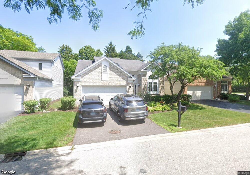
75 Manchester Dr Buffalo Grove, IL 60089
Estimated Value: $539,278 - $585,000
--
Bed
3
Baths
2,123
Sq Ft
$264/Sq Ft
Est. Value
About This Home
This home is located at 75 Manchester Dr, Buffalo Grove, IL 60089 and is currently estimated at $561,070, approximately $264 per square foot. 75 Manchester Dr is a home located in Lake County with nearby schools including Ivy Hall Elementary School, Twin Groves Middle School, and Adlai E Stevenson High School.
Ownership History
Date
Name
Owned For
Owner Type
Purchase Details
Closed on
Sep 24, 2025
Sold by
Skoptsova Irene
Bought by
Gladun Olena and Shafran Alan
Current Estimated Value
Purchase Details
Closed on
Feb 21, 1995
Sold by
Cole Taylor Bank
Bought by
Shafran Alex and Skoptsova Irene
Home Financials for this Owner
Home Financials are based on the most recent Mortgage that was taken out on this home.
Original Mortgage
$175,000
Interest Rate
8.97%
Create a Home Valuation Report for This Property
The Home Valuation Report is an in-depth analysis detailing your home's value as well as a comparison with similar homes in the area
Home Values in the Area
Average Home Value in this Area
Purchase History
| Date | Buyer | Sale Price | Title Company |
|---|---|---|---|
| Gladun Olena | -- | None Listed On Document | |
| Shafran Alex | $255,000 | Chicago Title Insurance Co |
Source: Public Records
Mortgage History
| Date | Status | Borrower | Loan Amount |
|---|---|---|---|
| Previous Owner | Shafran Alex | $175,000 |
Source: Public Records
Tax History Compared to Growth
Tax History
| Year | Tax Paid | Tax Assessment Tax Assessment Total Assessment is a certain percentage of the fair market value that is determined by local assessors to be the total taxable value of land and additions on the property. | Land | Improvement |
|---|---|---|---|---|
| 2024 | $12,832 | $149,536 | $40,257 | $109,279 |
| 2023 | $12,832 | $141,098 | $37,985 | $103,113 |
| 2022 | $9,683 | $136,455 | $36,735 | $99,720 |
| 2021 | $9,423 | $134,984 | $36,339 | $98,645 |
| 2020 | $9,168 | $135,445 | $36,463 | $98,982 |
| 2019 | $8,951 | $134,946 | $36,329 | $98,617 |
| 2018 | $8,905 | $118,753 | $39,491 | $79,262 |
| 2017 | $8,846 | $115,981 | $38,569 | $77,412 |
| 2016 | $10,201 | $111,061 | $36,933 | $74,128 |
| 2015 | $9,927 | $103,863 | $34,539 | $69,324 |
| 2014 | $9,729 | $100,536 | $37,095 | $63,441 |
| 2012 | $9,623 | $100,737 | $37,169 | $63,568 |
Source: Public Records
Map
Nearby Homes
- 232 Manor Dr Unit 12C
- 25 Crestview Terrace
- 36 Crestview Terrace
- 610 Maple Dr
- 412 Chateau Dr
- 728 Old Checker Rd Unit C4
- 746 Old Checker Rd Unit E5
- 496 Raupp Blvd
- 630 Woodhollow Ln
- 690 Dunhill Dr
- 220 Osage Ln
- 1112 Auburn Ln
- 10 Old Oak Dr Unit 103
- 612 White Pine Rd
- 665 Thornwood Dr
- 588 Fairway View Dr Unit 2E
- 51 Old Oak Dr Unit 414
- 620 Twisted Oak Ln
- 586 Fairway View Dr Unit 1A
- 8 Oak Creek Dr Unit 1803
- 73 Manchester Dr
- 77 Manchester Dr
- 79 Manchester Dr
- 66 Manchester Dr
- 80 Circle Dr
- 81 Manchester Dr
- 111 Circle Dr
- 68 Manchester Dr
- 83 Manchester Dr
- 70 Manchester Dr
- 85 Manchester Dr
- 87 Manchester Dr
- 72 Manchester Dr
- 110 Circle Dr
- 89 Manchester Dr
- 111 Manchester Dr
- 91 Manchester Dr
- 74 Manchester Dr
- 113 Manchester Dr
- 109 Manchester Dr