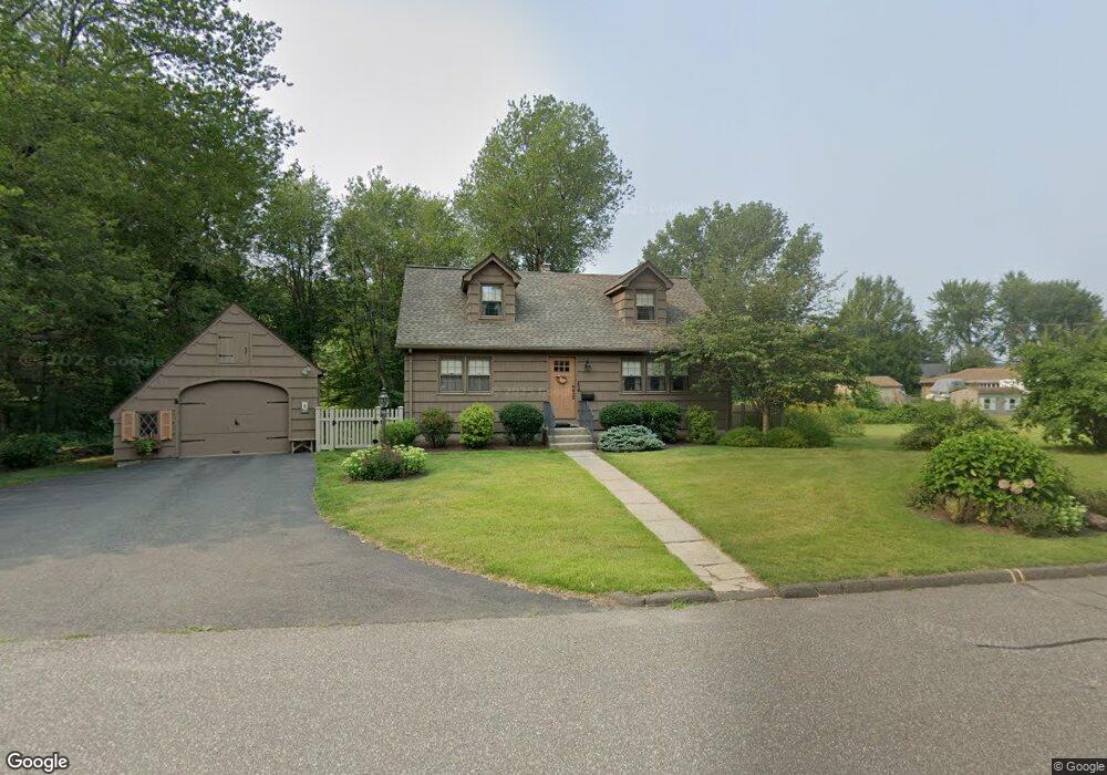
75 Mayer Dr Holyoke, MA 01040
Estimated Value: $367,135 - $442,000
5
Beds
2
Baths
2,524
Sq Ft
$162/Sq Ft
Est. Value
About This Home
This home is located at 75 Mayer Dr, Holyoke, MA 01040 and is currently estimated at $408,784, approximately $161 per square foot. 75 Mayer Dr is a home located in Hampden County with nearby schools including Lt. Elmer J. McMahon Elementary School, Lt. Clayre Sullivan Elementary School, and Holyoke High School.
Create a Home Valuation Report for This Property
The Home Valuation Report is an in-depth analysis detailing your home's value as well as a comparison with similar homes in the area
Home Values in the Area
Average Home Value in this Area
Tax History
| Year | Tax Paid | Tax Assessment Tax Assessment Total Assessment is a certain percentage of the fair market value that is determined by local assessors to be the total taxable value of land and additions on the property. | Land | Improvement |
|---|---|---|---|---|
| 2025 | $5,610 | $321,300 | $71,200 | $250,100 |
| 2024 | $5,321 | $280,800 | $67,800 | $213,000 |
| 2023 | $5,091 | $271,400 | $67,800 | $203,600 |
| 2022 | $4,902 | $254,500 | $67,800 | $186,700 |
| 2021 | $5,262 | $242,000 | $65,300 | $176,700 |
| 2020 | $4,427 | $232,000 | $65,300 | $166,700 |
| 2019 | $4,412 | $228,700 | $65,300 | $163,400 |
| 2018 | $4,211 | $220,100 | $65,300 | $154,800 |
| 2017 | $4,219 | $220,100 | $65,300 | $154,800 |
| 2016 | $4,178 | $218,500 | $67,100 | $151,400 |
| 2015 | $4,160 | $218,500 | $67,100 | $151,400 |
Source: Public Records
Map
Nearby Homes
- 287 Whitney Ave
- 53 Farnum Dr Unit 53
- 94 Vermont St
- 337 Westfield Rd
- 147 Sheehan Dr
- 286 Westfield Rd
- 350 Homestead Ave
- 89-111 Whitney Ave
- 958 Main St
- 934 Main St
- 25-27 Elmwood Ave
- 46 Maplewood Ave
- 2027-2029 Northampton St
- 10 View St
- 15 Maple Crest Cir Unit D
- 133-135 Brown Ave
- 36 Daley St
- 343 Chicopee St Unit 14
- 39 State St
- 361 Prospect Ave
Your Personal Tour Guide
Ask me questions while you tour the home.