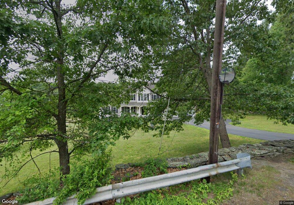
75 Mccracken Rd Millbury, MA 01527
Estimated Value: $885,000 - $990,000
4
Beds
3
Baths
2,474
Sq Ft
$371/Sq Ft
Est. Value
About This Home
This home is located at 75 Mccracken Rd, Millbury, MA 01527 and is currently estimated at $917,011, approximately $370 per square foot. 75 Mccracken Rd is a home located in Worcester County with nearby schools including Elmwood Street Elementary School, Raymond E. Shaw Elementary School, and Millbury Junior/Senior High School.
Ownership History
Date
Name
Owned For
Owner Type
Purchase Details
Closed on
Jul 16, 2010
Sold by
Skm Realty Inc
Bought by
Yaskis Michael P and Yaskis Ashley D
Current Estimated Value
Home Financials for this Owner
Home Financials are based on the most recent Mortgage that was taken out on this home.
Original Mortgage
$350,400
Outstanding Balance
$234,007
Interest Rate
4.82%
Mortgage Type
Purchase Money Mortgage
Estimated Equity
$683,004
Purchase Details
Closed on
Jul 8, 2009
Sold by
Allaire Donald G and Allaire Kathy P
Bought by
Skm Realty Inc
Create a Home Valuation Report for This Property
The Home Valuation Report is an in-depth analysis detailing your home's value as well as a comparison with similar homes in the area
Home Values in the Area
Average Home Value in this Area
Purchase History
| Date | Buyer | Sale Price | Title Company |
|---|---|---|---|
| Yaskis Michael P | $438,000 | -- | |
| Skm Realty Inc | $130,000 | -- |
Source: Public Records
Mortgage History
| Date | Status | Borrower | Loan Amount |
|---|---|---|---|
| Open | Yaskis Michael P | $350,400 |
Source: Public Records
Tax History Compared to Growth
Tax History
| Year | Tax Paid | Tax Assessment Tax Assessment Total Assessment is a certain percentage of the fair market value that is determined by local assessors to be the total taxable value of land and additions on the property. | Land | Improvement |
|---|---|---|---|---|
| 2025 | $11,384 | $850,200 | $162,900 | $687,300 |
| 2024 | $10,415 | $787,200 | $150,900 | $636,300 |
| 2023 | $9,788 | $677,400 | $105,900 | $571,500 |
| 2022 | $8,714 | $580,900 | $101,600 | $479,300 |
| 2021 | $8,574 | $555,700 | $101,600 | $454,100 |
| 2020 | $8,390 | $547,300 | $101,600 | $445,700 |
| 2019 | $8,278 | $522,300 | $88,400 | $433,900 |
| 2018 | $3,261 | $542,800 | $103,800 | $439,000 |
| 2017 | $7,877 | $479,400 | $103,800 | $375,600 |
| 2016 | $7,930 | $481,800 | $103,800 | $378,000 |
| 2015 | $8,153 | $495,300 | $110,300 | $385,000 |
| 2014 | $7,158 | $418,600 | $106,200 | $312,400 |
Source: Public Records
Map
Nearby Homes
- 33 Tainter Hill Rd Unit 33B
- 14 Auburn Rd
- 557 SW Cutoff Unit 79
- 557 SW Cutoff Unit 107
- 557 SW Cutoff Unit 17
- 5- 33 Tainter Hill Rd Unit 33A
- 5- 33 Tainter Hill Rd
- 47 Washington St Unit 26
- 0 Auburn Rd
- 24 Upper Windbrook
- 2 Breezy Bend
- 3 Lower Windbrook Dr
- 55 Old Common Rd
- 2 Camden Dr
- 15 Clearview Terrace Unit 68
- 90 Park Hill Ave
- 1295 Millbury St Unit B
- 32 Horne Way
- 2 Victoria Dr Unit 1
- 52 Clearview Terrace Unit 39
- 73 Mccracken Rd
- 73 Mccracken Rd
- 73 Mccracken Rd
- 76 Mccracken Rd
- 71 & 73 Mccracken Rd
- 71 Mccracken Rd
- 0 Dwinell Rd
- B Dwinell Rd
- A Dwinell Rd
- 80 Mccracken Rd
- 87 Mccracken Rd
- 82 Mccracken Rd
- 69 Mccracken Rd
- 55 Dwinell Rd
- 67 Mccracken Rd
- Lot B Dwinell Rd
- 68 Mccracken Rd
- 53 Dwinell Rd
- 88 Mccracken Rd
- 52 Dwinell Rd