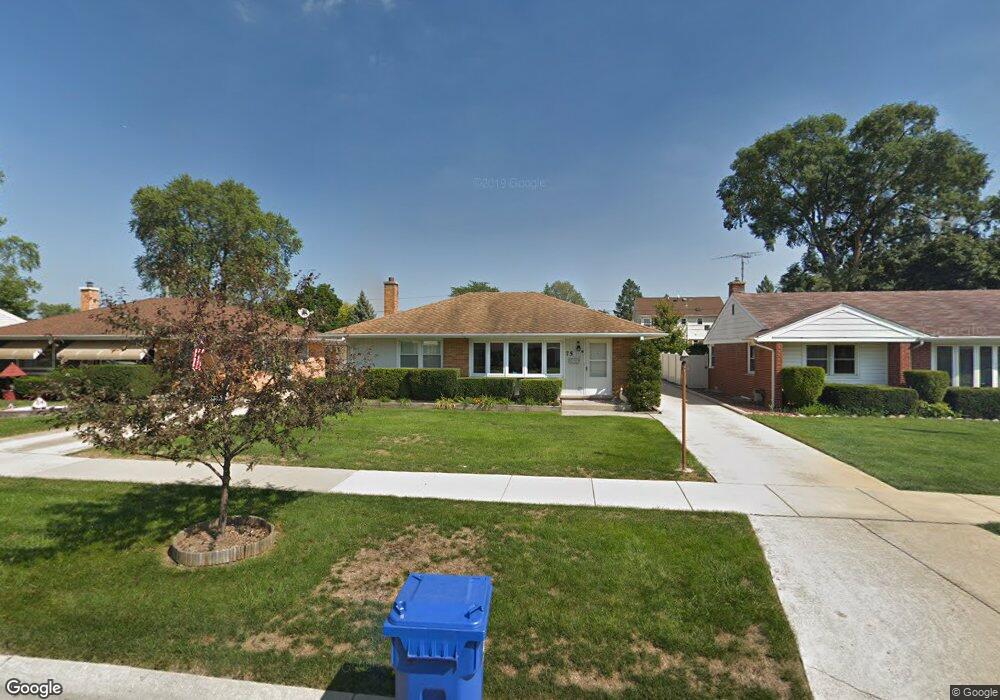
75 N Westgate Rd Des Plaines, IL 60016
Estimated Value: $356,000 - $397,000
3
Beds
1
Bath
1,045
Sq Ft
$365/Sq Ft
Est. Value
About This Home
This home is located at 75 N Westgate Rd, Des Plaines, IL 60016 and is currently estimated at $381,315, approximately $364 per square foot. 75 N Westgate Rd is a home located in Cook County with nearby schools including Terrace Elementary School, Chippewa Middle School, and Maine West High School.
Ownership History
Date
Name
Owned For
Owner Type
Purchase Details
Closed on
Oct 24, 2005
Sold by
Dankert David B and Dankert Chris
Bought by
Rentner Julia Marie
Current Estimated Value
Home Financials for this Owner
Home Financials are based on the most recent Mortgage that was taken out on this home.
Original Mortgage
$260,000
Outstanding Balance
$138,518
Interest Rate
5.98%
Mortgage Type
Fannie Mae Freddie Mac
Estimated Equity
$242,797
Create a Home Valuation Report for This Property
The Home Valuation Report is an in-depth analysis detailing your home's value as well as a comparison with similar homes in the area
Home Values in the Area
Average Home Value in this Area
Purchase History
| Date | Buyer | Sale Price | Title Company |
|---|---|---|---|
| Rentner Julia Marie | $325,000 | -- |
Source: Public Records
Mortgage History
| Date | Status | Borrower | Loan Amount |
|---|---|---|---|
| Open | Rentner Julia Marie | $260,000 |
Source: Public Records
Tax History
| Year | Tax Paid | Tax Assessment Tax Assessment Total Assessment is a certain percentage of the fair market value that is determined by local assessors to be the total taxable value of land and additions on the property. | Land | Improvement |
|---|---|---|---|---|
| 2025 | $6,508 | $35,000 | $7,150 | $27,850 |
| 2024 | $6,508 | $28,001 | $6,078 | $21,923 |
| 2023 | $6,324 | $28,001 | $6,078 | $21,923 |
| 2022 | $6,324 | $28,001 | $6,078 | $21,923 |
| 2021 | $6,416 | $24,203 | $5,005 | $19,198 |
| 2020 | $6,377 | $24,203 | $5,005 | $19,198 |
| 2019 | $6,396 | $27,195 | $5,005 | $22,190 |
| 2018 | $5,464 | $21,706 | $4,290 | $17,416 |
| 2017 | $5,385 | $21,706 | $4,290 | $17,416 |
| 2016 | $5,338 | $21,706 | $4,290 | $17,416 |
| 2015 | $5,179 | $19,753 | $3,753 | $16,000 |
| 2014 | $5,086 | $19,753 | $3,753 | $16,000 |
| 2013 | $4,941 | $19,753 | $3,753 | $16,000 |
Source: Public Records
Map
Nearby Homes
- 43 Inner Circle Dr
- 155 Cornell Ave
- 250 Anita St
- 502 S Edward St
- 305 S George St
- 475 Amherst Ave
- 915 S Owen St
- 372 Stratford Rd
- 1100 N Boxwood Dr Unit P4P5P6
- 576 Amherst Ave
- 321 Woodbridge St
- 373 Woodbridge St
- 170 Westmere Rd
- 567 Bedford Ln
- 787 E Golf Rd
- 220 University Dr Unit 35
- 586 N 7th Ave Unit 4
- 908 E Central Rd
- 114 S Elm St
- 381 W Millers Rd
- 65 N Westgate Rd
- 83 N Westgate Rd
- 59 N Westgate Rd
- 91 N Westgate Rd
- 68 N Cumberland Pkwy
- 74 N Cumberland Pkwy
- 60 N Cumberland Pkwy
- 51 N Westgate Rd
- 99 N Westgate Rd
- 50 N Cumberland Pkwy
- 84 N Cumberland Pkwy
- 78 N Westgate Rd
- 70 N Westgate Rd
- 86 N Westgate Rd
- 42 N Cumberland Pkwy
- 92 N Cumberland Pkwy
- 41 N Westgate Rd
- 60 N Westgate Rd
- 107 N Westgate Rd
- 94 N Westgate Rd
Your Personal Tour Guide
Ask me questions while you tour the home.