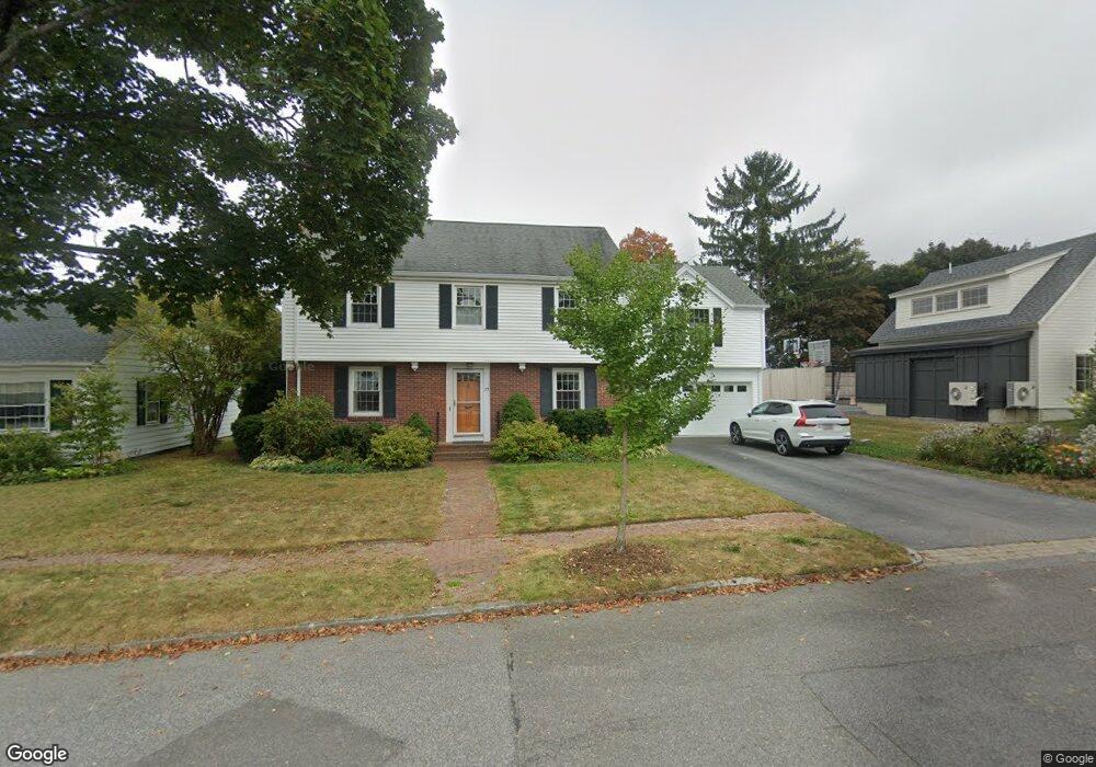
75 Parsons Rd Portland, ME 04103
Back Cove NeighborhoodEstimated Value: $910,000 - $1,043,185
4
Beds
2
Baths
1,786
Sq Ft
$534/Sq Ft
Est. Value
About This Home
This home is located at 75 Parsons Rd, Portland, ME 04103 and is currently estimated at $954,296, approximately $534 per square foot. 75 Parsons Rd is a home located in Cumberland County with nearby schools including Ocean Avenue Elementary School, Lyman Moore Middle School, and Baxter Academy for Tech & Sciences.
Ownership History
Date
Name
Owned For
Owner Type
Purchase Details
Closed on
Mar 21, 2025
Sold by
Guerin Paul R and Oneill Katharine T
Bought by
Guerin Ft and Guerin
Current Estimated Value
Purchase Details
Closed on
Aug 16, 2011
Sold by
Mougalian Alice Est and Mougalian
Bought by
Oneill Katharine T and Guerin Paul R
Home Financials for this Owner
Home Financials are based on the most recent Mortgage that was taken out on this home.
Original Mortgage
$272,500
Interest Rate
4.51%
Mortgage Type
Purchase Money Mortgage
Create a Home Valuation Report for This Property
The Home Valuation Report is an in-depth analysis detailing your home's value as well as a comparison with similar homes in the area
Home Values in the Area
Average Home Value in this Area
Purchase History
| Date | Buyer | Sale Price | Title Company |
|---|---|---|---|
| Guerin Ft | -- | None Available | |
| Guerin Ft | -- | None Available | |
| Oneill Katharine T | -- | -- | |
| Oneill Katharine T | -- | -- | |
| Oneill Katharine T | -- | -- |
Source: Public Records
Mortgage History
| Date | Status | Borrower | Loan Amount |
|---|---|---|---|
| Previous Owner | Oneill Katharine T | $272,500 |
Source: Public Records
Tax History Compared to Growth
Tax History
| Year | Tax Paid | Tax Assessment Tax Assessment Total Assessment is a certain percentage of the fair market value that is determined by local assessors to be the total taxable value of land and additions on the property. | Land | Improvement |
|---|---|---|---|---|
| 2024 | $9,886 | $658,600 | $148,600 | $510,000 |
| 2023 | $9,490 | $658,600 | $148,600 | $510,000 |
| 2022 | $8,825 | $648,400 | $148,600 | $499,800 |
| 2021 | $7,046 | $542,400 | $148,600 | $393,800 |
| 2020 | $6,131 | $263,000 | $110,900 | $152,100 |
| 2019 | $6,131 | $263,000 | $110,900 | $152,100 |
| 2018 | $5,912 | $263,000 | $110,900 | $152,100 |
| 2017 | $5,694 | $263,000 | $110,900 | $152,100 |
| 2016 | $5,552 | $263,000 | $110,900 | $152,100 |
| 2015 | $5,426 | $263,000 | $110,900 | $152,100 |
| 2014 | $5,260 | $263,000 | $110,900 | $152,100 |
Source: Public Records
Map
Nearby Homes
- 33 Bay View Dr
- 45 George St
- 44 Hersey St
- 33 Mayland St
- 42 Sawyer St
- 736 Forest Ave
- 37 Wellington Rd
- 25 Pleasant Ave
- 44 Pleasant Ave
- 48 Ashmont St
- 89 Clinton St
- 9 Bay View Terrace
- 930 Forest Ave
- 400 Ocean Ave
- 103 Deerfield Rd
- 412 Ocean Ave
- 147 Pleasant Ave Unit 2
- 65 Mcauley Way Unit 506
- 75 Mcauley Way Unit 307
- 75 Mcauley Way Unit 206