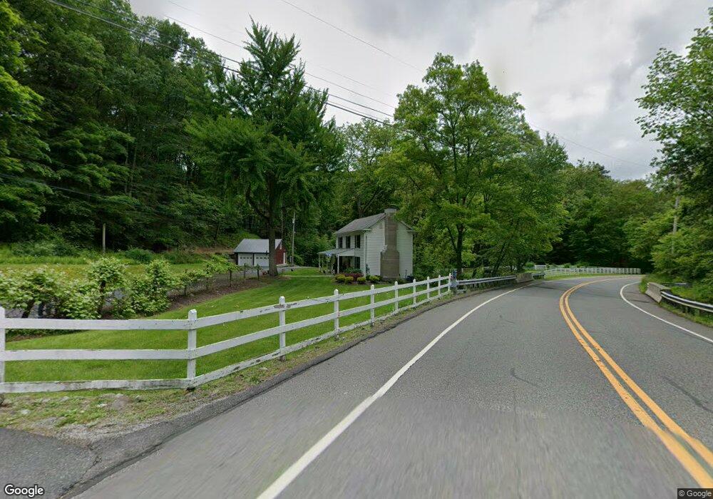
75 Paulinskill Lake Rd Newton, NJ 07860
Estimated Value: $377,000 - $572,000
2
Beds
2
Baths
1,296
Sq Ft
$342/Sq Ft
Est. Value
About This Home
This home is located at 75 Paulinskill Lake Rd, Newton, NJ 07860 and is currently estimated at $442,920, approximately $341 per square foot. 75 Paulinskill Lake Rd is a home located in Sussex County with nearby schools including Fredon Township School, Kittatinny Regional High School, and Lakeland Andover School.
Ownership History
Date
Name
Owned For
Owner Type
Purchase Details
Closed on
Dec 7, 2005
Sold by
Strader Richard and Strader Eugene
Bought by
Burrini Jesse J and Burrini Nichole
Current Estimated Value
Home Financials for this Owner
Home Financials are based on the most recent Mortgage that was taken out on this home.
Original Mortgage
$480,000
Outstanding Balance
$269,361
Interest Rate
6.34%
Mortgage Type
Purchase Money Mortgage
Estimated Equity
$173,559
Create a Home Valuation Report for This Property
The Home Valuation Report is an in-depth analysis detailing your home's value as well as a comparison with similar homes in the area
Home Values in the Area
Average Home Value in this Area
Purchase History
| Date | Buyer | Sale Price | Title Company |
|---|---|---|---|
| Burrini Jesse J | $601,000 | Advantage Title Agency Inc |
Source: Public Records
Mortgage History
| Date | Status | Borrower | Loan Amount |
|---|---|---|---|
| Open | Burrini Jesse J | $480,000 |
Source: Public Records
Tax History Compared to Growth
Tax History
| Year | Tax Paid | Tax Assessment Tax Assessment Total Assessment is a certain percentage of the fair market value that is determined by local assessors to be the total taxable value of land and additions on the property. | Land | Improvement |
|---|---|---|---|---|
| 2025 | $6,349 | $203,700 | $84,800 | $118,900 |
| 2024 | $6,080 | $203,700 | $84,800 | $118,900 |
| 2023 | $6,080 | $203,700 | $84,800 | $118,900 |
| 2022 | $5,958 | $203,700 | $84,800 | $118,900 |
| 2021 | $6,093 | $203,700 | $84,800 | $118,900 |
| 2020 | $6,060 | $203,700 | $84,800 | $118,900 |
| 2019 | $5,985 | $203,700 | $84,800 | $118,900 |
| 2018 | $5,883 | $203,700 | $84,800 | $118,900 |
| 2017 | $5,907 | $203,700 | $84,800 | $118,900 |
| 2016 | $5,854 | $203,700 | $84,800 | $118,900 |
| 2015 | $5,669 | $203,700 | $84,800 | $118,900 |
| 2014 | $5,573 | $203,700 | $84,800 | $118,900 |
Source: Public Records
Map
Nearby Homes
- 51 Paulinskill Lake Rd
- 903 Cedar Dr
- 905 Gapview Ct
- 920 Deer Run Rd
- 3 Roy Rd
- 903 Stony Rd
- 965 Cedar Dr
- 20 Stillwater Rd
- 63 Van Horn Rd
- 907 Meadowbrook Rd
- 936 Dove Island Rd
- 1024 County Road 619
- 208 Willows Rd
- 35 Puder Rd
- 929 Wall St
- 927 Wall St
- 932 Saddleback Rd
- 20 Anderson Hill Rd
- 5 Scenic Dr
- 30 Old Swartswood Rd
- 9 Schindler Ct
- 14 Farm Creek Rd
- 12 Farm Creek Rd
- 902 Ridge Rd
- 16 Farm Creek Rd
- 901 Orchard Terrace
- 951 W End Dr
- 907 Homestead Dr
- 903 Homestead Dr
- 909 Homestead Dr
- 10 Farm Creek Rd
- 901 Homestead Dr
- 907 Elm Terrace
- 18 Farm Creek Rd
- 57 Paulinskill Lake Rd
- 901 S Shore Terrace
- 913 Homestead Dr
- 8 Schindler Ct
- 7 Schindler Ct
- 9 Roy Rd