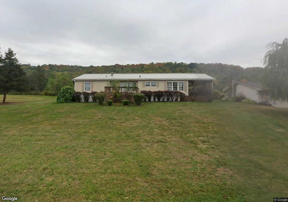
75 Playground Rd Brockport, PA 15823
Estimated Value: $120,000 - $186,000
3
Beds
2
Baths
--
Sq Ft
12,632
Sq Ft Lot
About This Home
This home is located at 75 Playground Rd, Brockport, PA 15823 and is currently estimated at $144,667. 75 Playground Rd is a home located in Elk County with nearby schools including Brockway Area Elementary School, Brockway Area Junior/Senior High School, and Hillside School.
Ownership History
Date
Name
Owned For
Owner Type
Purchase Details
Closed on
May 7, 2009
Sold by
Ceriani James A and Ceriani Heather M
Bought by
Woltu Tara and Valey Robert
Current Estimated Value
Home Financials for this Owner
Home Financials are based on the most recent Mortgage that was taken out on this home.
Original Mortgage
$73,641
Interest Rate
5.28%
Mortgage Type
FHA
Purchase Details
Closed on
Dec 14, 2006
Sold by
Equity One Inc
Bought by
Ceriani James A
Home Financials for this Owner
Home Financials are based on the most recent Mortgage that was taken out on this home.
Original Mortgage
$45,600
Interest Rate
6.24%
Mortgage Type
New Conventional
Create a Home Valuation Report for This Property
The Home Valuation Report is an in-depth analysis detailing your home's value as well as a comparison with similar homes in the area
Purchase History
| Date | Buyer | Sale Price | Title Company |
|---|---|---|---|
| Woltu Tara | -- | None Available | |
| Ceriani James A | $48,000 | None Available |
Source: Public Records
Mortgage History
| Date | Status | Borrower | Loan Amount |
|---|---|---|---|
| Previous Owner | Woltu Tara | $73,641 | |
| Previous Owner | Ceriani James A | $45,600 |
Source: Public Records
Tax History
| Year | Tax Paid | Tax Assessment Tax Assessment Total Assessment is a certain percentage of the fair market value that is determined by local assessors to be the total taxable value of land and additions on the property. | Land | Improvement |
|---|---|---|---|---|
| 2025 | $1,516 | $29,400 | $700 | $28,700 |
| 2024 | $1,508 | $29,400 | $700 | $28,700 |
| 2023 | $1,456 | $29,400 | $700 | $28,700 |
| 2022 | $1,446 | $29,400 | $700 | $28,700 |
| 2021 | $1,421 | $29,400 | $700 | $28,700 |
| 2020 | $1,421 | $29,400 | $700 | $28,700 |
| 2019 | $1,369 | $29,400 | $700 | $28,700 |
| 2018 | $1,332 | $29,400 | $700 | $28,700 |
| 2017 | $1,292 | $29,400 | $700 | $28,700 |
| 2016 | $1,127 | $29,400 | $700 | $28,700 |
| 2015 | -- | $29,400 | $700 | $28,700 |
| 2013 | -- | $29,400 | $700 | $28,700 |
Source: Public Records
Map
Nearby Homes
- 0 Sr2001 Rattlesnake Rd Unit 26-53
- 1981 Shawmut Rd
- 7956 U S 219
- 601 Sandbank Rd
- 565-566 Chester Ln
- 19 - 512 Lynyard Ln
- 181 Dolphin Head Rd
- 744 Dolphin Head Rd Unit 19 83 & 84
- 18 150 Malcolm Rd
- 14 Port-Au-prince Rd
- 323 Flamingo Rd
- 0 Boone Mountain - Heigel Road Rd Unit 1-2-5-6
- 0 Boone Mountain - Heigel Road Rd Unit 4 25-179
- 50 Steele Rd
- 211 Pimlico Rd
- 285 Saint Martin Rd
- 246 Whispering Trail Rd
- 249 Galloway Rd
- 360 6 Shilling Rd
- 362 6 Shilling Rd
- 95 Playground Rd
- 121 Playground Rd
- 26 Playground Rd
- 19 Playground Rd
- 8 Whites Rd
- 141 Playground Rd
- 0 Lot H Playground Rd
- 50 Whites Rd
- 106 Mountain Church Rd
- 5459 Route 219
- 150 Old Penfield Rd
- 52 Mountain Church Rd
- 45 Mountain Church Rd
- 118 Mountain Church Rd
- 57 Mclaughlin Rd
- 5604 Route 219
- 0 Lot I Playground Rd
- 56 Mclaughlin Rd
- 75 Mclaughlin Rd
- 5620 Route 219
Your Personal Tour Guide
Ask me questions while you tour the home.