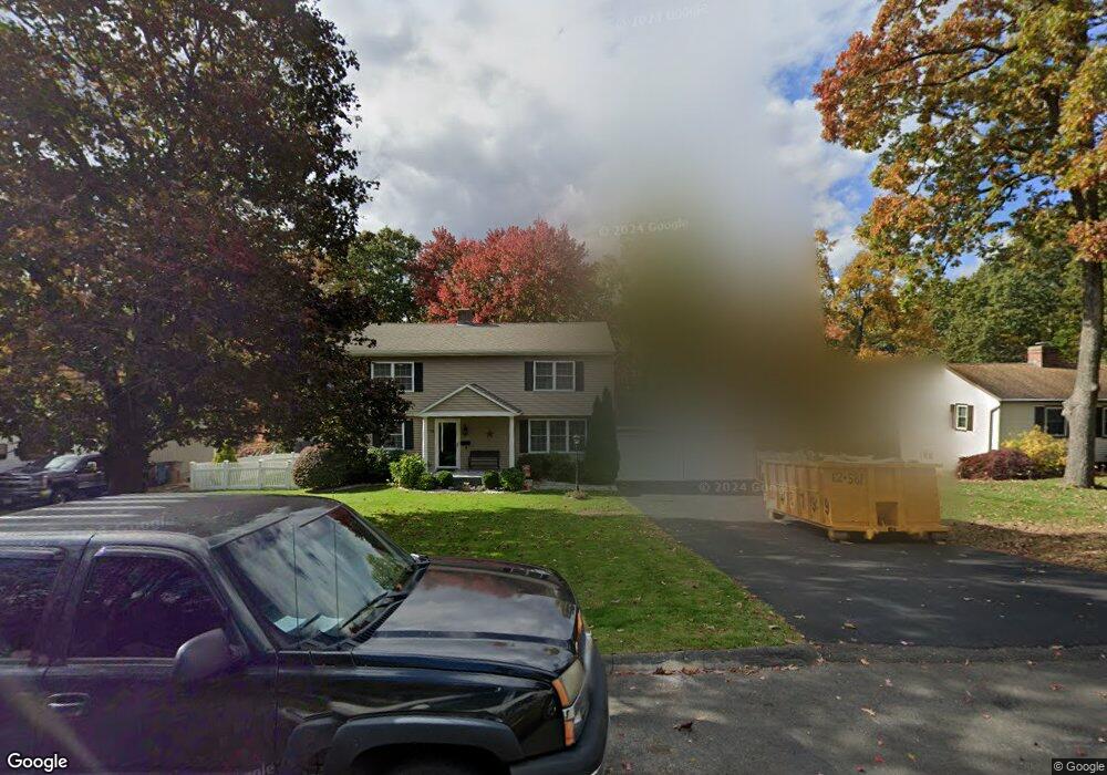
75 Range Hill Dr Vernon Rockville, CT 06066
North Vernon NeighborhoodEstimated Value: $381,000 - $461,000
4
Beds
2
Baths
1,876
Sq Ft
$220/Sq Ft
Est. Value
About This Home
This home is located at 75 Range Hill Dr, Vernon Rockville, CT 06066 and is currently estimated at $412,647, approximately $219 per square foot. 75 Range Hill Dr is a home located in Tolland County with nearby schools including Maple Street School, Vernon Center Middle School, and Rockville High School.
Ownership History
Date
Name
Owned For
Owner Type
Purchase Details
Closed on
Aug 15, 2011
Sold by
Tlv Transformations Ll
Bought by
Davila Yusseff and Davila Jessamyn E
Current Estimated Value
Home Financials for this Owner
Home Financials are based on the most recent Mortgage that was taken out on this home.
Original Mortgage
$242,687
Outstanding Balance
$168,840
Interest Rate
4.75%
Mortgage Type
FHA
Estimated Equity
$243,807
Purchase Details
Closed on
Nov 4, 2010
Sold by
Est Caldwell Harold and Nielson Margaret
Bought by
In Tlv Transformations
Create a Home Valuation Report for This Property
The Home Valuation Report is an in-depth analysis detailing your home's value as well as a comparison with similar homes in the area
Home Values in the Area
Average Home Value in this Area
Purchase History
| Date | Buyer | Sale Price | Title Company |
|---|---|---|---|
| Davila Yusseff | $249,000 | -- | |
| In Tlv Transformations | $140,000 | -- |
Source: Public Records
Mortgage History
| Date | Status | Borrower | Loan Amount |
|---|---|---|---|
| Open | In Tlv Transformations | $242,687 |
Source: Public Records
Tax History Compared to Growth
Tax History
| Year | Tax Paid | Tax Assessment Tax Assessment Total Assessment is a certain percentage of the fair market value that is determined by local assessors to be the total taxable value of land and additions on the property. | Land | Improvement |
|---|---|---|---|---|
| 2025 | $7,721 | $213,940 | $47,250 | $166,690 |
| 2024 | $6,769 | $192,910 | $47,250 | $145,660 |
| 2023 | $6,441 | $192,910 | $47,250 | $145,660 |
| 2022 | $6,441 | $192,910 | $47,250 | $145,660 |
| 2021 | $6,258 | $157,910 | $46,200 | $111,710 |
| 2020 | $6,258 | $157,910 | $46,200 | $111,710 |
| 2019 | $6,258 | $157,910 | $46,200 | $111,710 |
| 2018 | $6,258 | $157,910 | $46,200 | $111,710 |
| 2017 | $6,113 | $157,910 | $46,200 | $111,710 |
| 2016 | $5,607 | $147,440 | $52,150 | $95,290 |
| 2015 | $5,442 | $147,440 | $52,150 | $95,290 |
| 2014 | $5,324 | $147,440 | $52,150 | $95,290 |
Source: Public Records
Map
Nearby Homes
- 113 Regan Rd
- 201 Regan Rd Unit 3B
- 201 Regan Rd Unit 2B
- 60 Old Town Rd Unit 143
- 60 Old Town Rd Unit 29
- 70 Old Town Rd Unit 360
- 565 Talcottville Rd Unit 1C4
- 18 Hillcrest Dr
- 171 Center Rd
- 67 West St
- 343 Merline Rd
- 42 Valley View Ln
- 38 Winding Brook Trail
- 201 Skinner Rd
- 57 Grand Ave
- 16 Maple St Unit 11
- 77 Center Rd
- 16 Irene Dr
- 66 Village St
- 14 Pinney St Unit 24
- 81 Range Hill Dr
- 71 Range Hill Dr
- 65 Range Hill Dr
- 70 Range Hill Dr
- 74 Range Hill Dr
- 57 Range Hill Dr
- 93 Range Hill Dr
- 86 Range Hill Dr
- 51 Range Hill Dr
- 56 Range Hill Dr
- 92 Range Hill Dr
- 64 Range Hill Dr
- 99 Range Hill Dr
- 27 Country Ln
- 52 Range Hill Dr
- 39 Country Ln
- 100 Range Hill Dr
- 21 Country Ln
- 45 Range Hill Dr
- 45 Country Ln