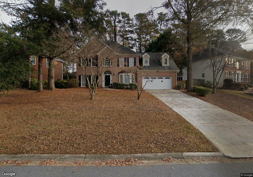
75 Rivershyre Cir Unit 10 Lawrenceville, GA 30043
Estimated Value: $450,427 - $510,000
5
Beds
3
Baths
2,927
Sq Ft
$164/Sq Ft
Est. Value
About This Home
This home is located at 75 Rivershyre Cir Unit 10, Lawrenceville, GA 30043 and is currently estimated at $480,107, approximately $164 per square foot. 75 Rivershyre Cir Unit 10 is a home located in Gwinnett County with nearby schools including Taylor Elementary School, Creekland Middle School, and Collins Hill High School.
Ownership History
Date
Name
Owned For
Owner Type
Purchase Details
Closed on
Dec 31, 2012
Sold by
Perolio Daniel S
Bought by
Tanner Mashaunda
Current Estimated Value
Home Financials for this Owner
Home Financials are based on the most recent Mortgage that was taken out on this home.
Original Mortgage
$7,500
Outstanding Balance
$5,212
Interest Rate
3.36%
Mortgage Type
New Conventional
Estimated Equity
$474,895
Purchase Details
Closed on
Jun 2, 2006
Sold by
Barrs William C and Barrs Mary A F
Bought by
Perolio Daniel S and Perolio Phyllis A
Home Financials for this Owner
Home Financials are based on the most recent Mortgage that was taken out on this home.
Original Mortgage
$155,073
Interest Rate
6.51%
Mortgage Type
New Conventional
Create a Home Valuation Report for This Property
The Home Valuation Report is an in-depth analysis detailing your home's value as well as a comparison with similar homes in the area
Home Values in the Area
Average Home Value in this Area
Purchase History
| Date | Buyer | Sale Price | Title Company |
|---|---|---|---|
| Tanner Mashaunda | $160,000 | -- | |
| Perolio Daniel S | $251,000 | -- |
Source: Public Records
Mortgage History
| Date | Status | Borrower | Loan Amount |
|---|---|---|---|
| Open | Tanner Mashaunda | $7,500 | |
| Open | Tanner Mashaunda | $157,102 | |
| Previous Owner | Perolio Daniel S | $155,073 |
Source: Public Records
Tax History Compared to Growth
Tax History
| Year | Tax Paid | Tax Assessment Tax Assessment Total Assessment is a certain percentage of the fair market value that is determined by local assessors to be the total taxable value of land and additions on the property. | Land | Improvement |
|---|---|---|---|---|
| 2024 | $4,553 | $160,280 | $32,800 | $127,480 |
| 2023 | $4,553 | $160,280 | $32,800 | $127,480 |
| 2022 | $4,195 | $144,600 | $32,800 | $111,800 |
| 2021 | $3,554 | $111,120 | $23,520 | $87,600 |
| 2020 | $3,483 | $106,640 | $23,520 | $83,120 |
| 2019 | $3,390 | $106,640 | $23,520 | $83,120 |
| 2018 | $3,216 | $98,480 | $18,720 | $79,760 |
| 2016 | $2,942 | $84,840 | $16,400 | $68,440 |
| 2015 | $2,967 | $84,840 | $16,400 | $68,440 |
| 2014 | $2,981 | $84,840 | $16,400 | $68,440 |
Source: Public Records
Map
Nearby Homes
- 1490 Rivershyre Pkwy
- 134 Waterloch Ct
- 1201 Brook Knoll Place
- 221 Larkshyre Trail
- 340 Channings Lake Dr
- 210 Timber Laurel Ct
- 260 Timber Laurel Ln
- 980 Charter Club Dr
- 1574 Glenfield Dr Unit 1
- 1475 Cheshire Ct
- 1401 Dorchester Dr
- 1230 Rivershyre Pkwy
- 1625 Cheshire Ct
- 531 Shyrewood Dr
- 1244 Riverloch Way
- 937 Sonny Boy Ln Unit 1
- 241 Russell Rd
- 2402 Malster Ln
- 75 Rivershyre Cir
- 85 Rivershyre Cir
- 55 Rivershyre Cir
- 105 Rivershyre Cir
- 45 Rivershyre Cir
- 70 Rivershyre Cir
- 1645 Rivershyre Pkwy
- 1655 Rivershyre Pkwy
- 60 Rivershyre Cir
- 80 Rivershyre Cir
- 90 Rivershyre Cir Unit 10
- 0 Rivershyre Cir Unit 7308658
- 0 Rivershyre Cir Unit 3132196
- 0 Rivershyre Cir Unit 8879266
- 0 Rivershyre Cir Unit 8803973
- 0 Rivershyre Cir Unit 8782194
- 0 Rivershyre Cir Unit 8211965
- 0 Rivershyre Cir Unit 8141150
- 0 Rivershyre Cir Unit 7631243
- 0 Rivershyre Cir Unit 7605019