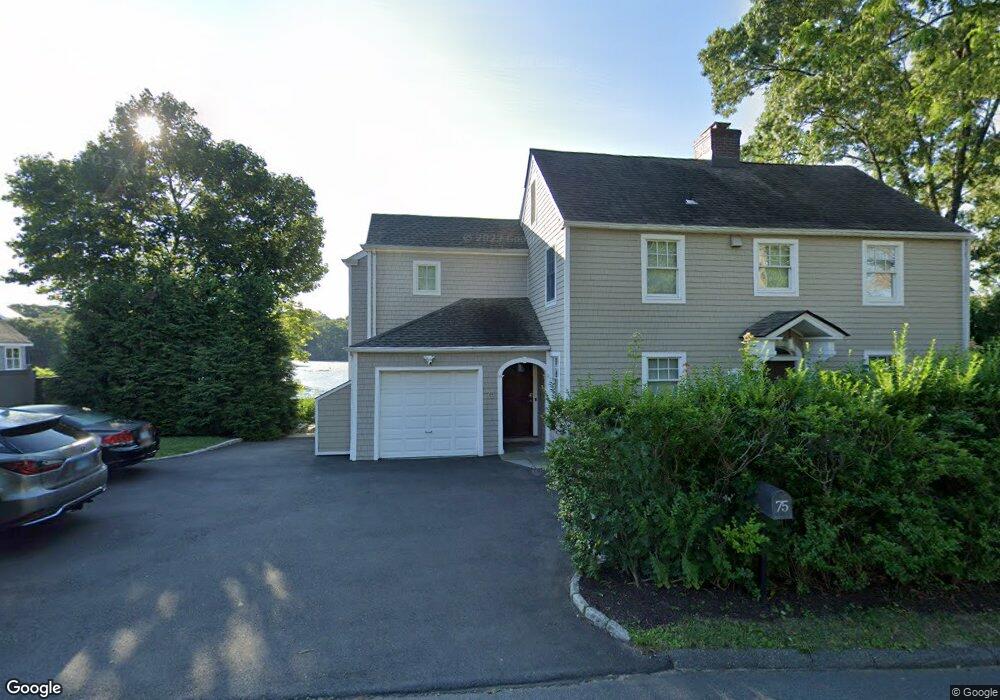
75 Riverside Ave Westport, CT 06880
Saugatuck NeighborhoodEstimated Value: $1,428,000 - $1,796,000
3
Beds
4
Baths
2,445
Sq Ft
$657/Sq Ft
Est. Value
About This Home
This home is located at 75 Riverside Ave, Westport, CT 06880 and is currently estimated at $1,605,505, approximately $656 per square foot. 75 Riverside Ave is a home located in Fairfield County with nearby schools including King's Highway Elementary School, Coleytown Middle School, and Staples High School.
Ownership History
Date
Name
Owned For
Owner Type
Purchase Details
Closed on
Apr 3, 2007
Sold by
Meyerson Ray L
Bought by
Larsen Dana and Larsen Rodney
Current Estimated Value
Home Financials for this Owner
Home Financials are based on the most recent Mortgage that was taken out on this home.
Original Mortgage
$417,000
Interest Rate
6.33%
Purchase Details
Closed on
Aug 8, 2002
Sold by
Burns-Howard G Bradley and Burns-Howard Roberta J
Bought by
Meyerson Ray L
Purchase Details
Closed on
May 2, 1989
Sold by
Turck Claire
Bought by
Burns Howar G Bradley
Create a Home Valuation Report for This Property
The Home Valuation Report is an in-depth analysis detailing your home's value as well as a comparison with similar homes in the area
Home Values in the Area
Average Home Value in this Area
Purchase History
| Date | Buyer | Sale Price | Title Company |
|---|---|---|---|
| Larsen Dana | $1,050,000 | -- | |
| Larsen Dana | $1,050,000 | -- | |
| Meyerson Ray L | $950,000 | -- | |
| Meyerson Ray L | $950,000 | -- | |
| Burns Howar G Bradley | $326,000 | -- |
Source: Public Records
Mortgage History
| Date | Status | Borrower | Loan Amount |
|---|---|---|---|
| Closed | Burns Howar G Bradley | $417,000 | |
| Closed | Burns Howar G Bradley | $300,000 |
Source: Public Records
Tax History Compared to Growth
Tax History
| Year | Tax Paid | Tax Assessment Tax Assessment Total Assessment is a certain percentage of the fair market value that is determined by local assessors to be the total taxable value of land and additions on the property. | Land | Improvement |
|---|---|---|---|---|
| 2025 | $10,722 | $568,500 | $332,700 | $235,800 |
| 2024 | $10,585 | $568,500 | $332,700 | $235,800 |
| 2023 | $10,432 | $568,500 | $332,700 | $235,800 |
| 2022 | $10,273 | $568,500 | $332,700 | $235,800 |
| 2021 | $10,273 | $568,500 | $332,700 | $235,800 |
| 2020 | $10,517 | $629,400 | $336,800 | $292,600 |
| 2019 | $10,612 | $629,400 | $336,800 | $292,600 |
| 2018 | $10,612 | $629,400 | $336,800 | $292,600 |
| 2017 | $10,612 | $629,400 | $336,800 | $292,600 |
| 2016 | $9,925 | $588,700 | $336,800 | $251,900 |
| 2015 | $12,717 | $703,000 | $480,100 | $222,900 |
| 2014 | $12,612 | $703,000 | $480,100 | $222,900 |
Source: Public Records
Map
Nearby Homes
- 21 Wright St
- 60 Wilton Rd Unit 2C
- 102 Compo Rd S
- 11 Old Hill Rd
- 113 Kings Hwy N
- 20 Old Hill Rd
- 6 Over Rock Ln
- 3 Laurel Ln
- 5 Franklin Ave
- 310 Main St
- 33 Pequot Trail
- 7 Wild Rose Rd
- 3 Bolton Ln
- 9 Crescent Park Rd
- 3 Tanglewood Ln
- 28 Crescent Park Rd
- 26 Crescent Park Rd
- 42 Kings Hwy S
- 171 & 169 Compo Rd S
- 23 Bridge St
- 79 Riverside Ave
- 76 Riverside Ave
- 68 Riverside Ave
- 82 Riverside Ave
- 62 Riverside Ave
- 62 Riverside Ave Unit 2
- 175 Riverside Ave
- 56 Riverside Ave Unit 1
- 56 Riverside Ave
- 37 Lincoln St
- 21 Lincoln St Unit 21
- 120 Post Rd W
- 24 Cross St
- 16 Cross St
- 25 Lincoln St
- 32 Lincoln St
- 20 Cross St Unit 2
- 20 Cross St Unit 10
- 20 Cross St Unit 9
- 20 Cross St Unit 8