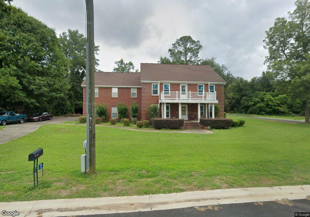
75 S Boundary St Reynolds, GA 31076
Estimated Value: $273,000 - $333,442
--
Bed
--
Bath
3,768
Sq Ft
$77/Sq Ft
Est. Value
About This Home
This home is located at 75 S Boundary St, Reynolds, GA 31076 and is currently estimated at $289,111, approximately $76 per square foot. 75 S Boundary St is a home with nearby schools including Taylor County Upper Elementary School, Taylor County Primary School, and Taylor County Middle School.
Ownership History
Date
Name
Owned For
Owner Type
Purchase Details
Closed on
Mar 21, 2011
Sold by
The Citizens State Bank Of Taylor County
Bought by
Biddle Jemeel N
Current Estimated Value
Home Financials for this Owner
Home Financials are based on the most recent Mortgage that was taken out on this home.
Original Mortgage
$131,577
Outstanding Balance
$90,236
Interest Rate
4.75%
Mortgage Type
FHA
Estimated Equity
$198,875
Purchase Details
Closed on
Mar 4, 2009
Sold by
Sloan Glenn R
Bought by
The Citizens State Bank Of Taylor County
Purchase Details
Closed on
Dec 31, 2001
Sold by
Barrow John
Bought by
Sloan Glen R and Sloan Shea
Purchase Details
Closed on
Aug 29, 2001
Sold by
Reynolds Industrial
Bought by
Barrow John
Purchase Details
Closed on
Jul 5, 1994
Bought by
Reynolds Industrial
Create a Home Valuation Report for This Property
The Home Valuation Report is an in-depth analysis detailing your home's value as well as a comparison with similar homes in the area
Home Values in the Area
Average Home Value in this Area
Purchase History
| Date | Buyer | Sale Price | Title Company |
|---|---|---|---|
| Biddle Jemeel N | $135,000 | -- | |
| The Citizens State Bank Of Taylor County | -- | -- | |
| Sloan Glen R | $7,000 | -- | |
| Barrow John | $5,300 | -- | |
| Reynolds Industrial | $4,500 | -- |
Source: Public Records
Mortgage History
| Date | Status | Borrower | Loan Amount |
|---|---|---|---|
| Open | Biddle Jemeel N | $131,577 |
Source: Public Records
Tax History Compared to Growth
Tax History
| Year | Tax Paid | Tax Assessment Tax Assessment Total Assessment is a certain percentage of the fair market value that is determined by local assessors to be the total taxable value of land and additions on the property. | Land | Improvement |
|---|---|---|---|---|
| 2024 | $5,188 | $133,800 | $3,600 | $130,200 |
| 2023 | $4,418 | $110,160 | $3,600 | $106,560 |
| 2022 | $2,622 | $104,240 | $3,600 | $100,640 |
| 2021 | $2,451 | $97,160 | $3,600 | $93,560 |
| 2020 | $2,469 | $97,160 | $3,600 | $93,560 |
| 2019 | $2,373 | $92,440 | $3,600 | $88,840 |
| 2018 | $3,177 | $92,440 | $3,600 | $88,840 |
| 2017 | $2,573 | $102,438 | $5,700 | $96,738 |
| 2016 | $1,914 | $78,471 | $5,700 | $72,771 |
| 2015 | -- | $78,471 | $5,700 | $72,771 |
| 2014 | -- | $92,243 | $4,800 | $87,443 |
| 2013 | -- | $95,527 | $5,600 | $89,927 |
Source: Public Records
Map
Nearby Homes
- 29 Mimms St
- 46 E Calhoun St
- 25 W Marion St
- 67 N Collins St
- 9 Friar Tuck Rd
- 0 Briar Patch Way Unit 10546919
- 160 Underwood Rd
- 30 Potterville Main St
- 30 Pottervile Main St
- 296 Boxwood Rd
- Cummings Rd
- 708 Tommy Purvis Junior Rd
- 1800 Cummings Rd
- 246 Wilville Rd
- 000 Avera Rd
- Parcel 6 Carl Rogers Rd
- Parcel 13 Carl Rogers Rd
- Parcel 8 Carl Rogers Rd
- Parcel 5 Carl Rogers Rd
- Parcel 7 Carl Rogers Rd
- 73 S Boundary St
- 69 S Boundary St
- 74 S Boundary St
- 38 S Lashley St
- 80 S Boundary St
- 35 Mimms St
- 35 Mims St
- 68 S Boundary St
- 65 S Boundary St
- 34 S Lashley St
- 64 S Boundary St
- 34 Mimms St
- 25 Mimms St
- 61 S Boundary St
- 60 S Boundary St
- 28 Mimms St
- 59 S Boundary St
- 90 S Boundary St
- 29 Mimms St
- 42 E Haynes St