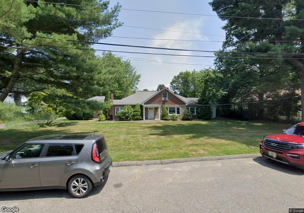
75 Sanford Ln Stamford, CT 06905
Turn of the River-Newfield Neighborhood
5
Beds
3
Baths
2,350
Sq Ft
0.59
Acres
About This Home
This home is located at 75 Sanford Ln, Stamford, CT 06905. 75 Sanford Ln is a home located in Fairfield County with nearby schools including Newfield School, Rippowam Middle School, and Stamford High School.
Ownership History
Date
Name
Owned For
Owner Type
Purchase Details
Closed on
Oct 4, 2016
Sold by
Saint Vincents Specl N
Bought by
Abilis Inc
Home Financials for this Owner
Home Financials are based on the most recent Mortgage that was taken out on this home.
Original Mortgage
$488,160
Outstanding Balance
$222,362
Interest Rate
2.74%
Mortgage Type
New Conventional
Purchase Details
Closed on
Jun 7, 2000
Sold by
Curas Mary
Bought by
Saint Vincents Special
Create a Home Valuation Report for This Property
The Home Valuation Report is an in-depth analysis detailing your home's value as well as a comparison with similar homes in the area
Home Values in the Area
Average Home Value in this Area
Purchase History
| Date | Buyer | Sale Price | Title Company |
|---|---|---|---|
| Abilis Inc | $322,000 | -- | |
| Abilis Inc | $322,000 | -- | |
| Saint Vincents Special | $439,000 | -- | |
| Saint Vincents Special | $439,000 | -- |
Source: Public Records
Mortgage History
| Date | Status | Borrower | Loan Amount |
|---|---|---|---|
| Open | Abilis Inc | $488,160 | |
| Closed | Abilis Inc | $488,160 | |
| Previous Owner | Saint Vincents Special | $100,000 |
Source: Public Records
Tax History Compared to Growth
Tax History
| Year | Tax Paid | Tax Assessment Tax Assessment Total Assessment is a certain percentage of the fair market value that is determined by local assessors to be the total taxable value of land and additions on the property. | Land | Improvement |
|---|---|---|---|---|
| 2025 | $0 | $635,190 | $375,840 | $259,350 |
| 2024 | -- | $635,190 | $375,840 | $259,350 |
| 2023 | $0 | $635,190 | $375,840 | $259,350 |
| 2022 | $0 | $468,140 | $257,170 | $210,970 |
| 2021 | $0 | $468,140 | $257,170 | $210,970 |
| 2020 | $0 | $468,140 | $257,170 | $210,970 |
| 2019 | $0 | $468,140 | $257,170 | $210,970 |
| 2018 | $0 | $468,140 | $257,170 | $210,970 |
| 2017 | $0 | $415,970 | $217,750 | $198,220 |
| 2016 | -- | $415,970 | $217,750 | $198,220 |
| 2015 | -- | $415,970 | $217,750 | $198,220 |
| 2014 | -- | $415,970 | $217,750 | $198,220 |
Source: Public Records
Map
Nearby Homes
- 31 Gray Farms Rd
- 22 Hastings Ln
- 24 Haig Ave
- 172 Joffre Ave
- 100 Hirsch Rd
- 182 Turner Rd
- 31 Sussex Place
- 78 Elizabeth Ave
- 433 High Ridge Rd
- 143 Overbrook Dr
- 543 Newfield Ave
- 6 Walnut Ridge Ct
- 12 Walnut Ridge Ct
- 21 Nichols Ave
- 39 Camore St
- 30 Lindsey Ave
- 27 Emma Rd
- 393 Upper Haig Ave
- 44 Brundage St
- 27 Crane Rd N
- 87 Sanford Ln
- 63 Sanford Ln
- 16 Denicola Rd
- 95 Sanford Ln
- 70 Sanford Ln
- 88 Sanford Ln
- 78 Sanford Ln
- 11 Denicola Rd
- 64 Sanford Ln
- 53 Sanford Ln
- 96 Sanford Ln
- 12 Denicola Rd
- 10 Kensington Rd
- 826 Newfield Ave
- 97 Harvest Hill Ln
- 35 Sanford Ln
- 104 Sanford Ln
- 2 Denicola Rd
- 93 Harvest Hill Ln
- 790 Newfield Ave