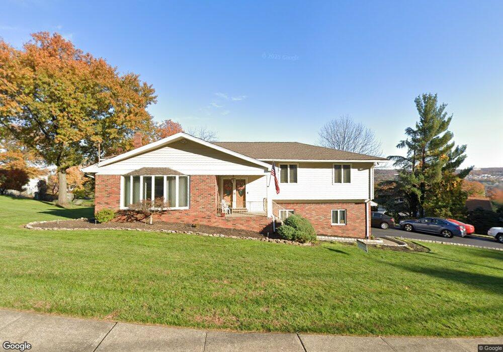
75 Stanford Ct Totowa, NJ 07512
Estimated Value: $790,118 - $974,000
--
Bed
--
Bath
2,548
Sq Ft
$344/Sq Ft
Est. Value
About This Home
This home is located at 75 Stanford Ct, Totowa, NJ 07512 and is currently estimated at $875,280, approximately $343 per square foot. 75 Stanford Ct is a home located in Passaic County with nearby schools including Washington Park Elementary School, Passaic Valley High School, and John P Holland Charter School.
Ownership History
Date
Name
Owned For
Owner Type
Purchase Details
Closed on
Oct 9, 2018
Sold by
Hoogmoed Jaclyn and Zuzak Jessica
Bought by
Zuzak Jessica and Hoogmoed Jaclyn
Current Estimated Value
Purchase Details
Closed on
Jun 20, 2018
Sold by
Hoogmoed Jaclyn and Zuzak Jessica
Bought by
Hoogmoed Jaclyn and Zuzak Jessica
Purchase Details
Closed on
Jan 20, 2016
Sold by
Indovina Carlo and Indovina Anna
Bought by
Carlo Indovine Family Trust and Hoodmoed Jaclyn
Purchase Details
Closed on
Apr 7, 2000
Sold by
Indovina Carlo and Indovina Anna
Bought by
Indovina Carlo and Indovina Anna
Create a Home Valuation Report for This Property
The Home Valuation Report is an in-depth analysis detailing your home's value as well as a comparison with similar homes in the area
Home Values in the Area
Average Home Value in this Area
Purchase History
| Date | Buyer | Sale Price | Title Company |
|---|---|---|---|
| Zuzak Jessica | -- | None Available | |
| Hoogmoed Jaclyn | -- | None Available | |
| Carlo Indovine Family Trust | -- | None Available | |
| Indovina Carlo | -- | -- |
Source: Public Records
Tax History Compared to Growth
Tax History
| Year | Tax Paid | Tax Assessment Tax Assessment Total Assessment is a certain percentage of the fair market value that is determined by local assessors to be the total taxable value of land and additions on the property. | Land | Improvement |
|---|---|---|---|---|
| 2025 | $13,520 | $498,700 | $195,500 | $303,200 |
| 2024 | $12,931 | $498,700 | $195,500 | $303,200 |
| 2022 | $12,158 | $498,700 | $195,500 | $303,200 |
| 2021 | $11,864 | $498,700 | $195,500 | $303,200 |
| 2020 | $12,079 | $498,700 | $195,500 | $303,200 |
| 2019 | $11,909 | $498,700 | $195,500 | $303,200 |
| 2018 | $11,884 | $498,700 | $195,500 | $303,200 |
| 2017 | $11,764 | $498,700 | $195,500 | $303,200 |
| 2016 | $11,714 | $498,700 | $195,500 | $303,200 |
| 2015 | $11,390 | $498,700 | $195,500 | $303,200 |
| 2014 | $10,582 | $498,700 | $195,500 | $303,200 |
Source: Public Records
Map
Nearby Homes
- 8 Flintlock Ct
- 81 Columbus Ave
- 302 Lincoln Ave
- 125 Hamilton Trail
- 28 Battle Ridge Trail
- 107 Hamilton Trail
- 51 Columbus Ave
- 156 Barnert Ave
- 7 Lookout Point Trail
- 151 Sutton Ave
- 256 Elberon Ave Unit 258
- 256-258 Elberon Ave
- 253 Emerson Ave Unit 255
- 26 Crosby Ave
- 41 Stirling Terrace
- 207 Burlington Ave
- 203-207 Burlington Ave
- 91 Chatham Ave
- 89-91 Chatham Ave
- 84 Stanford Ct
- 72 Stanford Ct
- 78 Stanford Ct
- 314 Barnert Ave
- 326 Barnert Ave
- 64 Stanford Ct
- 302 Barnert Ave
- 57 Stanford Ct
- 321 Barnert Ave
- 56 Stanford Ct
- 334 Barnert Ave
- 288 Barnert Ave
- 301 Barnert Ave
- 91 Columbus Ave
- 45 Stanford Ct
- 46 Stanford Ct
- 359 Boyle Ave
- 406 Lincoln Ave
- 280 Barnert Ave
- 344 Barnert Ave