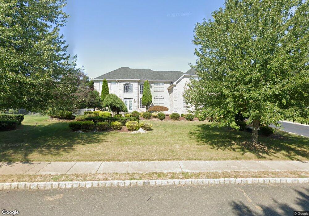
75 Stevenson Dr Marlboro, NJ 07746
Estimated Value: $1,326,000 - $1,412,000
4
Beds
2
Baths
3,845
Sq Ft
$358/Sq Ft
Est. Value
About This Home
This home is located at 75 Stevenson Dr, Marlboro, NJ 07746 and is currently estimated at $1,378,301, approximately $358 per square foot. 75 Stevenson Dr is a home located in Monmouth County with nearby schools including Marlboro Elementary School, Marlboro Middle School, and Marlboro High School.
Ownership History
Date
Name
Owned For
Owner Type
Purchase Details
Closed on
Feb 11, 1999
Sold by
Lafayette Knolls Inc
Bought by
Cohen Jacob and Cohen Diane
Current Estimated Value
Home Financials for this Owner
Home Financials are based on the most recent Mortgage that was taken out on this home.
Original Mortgage
$180,000
Outstanding Balance
$42,605
Interest Rate
6.74%
Estimated Equity
$1,335,696
Create a Home Valuation Report for This Property
The Home Valuation Report is an in-depth analysis detailing your home's value as well as a comparison with similar homes in the area
Home Values in the Area
Average Home Value in this Area
Purchase History
| Date | Buyer | Sale Price | Title Company |
|---|---|---|---|
| Cohen Jacob | $345,990 | -- |
Source: Public Records
Mortgage History
| Date | Status | Borrower | Loan Amount |
|---|---|---|---|
| Open | Cohen Jacob | $180,000 |
Source: Public Records
Tax History Compared to Growth
Tax History
| Year | Tax Paid | Tax Assessment Tax Assessment Total Assessment is a certain percentage of the fair market value that is determined by local assessors to be the total taxable value of land and additions on the property. | Land | Improvement |
|---|---|---|---|---|
| 2025 | $19,329 | $775,000 | $266,000 | $509,000 |
| 2024 | $18,476 | $775,000 | $266,000 | $509,000 |
| 2023 | $18,476 | $775,000 | $266,000 | $509,000 |
| 2022 | $18,003 | $775,000 | $266,000 | $509,000 |
| 2021 | $17,825 | $775,000 | $266,000 | $509,000 |
| 2020 | $17,817 | $775,000 | $266,000 | $509,000 |
| 2019 | $17,825 | $775,000 | $266,000 | $509,000 |
| 2018 | $17,523 | $775,000 | $266,000 | $509,000 |
| 2017 | $17,182 | $775,000 | $266,000 | $509,000 |
| 2016 | $17,421 | $775,000 | $266,000 | $509,000 |
| 2015 | $17,004 | $781,800 | $266,000 | $515,800 |
| 2014 | $14,604 | $664,400 | $226,000 | $438,400 |
Source: Public Records
Map
Nearby Homes
- 20 Birch Ln
- 202 Shore Ct
- 203 Shore Ct
- 1304 Shore Ct
- 11 Applethorn Ct
- 5 Buck Ln
- 12 Crest Dr
- 20 N Main St
- 10 Livingston Ct
- 67 School Rd E
- 88 Clover Hill Rd
- 680 - 21.04 County Road 520
- 680 - 21.1 County Road 520
- 680 - 21.21 County Road 520
- 680 County Road 520
- 680 - 21.15 County Road 520
- 680 - 21.19 County Road 520
- 680 - 21.11 County Road 520
- 680 - 21.12 County Road 520
- 680 - 21.09 County Road 520
- 77 Stevenson Dr
- 73 Stevenson Dr
- 60 Stevenson Dr
- 79 Stevenson Dr
- 62 Stevenson Dr
- 58 Stevenson Dr
- 71 Stevenson Dr
- 64 Stevenson Dr
- 81 Stevenson Dr
- 56 Stevenson Dr
- 69 Stevenson Dr
- 24 Graversham
- 26 Graversham
- 66 Stevenson Dr
- 54 Stevenson Dr
- 22 Graversham
- 67 Stevenson Dr
- 28 Graversham
- 85 Stevenson Dr
- 52 Stevenson Dr