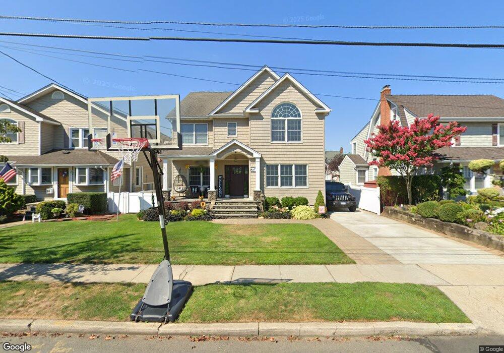
75 Taft Ave Lynbrook, NY 11563
Estimated Value: $748,000 - $854,466
Studio
3
Baths
2,692
Sq Ft
$298/Sq Ft
Est. Value
About This Home
This home is located at 75 Taft Ave, Lynbrook, NY 11563 and is currently estimated at $801,233, approximately $297 per square foot. 75 Taft Ave is a home located in Nassau County with nearby schools including Lynbrook Senior High School, Our Lady Of Peace School, and Valley Stream Christian Academy.
Ownership History
Date
Name
Owned For
Owner Type
Purchase Details
Closed on
Jun 12, 2003
Sold by
First Elite Properties Gr
Bought by
Dichter Ross
Current Estimated Value
Purchase Details
Closed on
Oct 30, 2002
Sold by
Wenk Robert
Bought by
Powerhouse Realty Corp
Purchase Details
Closed on
Oct 20, 2002
Sold by
Powerhouse Realty Corp
Bought by
Perlamuter Jack
Purchase Details
Closed on
Oct 24, 1996
Sold by
Coleman John and Coleman Cynthia
Bought by
Wenk Robert and Wenk Ann
Create a Home Valuation Report for This Property
The Home Valuation Report is an in-depth analysis detailing your home's value as well as a comparison with similar homes in the area
Home Values in the Area
Average Home Value in this Area
Purchase History
| Date | Buyer | Sale Price | Title Company |
|---|---|---|---|
| Dichter Ross | $347,500 | -- | |
| Powerhouse Realty Corp | $280,000 | -- | |
| Perlamuter Jack | $319,000 | -- | |
| Wenk Robert | $185,000 | -- |
Source: Public Records
Tax History
| Year | Tax Paid | Tax Assessment Tax Assessment Total Assessment is a certain percentage of the fair market value that is determined by local assessors to be the total taxable value of land and additions on the property. | Land | Improvement |
|---|---|---|---|---|
| 2025 | $13,464 | $629 | $189 | $440 |
| 2024 | $1,342 | $645 | $194 | $451 |
Source: Public Records
Map
Nearby Homes
- 14 Hawthorne St
- 232 Sherman St
- 149 Foster Ave
- 263 Foster Ave
- 89 Foster Ave
- 504 Merrick Rd Unit 4J
- 504 Merrick Rd Unit 4E
- 504 Merrick Rd Unit 2k
- 127 Smith St
- 145 Cornwell Ave
- 29 Summit Ave
- 57 Nieman Ave
- 33 Cleveland St
- 225 E Mineola Ave
- 42 Hendrickson Ave
- 181 Walnut St
- 40 Hendrickson Ave
- 51 Manor Rd
- 35 Carlton St
- 64 Hodson Ave
Your Personal Tour Guide
Ask me questions while you tour the home.