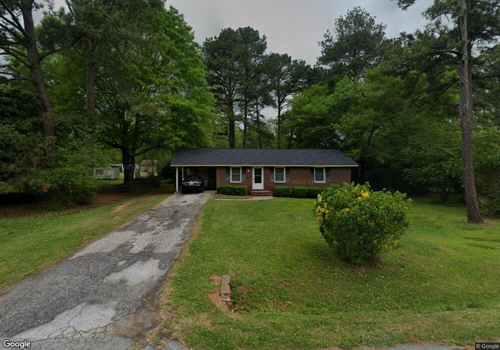
75 W Keel St Oxford, GA 30054
Estimated Value: $185,350 - $239,000
3
Beds
1
Bath
1,025
Sq Ft
$215/Sq Ft
Est. Value
About This Home
This home is located at 75 W Keel St, Oxford, GA 30054 and is currently estimated at $220,338, approximately $214 per square foot. 75 W Keel St is a home located in Newton County with nearby schools including Flint Hill Elementary School, Cousins Middle School, and Newton High School.
Ownership History
Date
Name
Owned For
Owner Type
Purchase Details
Closed on
Aug 15, 2011
Sold by
Blair Paul
Bought by
Blair Janet
Current Estimated Value
Purchase Details
Closed on
Feb 4, 2011
Sold by
Patterson R/E Group Inc
Bought by
Btn Homes Llc
Purchase Details
Closed on
Jul 6, 2010
Sold by
Labon Diana A
Bought by
Patterson R/E Group Llc
Purchase Details
Closed on
Oct 2, 2007
Sold by
Kemp Willie J and Kemp Linda R
Bought by
Wells Fargo Bk
Create a Home Valuation Report for This Property
The Home Valuation Report is an in-depth analysis detailing your home's value as well as a comparison with similar homes in the area
Home Values in the Area
Average Home Value in this Area
Purchase History
| Date | Buyer | Sale Price | Title Company |
|---|---|---|---|
| Blair Janet | -- | -- | |
| Blair Paul | -- | -- | |
| Btn Homes Llc | -- | -- | |
| Patterson R/E Group Llc | $9,640 | -- | |
| Wells Fargo Bk | $39,937 | -- |
Source: Public Records
Tax History Compared to Growth
Tax History
| Year | Tax Paid | Tax Assessment Tax Assessment Total Assessment is a certain percentage of the fair market value that is determined by local assessors to be the total taxable value of land and additions on the property. | Land | Improvement |
|---|---|---|---|---|
| 2025 | $1,893 | $73,680 | $10,000 | $63,680 |
| 2024 | $1,722 | $65,640 | $10,000 | $55,640 |
| 2023 | $1,459 | $51,600 | $8,000 | $43,600 |
| 2022 | $1,249 | $43,840 | $8,000 | $35,840 |
| 2021 | $1,185 | $37,120 | $8,000 | $29,120 |
| 2020 | $760 | $20,920 | $8,000 | $12,920 |
| 2019 | $772 | $20,960 | $8,000 | $12,960 |
| 2018 | $759 | $20,440 | $8,000 | $12,440 |
| 2017 | $773 | $20,840 | $8,000 | $12,840 |
| 2016 | $773 | $20,840 | $8,000 | $12,840 |
| 2015 | $764 | $20,600 | $8,000 | $12,600 |
| 2014 | $762 | $20,600 | $0 | $0 |
Source: Public Records
Map
Nearby Homes
- 20 ACRES Oxford Rd
- 36 ACRES Oxford Rd
- 70 Oxford Rd
- 142 Longstreet Cir
- 80 Victoria Blvd
- 122 Longstreet Cir
- 9226 Carlton Trail NW
- 1206 Wesley St
- 318 W Bonnell St
- 0 Asbury St Unit 10646779
- 405 W Richardson St
- 0 W Richardson St Unit 10643275
- 908 Emory St
- 1008 Emory St
- 1417 Wesley St
- 1310 Emory St
- 497 Cook Rd
- 40 Wentworth Dr
- 205 Emory Way
- 208 Emory Way