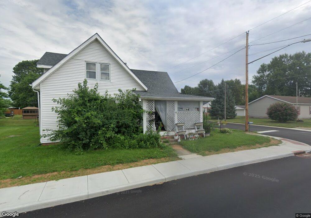
75 West St Whiteland, IN 46184
Estimated Value: $412,000 - $853,000
3
Beds
2
Baths
2,563
Sq Ft
$278/Sq Ft
Est. Value
About This Home
This home is located at 75 West St, Whiteland, IN 46184 and is currently estimated at $713,792, approximately $278 per square foot. 75 West St is a home located in Johnson County with nearby schools including Pleasant Crossing Elementary School, Clark-Pleasant Middle School, and Whiteland Community High School.
Ownership History
Date
Name
Owned For
Owner Type
Purchase Details
Closed on
May 14, 2021
Sold by
Kelsay Deborah L and Burns June Anne
Bought by
Davis Laura Michelle and Davis James E
Current Estimated Value
Home Financials for this Owner
Home Financials are based on the most recent Mortgage that was taken out on this home.
Original Mortgage
$550,000
Outstanding Balance
$498,730
Interest Rate
3%
Mortgage Type
New Conventional
Estimated Equity
$215,062
Create a Home Valuation Report for This Property
The Home Valuation Report is an in-depth analysis detailing your home's value as well as a comparison with similar homes in the area
Home Values in the Area
Average Home Value in this Area
Purchase History
| Date | Buyer | Sale Price | Title Company |
|---|---|---|---|
| Davis Laura Michelle | $650,000 | None Available |
Source: Public Records
Mortgage History
| Date | Status | Borrower | Loan Amount |
|---|---|---|---|
| Open | Davis Laura Michelle | $550,000 | |
| Closed | Davis Laura Michelle | $550,000 |
Source: Public Records
Tax History Compared to Growth
Tax History
| Year | Tax Paid | Tax Assessment Tax Assessment Total Assessment is a certain percentage of the fair market value that is determined by local assessors to be the total taxable value of land and additions on the property. | Land | Improvement |
|---|---|---|---|---|
| 2025 | $5,002 | $569,200 | $84,600 | $484,600 |
| 2024 | $5,002 | $469,800 | $84,100 | $385,700 |
| 2023 | $4,848 | $426,200 | $81,200 | $345,000 |
| 2022 | $4,889 | $418,300 | $71,200 | $347,100 |
| 2021 | $4,157 | $345,400 | $70,500 | $274,900 |
| 2020 | $3,880 | $314,800 | $67,400 | $247,400 |
| 2019 | $3,692 | $294,700 | $66,500 | $228,200 |
| 2018 | $3,819 | $298,300 | $66,700 | $231,600 |
| 2017 | $3,571 | $289,600 | $67,500 | $222,100 |
| 2016 | $3,600 | $290,800 | $68,000 | $222,800 |
| 2014 | $3,447 | $267,300 | $68,300 | $199,000 |
| 2013 | $3,447 | $263,500 | $67,300 | $196,200 |
Source: Public Records
Map
Nearby Homes
- 452 Southern Pines Dr
- 768 Tall Timber Dr
- 2437 Grand Fir Dr
- 754 Pine Lake Dr
- 2284 Blossom Dr
- 2982 Weald St
- 2449 Joust Dr
- 0 W Worthsville Rd
- 3292 Underwood Dr
- 2525 Summerwood Ln
- 75 Declaration Dr
- 809 Blackberry Dr
- 2350 Harvest Moon Dr
- 2433 Harvest Moon Dr
- 2418 Ashton Ln
- 1881 Harvest Meadow Dr
- 2277 Maple Stone Ln
- 2302 Ashton Ln
- 950 Edmonds Place
- 928 Cherry Tree Ln
- 75 West St
- 75 West St
- 75 West St
- 75 West St
- 75 West St
- 75 West St
- 450 Ponderosa Pine Dr
- 480 Ponderosa Pine Dr
- 465 Ponderosa Pine Dr
- 2880 Lodgepole Dr
- 2898 Lodgepole Dr
- 2797 Grand Fir Dr
- 2907 Lodgepole Dr
- 2789 Grand Fir Dr
- 510 Ponderosa Pine Dr
- 2916 Lodgepole Dr
- 543 Scotch Pine Dr
- 2791 Grand Fir Dr
- 2785 Grand Fir Dr
- 2785 Grand Fir Dr Unit 475