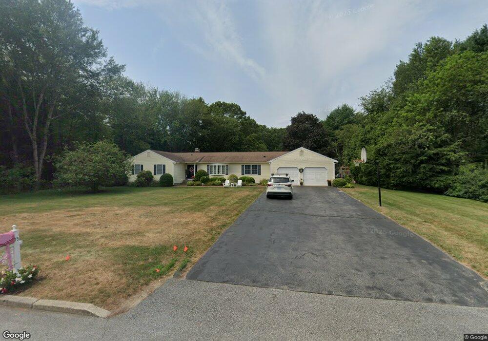
75 Woodbridge Dr East Greenwich, RI 02818
Tillinghast NeighborhoodEstimated Value: $956,368 - $1,078,000
5
Beds
3
Baths
2,568
Sq Ft
$396/Sq Ft
Est. Value
About This Home
This home is located at 75 Woodbridge Dr, East Greenwich, RI 02818 and is currently estimated at $1,017,092, approximately $396 per square foot. 75 Woodbridge Dr is a home located in Kent County with nearby schools including Frenchtown Elementary School, James H. Eldredge Elementary School, and East Greenwich High School.
Ownership History
Date
Name
Owned For
Owner Type
Purchase Details
Closed on
Jun 3, 1985
Bought by
Behbehani Alaedin and Behbehani Mary E
Current Estimated Value
Create a Home Valuation Report for This Property
The Home Valuation Report is an in-depth analysis detailing your home's value as well as a comparison with similar homes in the area
Home Values in the Area
Average Home Value in this Area
Purchase History
| Date | Buyer | Sale Price | Title Company |
|---|---|---|---|
| Behbehani Alaedin | $30,000 | -- |
Source: Public Records
Mortgage History
| Date | Status | Borrower | Loan Amount |
|---|---|---|---|
| Open | Behbehani Alaedin | $215,000 | |
| Closed | Behbehani Alaedin | $200,000 |
Source: Public Records
Tax History Compared to Growth
Tax History
| Year | Tax Paid | Tax Assessment Tax Assessment Total Assessment is a certain percentage of the fair market value that is determined by local assessors to be the total taxable value of land and additions on the property. | Land | Improvement |
|---|---|---|---|---|
| 2025 | $13,513 | $867,900 | $223,600 | $644,300 |
| 2024 | $12,784 | $867,900 | $223,600 | $644,300 |
| 2023 | $12,007 | $549,500 | $186,300 | $363,200 |
| 2022 | $11,770 | $549,500 | $186,300 | $363,200 |
| 2021 | $11,545 | $549,500 | $186,300 | $363,200 |
| 2020 | $11,666 | $497,900 | $162,900 | $335,000 |
| 2019 | $11,556 | $497,900 | $162,900 | $335,000 |
| 2018 | $11,452 | $497,900 | $162,900 | $335,000 |
| 2017 | $10,713 | $452,800 | $173,600 | $279,200 |
| 2016 | $10,908 | $452,800 | $173,600 | $279,200 |
| 2015 | $10,722 | $452,800 | $173,600 | $279,200 |
| 2014 | $12,037 | $517,500 | $184,700 | $332,800 |
Source: Public Records
Map
Nearby Homes
- 85 Sheep Farm Dr
- 50 Pheasant Dr
- 15 Forest Ln
- 60 Pheasant Dr
- 0 Tipping Rock Dr Unit 1399322
- 20 Bailey Blvd
- 69 Bates Trail
- 140 Tipping Rock Dr
- 130 Tipping Rock Dr
- 116 Tipping Rock Dr
- 1121 Tillinghast Rd
- 3 Amore Ln
- 1 Amore Ln
- 0 Princess Pine Dr
- 10 Mcpartland Way
- 2 Amore Ln
- 65 Huguenot Dr
- 105 Princess Pine Dr
- 20 Mcpartland Way
- 1289 South Rd
- 65 Woodbridge Dr
- 80 Woodbridge Dr
- 85 Woodbridge Dr
- 85 Woodbridge Dr Unit 1
- 55 Woodbridge Dr
- 60 Woodbridge Dr
- 0 Sonnet Dr
- 10 Sonnet Dr
- 45 Woodbridge Dr
- 200 Deerfield Dr
- 195 Deerfield Dr
- 95 Woodbridge Dr
- 20 Sonnet Dr
- 0 Sonnett Dr
- 40 Woodbridge Dr
- 100 Woodbridge Dr
- 30 Sonnet Dr
- 185 Deerfield Dr
- 15 Sonnet Dr
- 110 Woodbridge Dr