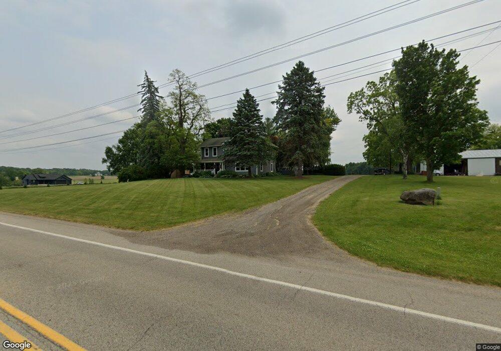
750 142nd Ave Wayland, MI 49348
Estimated Value: $444,310 - $617,000
4
Beds
3
Baths
2,614
Sq Ft
$203/Sq Ft
Est. Value
About This Home
This home is located at 750 142nd Ave, Wayland, MI 49348 and is currently estimated at $530,655, approximately $203 per square foot. 750 142nd Ave is a home located in Allegan County with nearby schools including Wayland High School and Moline Christian School.
Ownership History
Date
Name
Owned For
Owner Type
Purchase Details
Closed on
Jan 24, 2025
Sold by
Phillips Peter J and Phillips Julia G
Bought by
Peter J Phillips And Julia G Phillips Living and Phillips
Current Estimated Value
Purchase Details
Closed on
Jul 5, 2006
Sold by
Ernestine Chesebro Trust
Bought by
Phillips Peter J and Phillips Julia G
Home Financials for this Owner
Home Financials are based on the most recent Mortgage that was taken out on this home.
Original Mortgage
$100,000
Interest Rate
6.82%
Mortgage Type
Purchase Money Mortgage
Purchase Details
Closed on
Sep 5, 2000
Sold by
Chesebro Ernestine
Bought by
Phillips Peter J and Phillips Julia G
Create a Home Valuation Report for This Property
The Home Valuation Report is an in-depth analysis detailing your home's value as well as a comparison with similar homes in the area
Home Values in the Area
Average Home Value in this Area
Purchase History
| Date | Buyer | Sale Price | Title Company |
|---|---|---|---|
| Peter J Phillips And Julia G Phillips Living | -- | None Listed On Document | |
| Phillips Peter J | $155,185 | Michigan Bankers Title | |
| Phillips Peter J | $155,200 | -- |
Source: Public Records
Mortgage History
| Date | Status | Borrower | Loan Amount |
|---|---|---|---|
| Previous Owner | Phillips Peter J | $100,000 |
Source: Public Records
Tax History Compared to Growth
Tax History
| Year | Tax Paid | Tax Assessment Tax Assessment Total Assessment is a certain percentage of the fair market value that is determined by local assessors to be the total taxable value of land and additions on the property. | Land | Improvement |
|---|---|---|---|---|
| 2025 | $6,033 | $307,000 | $187,100 | $119,900 |
| 2024 | $5,864 | $271,400 | $152,600 | $118,800 |
| 2023 | $5,864 | $249,600 | $140,800 | $108,800 |
| 2022 | $5,864 | $225,100 | $123,500 | $101,600 |
| 2021 | $5,364 | $218,600 | $123,500 | $95,100 |
| 2020 | $5,279 | $214,400 | $120,800 | $93,600 |
| 2019 | $4,985 | $205,000 | $113,500 | $91,500 |
| 2018 | $4,741 | $192,200 | $113,500 | $78,700 |
| 2017 | $0 | $178,700 | $99,900 | $78,800 |
| 2016 | $0 | $176,000 | $101,200 | $74,800 |
| 2015 | -- | $176,000 | $101,200 | $74,800 |
| 2014 | -- | $165,500 | $98,600 | $66,900 |
| 2013 | $4,987 | $155,300 | $90,600 | $64,700 |
Source: Public Records
Map
Nearby Homes
- 1376 142nd Ave
- 3905 Sunset View
- 4243 Butternut Dr
- 4245 Butternut Dr
- 4249 Butternut Dr
- Lot 142 Butternut Dr
- Lot 141 Butternut Dr
- 4240 Butternut Dr
- Vienna Plan at Harvest Meadows
- Charlotte Plan at Harvest Meadows
- Sierra Plan at Harvest Meadows
- Karolynn Plan at Harvest Meadows
- Reno Plan at Harvest Meadows
- Bayberry Plan at Harvest Meadows
- Freedom Plan at Harvest Meadows
- London Plan at Harvest Meadows
- Hampton Plan at Harvest Meadows
- Oxford Plan at Harvest Meadows
- 4274 Butternut Dr
- Unit 111 Highpoint Dr
- 753 142nd Ave
- 249 Grayback Ridge
- 730 142nd Ave
- 627 Grayback Ridge
- 781 142nd Ave
- F3 Grayback Ridge
- 3 Grayback Ridge
- 765 142nd Ave
- 784 142nd Ave
- 800 142nd Ave
- 705 142nd Ave
- 803 142nd Ave
- 4215 Swansea St
- 789 142nd Ave
- 0 Swansea Dr
- 684 142nd Ave
- 4237 Swansea St
- 4244 Swansea St
- 670 142nd Ave
- 4248 Swansea St