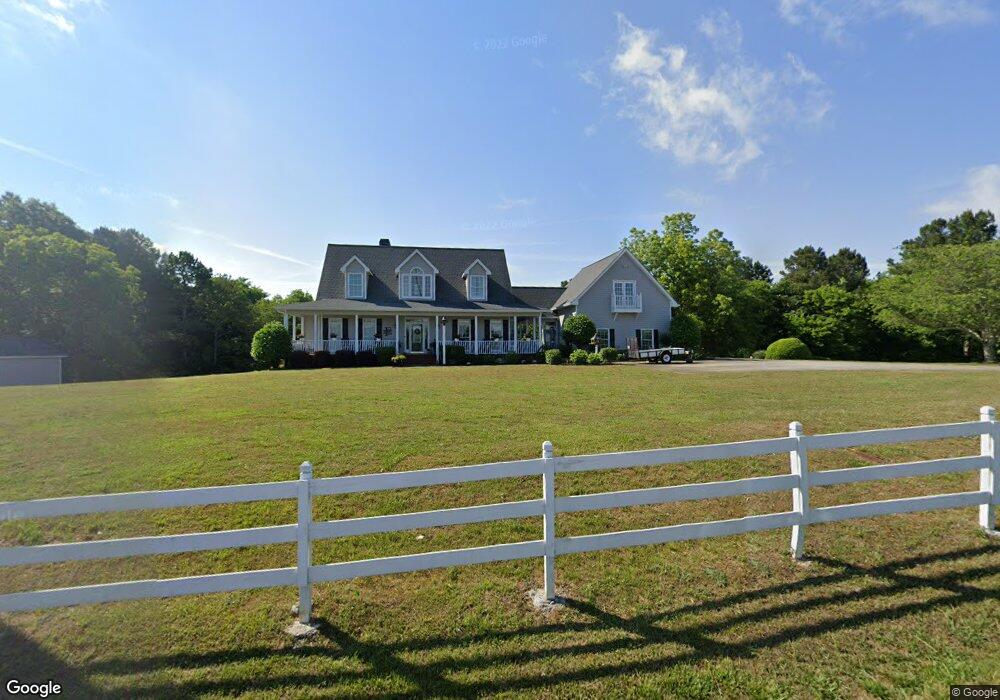
750 Dabbs Bridge Rd Dallas, GA 30132
Cedarcrest NeighborhoodEstimated Value: $488,000 - $732,000
3
Beds
3
Baths
1,972
Sq Ft
$287/Sq Ft
Est. Value
About This Home
This home is located at 750 Dabbs Bridge Rd, Dallas, GA 30132 and is currently estimated at $565,382, approximately $286 per square foot. 750 Dabbs Bridge Rd is a home located in Paulding County with nearby schools including Burnt Hickory Elementary School, Sammy Mcclure Sr. Middle School, and North Paulding High School.
Ownership History
Date
Name
Owned For
Owner Type
Purchase Details
Closed on
Nov 19, 1999
Sold by
Barfield Cameron E and Barfield Robert L
Bought by
Foley Francis N and Foley Susan K
Current Estimated Value
Home Financials for this Owner
Home Financials are based on the most recent Mortgage that was taken out on this home.
Original Mortgage
$124,000
Interest Rate
7.8%
Mortgage Type
New Conventional
Create a Home Valuation Report for This Property
The Home Valuation Report is an in-depth analysis detailing your home's value as well as a comparison with similar homes in the area
Home Values in the Area
Average Home Value in this Area
Purchase History
| Date | Buyer | Sale Price | Title Company |
|---|---|---|---|
| Foley Francis N | $274,000 | -- |
Source: Public Records
Mortgage History
| Date | Status | Borrower | Loan Amount |
|---|---|---|---|
| Previous Owner | Foley Francis N | $124,000 |
Source: Public Records
Tax History Compared to Growth
Tax History
| Year | Tax Paid | Tax Assessment Tax Assessment Total Assessment is a certain percentage of the fair market value that is determined by local assessors to be the total taxable value of land and additions on the property. | Land | Improvement |
|---|---|---|---|---|
| 2024 | $1,328 | $192,976 | $45,240 | $147,736 |
| 2023 | $1,484 | $184,408 | $44,120 | $140,288 |
| 2022 | $1,385 | $170,484 | $38,360 | $132,124 |
| 2021 | $1,368 | $136,728 | $32,440 | $104,288 |
| 2020 | $1,325 | $124,984 | $32,440 | $92,544 |
| 2019 | $1,367 | $124,172 | $30,880 | $93,292 |
| 2018 | $1,201 | $110,804 | $27,160 | $83,644 |
| 2017 | $1,176 | $104,760 | $26,040 | $78,720 |
| 2016 | $962 | $88,728 | $24,440 | $64,288 |
| 2015 | $917 | $81,392 | $23,760 | $57,632 |
| 2014 | $891 | $74,816 | $21,520 | $53,296 |
| 2013 | -- | $70,200 | $23,400 | $46,800 |
Source: Public Records
Map
Nearby Homes
- 98 Wards Creek Ln
- 682 Ferguson Place
- 1569 Dabbs Bridge Rd
- 790 Ferguson Place
- 856 Ferguson Place
- 154 Windlake Path
- 4358 Harmony Grove Church Rd
- 4243 Harmony Grove Church Rd
- 264 Holland Grove Dr
- TBD Cochran Rd
- 7 Pioneer Trail
- 30 Stephen Ct
- 198 Holland Grove Ln
- 71 Moonrise Crossing
- 1235 Williams Rd
- 2284 Dabbs Bridge Rd
- 105 Sugar Birch Way
- 71 Windrift Dr
- 866 Dabbs Bridge Rd
- 20 Windrift Dr
- 10 Windrift Dr
- 50 Windrift Dr
- 111 Windrift Dr
- 0 Thomason Path
- 0 Thomason Path Unit 8571143
- 0 Thomason Path Unit 8775776
- 0 Thomason Path Unit 5663619
- 110 Windrift Dr
- 145 Windrift Dr
- 880 Dabbs Bridge Rd
- 136 Windrift Dr
- 136 Windrift Dr Unit 18
- 546 Dabbs Bridge Rd
- 179 Windrift Dr
- 109 Thomason Path
- 166 Windrift Dr
- 10442 Cartersville Hwy