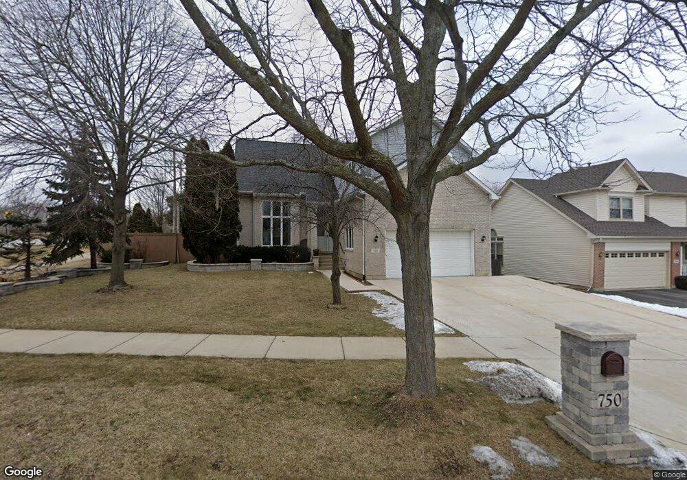
750 Harmon Blvd Hoffman Estates, IL 60169
South Hoffman Estates NeighborhoodEstimated Value: $667,166 - $716,000
About This Home
This home is located at 750 Harmon Blvd, Hoffman Estates, IL 60169 and is currently estimated at $692,042, approximately $235 per square foot. 750 Harmon Blvd is a home located in Cook County with nearby schools including Neil Armstrong Elementary School, Helen Keller Junior High School, and Hoffman Estates High School.
Ownership History
We collect this data history from publicly available records. To have your information removed, we recommend requesting removal directly through your county’s website.
Purchase Details
Home Financials for this Owner
Home Financials are based on the most recent Mortgage that was taken out on this home.Purchase Details
Home Financials for this Owner
Home Financials are based on the most recent Mortgage that was taken out on this home.Home Values in the Area
Average Home Value in this Area
Purchase History
We collect this data history from publicly available records. To have your information removed, we recommend requesting removal directly through your county’s website.
| Date | Buyer | Sale Price | Title Company |
|---|---|---|---|
| $500,500 | Baird & Warner Title Service | ||
| -- | Attorneys Natl Title Network |
Mortgage History
We collect this data history from publicly available records. To have your information removed, we recommend requesting removal directly through your county’s website.
| Date | Status | Borrower | Loan Amount |
|---|---|---|---|
| Closed | $200,000 | ||
| Previous Owner | $224,000 |
Tax History
We collect this data history from publicly available records. To have your information removed, we recommend requesting removal directly through your county’s website.
| Year | Tax Paid | Tax Assessment Tax Assessment Total Assessment is a certain percentage of the fair market value that is determined by local assessors to be the total taxable value of land and additions on the property. | Land | Improvement |
|---|---|---|---|---|
| 2025 | $13,406 | $62,000 | $13,229 | $48,771 |
| 2024 | $13,406 | $47,000 | $12,402 | $34,598 |
| 2023 | $12,943 | $47,000 | $12,402 | $34,598 |
| 2022 | $12,943 | $47,000 | $12,402 | $34,598 |
| 2021 | $12,689 | $41,204 | $10,955 | $30,249 |
| 2020 | $12,467 | $41,204 | $10,955 | $30,249 |
| 2019 | $12,400 | $45,783 | $10,955 | $34,828 |
| 2018 | $11,512 | $38,741 | $9,301 | $29,440 |
| 2017 | $11,327 | $38,741 | $9,301 | $29,440 |
| 2016 | $11,587 | $41,391 | $9,301 | $32,090 |
| 2015 | $12,185 | $40,563 | $8,061 | $32,502 |
| 2014 | $11,988 | $40,563 | $8,061 | $32,502 |
| 2013 | $11,663 | $40,563 | $8,061 | $32,502 |
Map
- 1605 Crowfoot Cir S
- 752 N Brookdale Dr
- 815 Mansfield Ct
- 819 Mansfield Ct Unit 2
- 990 Sweetflower Dr
- 1813 Lancashire Ct Unit 3
- 1726 Southbridge Ct
- 1914 Flintshire Dr Unit 1914
- 780 N Dexter Ln
- 2013 Briar Hill Dr
- 1987 Leiter Way Unit 11003
- 1994 Leiter Way Unit 14003
- 1989 Leiter Way Unit 11004
- 505 Tebay Place
- 658 Wainsford Dr
- 1767 Pebble Beach Dr
- 1729 Pebble Beach Ct
- 1751 Pebble Beach Dr
- 877 N Dovington Dr
- 1760 Pebble Beach Dr
- 765 Harmon Blvd
- 785 Harmon Blvd
- 755 Harmon Blvd
- 795 Harmon Blvd
- 770 Harmon Blvd
- 760 Harmon Blvd
- 780 Harmon Blvd
- 1645 Crowfoot Cir S
- 790 Harmon Blvd
- 1635 Crowfoot Cir S
- 807 Apple Dr
- 809 Apple Dr
- 800 Harmon Blvd
- 1625 Crowfoot Cir S
- 721 Stockbridge Ct
- 810 Harmon Blvd
- 1650 Crowfoot Cir S
- 803 Apple Dr
- 1615 Crowfoot Cir S
- 717 Stockbridge Ct
Ask me questions while you tour the home.