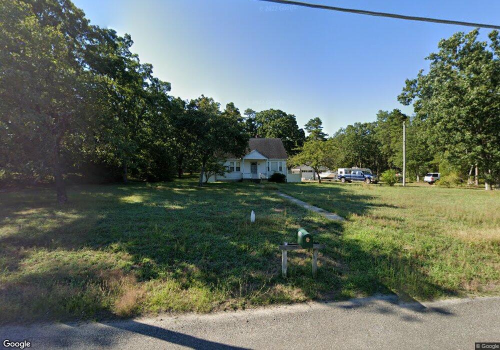
750 Lakehurst Rd Browns Mills, NJ 08015
Estimated Value: $156,000 - $281,122
--
Bed
--
Bath
780
Sq Ft
$291/Sq Ft
Est. Value
About This Home
This home is located at 750 Lakehurst Rd, Browns Mills, NJ 08015 and is currently estimated at $227,031, approximately $291 per square foot. 750 Lakehurst Rd is a home located in Burlington County.
Ownership History
Date
Name
Owned For
Owner Type
Purchase Details
Closed on
May 1, 2003
Sold by
Perrine Ronald L and Perrine Mary K
Bought by
Green Donald M
Current Estimated Value
Home Financials for this Owner
Home Financials are based on the most recent Mortgage that was taken out on this home.
Original Mortgage
$108,000
Outstanding Balance
$47,110
Interest Rate
5.84%
Mortgage Type
Purchase Money Mortgage
Estimated Equity
$179,921
Purchase Details
Closed on
Nov 29, 2001
Sold by
Estate Of John Humphries and Humphries Dvorschak Karen J
Bought by
Perrine Ronald L
Create a Home Valuation Report for This Property
The Home Valuation Report is an in-depth analysis detailing your home's value as well as a comparison with similar homes in the area
Home Values in the Area
Average Home Value in this Area
Purchase History
| Date | Buyer | Sale Price | Title Company |
|---|---|---|---|
| Green Donald M | $145,000 | -- | |
| Perrine Ronald L | $117,000 | -- |
Source: Public Records
Mortgage History
| Date | Status | Borrower | Loan Amount |
|---|---|---|---|
| Open | Green Donald M | $108,000 |
Source: Public Records
Tax History Compared to Growth
Tax History
| Year | Tax Paid | Tax Assessment Tax Assessment Total Assessment is a certain percentage of the fair market value that is determined by local assessors to be the total taxable value of land and additions on the property. | Land | Improvement |
|---|---|---|---|---|
| 2025 | $4,279 | $139,600 | $49,500 | $90,100 |
| 2024 | $4,015 | $139,600 | $49,500 | $90,100 |
| 2023 | $4,015 | $139,600 | $49,500 | $90,100 |
| 2022 | $3,716 | $139,600 | $49,500 | $90,100 |
| 2021 | $3,359 | $139,600 | $49,500 | $90,100 |
| 2020 | $3,430 | $139,600 | $49,500 | $90,100 |
| 2019 | $3,285 | $139,600 | $49,500 | $90,100 |
| 2018 | $3,173 | $139,600 | $49,500 | $90,100 |
| 2017 | $3,108 | $139,600 | $49,500 | $90,100 |
| 2016 | $3,461 | $92,600 | $28,600 | $64,000 |
| 2015 | $3,434 | $92,600 | $28,600 | $64,000 |
| 2014 | $3,283 | $92,600 | $28,600 | $64,000 |
Source: Public Records
Map
Nearby Homes
- 764 Lakehurst Rd
- 9 Winnebago Trail
- 406 Cherokee Dr
- 13 Muskogean Trail
- 2 Kiowa Trail
- 22 Maricopa Trail
- 77 Sepulga Dr
- 1714 Red Feather Trail
- 203 Seneca Trail
- 224 Cherokee Dr
- 304 Mohawk Trail
- 338 Ridge Rd
- 0 Margaret St
- 304 Spring Lake Blvd
- 300 Ridge Rd
- 256 Ridge Rd
- 258 Ridge Rd
- 317 Cayuga Trail
- 306 Apache Trail
- 315 Algonquin Trail
- 754 Lakehurst Rd
- 713 Lakehurst Rd
- 725 Lakehurst Rd
- 756 Lakehurst Rd Unit FRONT
- 756 Lakehurst Rd Unit BACK
- 756 Lakehurst Rd Unit A (REAR)
- 756 Lakehurst Rd
- 756a Lakehurst Rd
- 729 Lakehurst Rd
- 760 Lakehurst Rd
- 733 Lakehurst Rd
- 735 Lakehurst Rd
- 705 Lakehurst Rd
- 737 Lakehurst Rd
- 766 Lakehurst Rd
- 770 Lakehurst Rd
- 707 Lakehurst Rd
- 739 Lakehurst Rd
- 768 Lakehurst Rd
- 772 Lakehurst Rd